
🌘 🌑 🌗 🌕 Waning Crescent Moon, sky cover overnight Tue. to Wed. 100% to 67% to 85%, winds W to NW, 15 to 5 MPH, G26 to 11 MPH, Low 34, 5a to 8a
NWS CHGO | NWS HRLY | /NWSchicago | 🌡
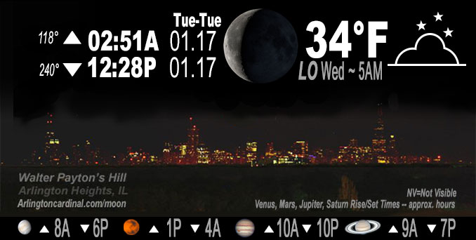
ARLINGTON HEIGHTS WEATHER
▴ forecast7 (Arl. Hts.) | RADAR | WIDE RADAR
IMPORTANT NOTE ON NWS DATA
======================
NIGHT FORECASTS …
NOTE 1: Forecast and information text below may refer to a previous night on Arlingtoncardinal.com, and might not be updated until late afternoon, evening, or overnight. However, Night Sky archives on CARDINAL NEWS Magazine include text forecasts that correspond to the lunar phase graphic above.
NOTE 2: Keep in mind lunar rise and set times don’t always correspond with night weather and early morning lows because on some days during the month the moon is visible in the sky predominantly during the daytime hours.
Overnight Tuesday/Wednesday …
No Weather Hazards expected …
After falling temperatures during the day on Tuesday, the morning low temperature will stay above freezing.
DISCUSSION…
When using the actual and forecast highs and lows for both Monday (yesterday) and Tuesday (today) to determine forecast daily average temperatures, it appears the first 17 days of January 2023 could turn out to produce an average that becomes the second warmest on record at both Chicago and Rockford — though much will depend on temperatures right at midnight Monday/Tuesday.
Hello mobile users! If you encounter mobile “unfriendly” weather page, turn your phone sideways for a better view.
======================
O’HARE FORECAST …
Forecast Beginning Tuesday Night, Jan. 17, 2023 …
Tuesday Night: Cloudy, with a low around 34. West wind 5 to 15 mph, with gusts as high as 25 mph.
Wednesday: A slight chance of rain and snow after 3pm. Mostly cloudy, with a high near 40. West northwest wind 5 to 10 mph becoming east northeast in the afternoon. Chance of precipitation is 20%.
Wednesday Night: Rain, possibly mixed with snow before 9pm, then rain between 9pm and 3am, then drizzle after 3am. Patchy fog after midnight. Low around 36. East northeast wind 5 to 15 mph, with gusts as high as 30 mph. Chance of precipitation is 100%. Little or no snow accumulation expected.
Thursday: Drizzle likely before 9am, then rain likely between 9am and 3pm, then rain and snow likely after 3pm. Patchy fog before 10am. Otherwise, cloudy, with a high near 43. East southeast wind 5 to 15 mph becoming west in the afternoon. Winds could gust as high as 20 mph. Chance of precipitation is 60%.
Thursday Night: A chance of sprinkles and flurries before 9pm, then a chance of flurries between 9pm and midnight. Cloudy, with a low around 30.
Friday: Mostly cloudy, with a high near 34.
Friday Night: Mostly cloudy, with a low around 26.
Saturday: Mostly cloudy, with a high near 33.
Saturday Night: Mostly cloudy, with a low around 28.
Sunday: Partly sunny, with a high near 37.
Sunday Night: A chance of snow. Mostly cloudy, with a low around 28.
Monday: Mostly cloudy, with a high near 37.
O’Hare forecast archive and hourly weather observations archive are available HERE on the CARDINAL NEWS Magazine.
Arlingtoncardinal.com/moonphases
Arlingtoncardinal.com/nightsky
NIGHT SKY THIS MONTH …
Check the night sky objects for this month and past months in the playlist from the Space Telescope Science Institute YouTube channel Backyard stargazers get a monthly guide to the northern hemisphere’s skywatching events with “Tonight’s Sky” (Musical track The Far River written by Jonn Serrie, from the album And the Stars Go With You courtesy of New World Music Ltd. Musical track The Far River written by Jonn Serrie, from the album And the Stars Go With You courtesy of New World Music Ltd).
Telephoto lens, ISO 100, f/11, Shutter Speed 1/100 to 1/125 for the Moon.
Get updates from The Cardinal ALL NEWS FEEDS on Facebook. Just ‘LIKE’ the ‘Arlington Cardinal Page (become a fan of our page). The updates cover all posts and sub-category posts from The Cardinal — Arlingtoncardinal.com. You can also limit feeds to specific categories. See all of The Cardinal Facebook fan pages at Arlingtoncardinal.com/about/facebook …
Help fund The Cardinal Arlingtoncardinal.com/sponsor
Telephoto lens, ISO 1600, f/11, Shutter Speed 2.5″ for the skyline. The skyline exposure was toned down, and brightness and contrast was adjusted in Photoshop.
Area Forecast Discussion
National Weather Service Chicago/Romeoville, IL
1117 PM CST Tue Jan 17 2023
.SHORT TERM… Issued at 244 PM CST Tue Jan 17 2023
Through Thursday…
Main forecast concerns… *Breezy conditions through Tuesday evening
*Storm system brings widespread rain to the area Wednesday night through Thursday
*Chance for some slushy snow accumulations and possible sleet near the IL-WI state line Wednesday night
Overcast and breezy conditions will continue through the rest of the afternoon and into the evening as an upper low continues to east though the northern Great Lakes. Wind gusts upwards of 30 mph can be expected through late evening before gusts gradually ease overnight. Temperatures will also be gradually cooling through the evening with lows in the low to mid 30s Wednesday morning.
While most of the day on Wednesday will be quiet with cloudy skies, our next storm system will be moving across the south-central Plains towards northeastern Illinois. Guidance is actually in really good agreement with the track of the surface low, which brings it over northern Illinois late Wednesday night into Thursday morning. The initial wave of precipitation is expected to move into the area Wednesday evening as the occluded front ahead of the surface low moves into the area. As the precipitation begins guidance is moving the 850 mb low across northeastern Iowa into southern Wisconsin which keeps the majority of our CWA under the above freezing 850 mb temperatures and therefore keeping the precipitation as rain. However, as the 850 mb low moves into southern Wisconsin Wednesday evening subfreezing temperatures aloft are expected to drift into portions of far northern Illinois near the IL-WI border. Forecast soundings show these temperatures to be sufficient enough to transition the ongoing rain over to a mix of slushy snow and sleet for a period of time before cloud ice begins to deplete as the dry slot moves into the area late Wednesday night. At this time snow accumulations continue to look marginal across far northern Illinois due to the expected mixed precipitation and near to above freezing temperature with amounts generally under 2 inches expected, but there is some uncertainty on the track of the 850 mb low. If the track is to shift a bit farther to the south then the higher snowfall amounts currently forecast to remain in Wisconsin could dip into northern Illinois. Regardless, some slippery travel should be expected for areas near the IL-WI border so be sure to use caution during the evening commute on Wednesday.
As the aforementioned dry slot begins to move into the area late Wednesday night into Thursday morning, mid-level moisture is expected to diminish which will transition the rain and wintry mix over to drizzle by daybreak on Thursday. This will create reduced visibilities and potentially fog for the morning commute on Thursday into Thursday afternoon. Better moisture is expected to return Thursday afternoon as the dry slot moves east of the area which will bring additional chances for rain and possibly some snow showers. While temperatures aloft are expected to be cold enough for snow production, surface temperatures look to be in the upper 30s and lower 40s which should keep the precipitation as rain for most of the area. However, as temperatures cool during the late afternoon a few snow showers may be realized especially for areas north of I-88 heading into Thursday evening.
Additionally, sharp pressure falls ahead of the surface low Wednesday evening will also create gusty winds of 30 to 35 mph and possibly higher. While gusts are expected to be pretty brief and will ease late Wednesday night as the surface low moves overhead, gusts do look to increase behind the low Thursday afternoon with gusts around 25 to 30 mph expected.
Yack/NWS Chicago
