
🌒 🌓 🌕 🌗 Waxing Crescent Moon, sky cover overnight Tue. to Wed., mostly cloudy, showers likely, winds N to NW to N to NW, 21 to 13 MPH, G23 to 28 to 21 MPH. 9p to 6a, Low 46, 8a to 9a
NWS CHGO | NWS HRLY | /NWSchicago | 🌡
ARLINGTON HEIGHTS WEATHER
▴ forecast7 (Arl. Hts.) | RADAR | WIDE RADAR
IMPORTANT NOTE ON NWS DATA
======================
No Watches or Warnings overnight Tuesday to Wednesday.
Updates at Arlingtoncardinal.com/NWSChicago
The first appreciable widespread rainfall in several weeks will continue into tonight but light rain moving out by around sunrise or 6 a.m. to 7 a.m.
Poor stargazing with rain, chill moves in and the actual temperature was below forecast, 43 degrees at 7:51 a.m. instead of the forecasted low of 46 degrees.
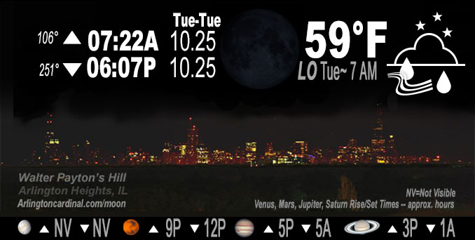
New Moon is officially on Tuesday, October 25, 2022, but occurs overnight from Monday to Tuesday.
======================
O’HARE FORECAST …
Forecast Beginning Tuesday Night, Oct. 25, 2022
Tuesday Night: Showers. The rain could be heavy at times. Low around 46. North wind 10 to 15 mph, with gusts as high as 30 mph. Chance of precipitation is 100%. New precipitation amounts between three quarters and one inch possible.
Wednesday: Showers likely, mainly before 9am. Cloudy through mid morning, then gradual clearing, with a high near 56. Breezy, with a north northwest wind 15 to 20 mph, with gusts as high as 30 mph. Chance of precipitation is 60%. New precipitation amounts of less than a tenth of an inch possible.
Wednesday Night: Mostly clear, with a low around 38. Northwest wind 5 to 10 mph.
Thursday: Partly sunny, with a high near 56. Light and variable wind becoming east 5 to 10 mph in the morning.
Thursday Night: Mostly cloudy, with a low around 44.
Friday: Mostly sunny, with a high near 57.
Friday Night: Mostly clear, with a low around 43.
Saturday: Sunny, with a high near 60.
Saturday Night: Mostly cloudy, with a low around 46.
Sunday: Partly sunny, with a high near 59.
Sunday Night: A chance of showers. Mostly cloudy, with a low around 47.
Monday: Mostly cloudy, with a high near 59.
O’Hare forecast archive and hourly weather observations archive are available HERE on the CARDINAL NEWS Magazine.
Arlingtoncardinal.com/moonphases
Arlingtoncardinal.com/nightsky
NIGHT SKY THIS MONTH …
Check the night sky objects for this month and past months in the playlist from the Space Telescope Science Institute YouTube channel Backyard stargazers get a monthly guide to the northern hemisphere’s skywatching events with “Tonight’s Sky” (Musical track The Far River written by Jonn Serrie, from the album And the Stars Go With You courtesy of New World Music Ltd. Musical track The Far River written by Jonn Serrie, from the album And the Stars Go With You courtesy of New World Music Ltd).
Telephoto lens, ISO 100, f/11, Shutter Speed 1/100 to 1/125 for the Moon.
Get updates from The Cardinal ALL NEWS FEEDS on Facebook. Just ‘LIKE’ the ‘Arlington Cardinal Page (become a fan of our page). The updates cover all posts and sub-category posts from The Cardinal — Arlingtoncardinal.com. You can also limit feeds to specific categories. See all of The Cardinal Facebook fan pages at Arlingtoncardinal.com/about/facebook …
Help fund The Cardinal Arlingtoncardinal.com/sponsor
Telephoto lens, ISO 1600, f/11, Shutter Speed 2.5″ for the skyline. The skyline exposure was toned down, and brightness and contrast was adjusted in Photoshop.
Area Forecast Discussion
National Weather Service Chicago/Romeoville, IL
1246 AM CDT Wed Oct 26 2022
.SHORT TERM…
Issued at 243 PM CDT Tue Oct 25 2022
Through Wednesday…
The first appreciable widespread rainfall in several weeks will continue into tonight, with multiple additional waves of showers expected. Rainfall amounts through 2pm have ranged from around 0.25″ across the northern CWA to locally around 0.75″ in the southeast CWA. Overall coverage of higher rainfall rates has been limited so far as broader scale ascent has been confined to the entrance of a departing upper jet streak to the north and slightly diffluent flow aloft in advance of a compact mid-level wave currently entering southeast Missouri. Meanwhile, a cold front that has made decent southeast progress early this morning stalled roughly along a line from Waukegan to Aurora to Ottawa from the low-level mass response ahead of the wave and associated surface low south of St. Louis. The upper wave is expected to achieve maximum strength while entering southern Illinois this evening before it gradually weakens with ENE extent through the Ohio River Valley tonight and Wednesday. the associated surface low will track NE along the cold front and cross the southeast CWA late this evening into the early overnight.
Overall, no substantial changes were made to the precip forecast trends. An extensive rain shield currently over the forecast area will lift northward through early evening. Precip rates around 0.25″ an hour to locally 0.5″ an hour have been observed upstream and are expected to persist across a vast majority of the CWA. Given antecedent dry conditions, low streamflows, and relatively low precip rates, flood concerns will be limited to brief localized ponding and poor drainage due to leaf-clogged storm gutters and drains. Isolated embedded storms also remain possible generally southeast of I-55 where increasing deep forcing and marginal lapse rates straddle a fine line between convective and slantwise instability.
A developing TROWAL under the deformation axis of the upper wave will likely settle SW to NE across the CWA this evening into the overnight hours, with overall obs trends and consensus guidance still favoring roughly somewhere along/northwest of and parallel to the I-55 corridor. Warm rain processes may become more prevalent as some mid-level drying begins and isentropic ascent enhances low- level forcing. Concerns remain that a narrow axis or pocket of moderate to heavy rainfall will occur in this corridor late this evening and into the overnight hours as the low pivots through the area, producing locally 2″+ storm total rainfall values. Isolated lightning is also possible in this area. The deformation axis should quickly exit eastward late tonight through daybreak Wednesday, with most areas likely precip-free around sunrise. While some stratus may linger in the morning, skies will clear quickly from west to east by the afternoon as CAA keeps temps in the mid 50s.
Kluber/NWS Chicago
