
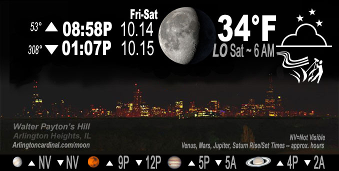
🌖 🌗 🌑 🌓 Waning Gibbous Moon, sky cover overnight Fri. to Sat., 98% to 9 to 39%, winds W, 16 to 10 MPH, G28 to 14 to 15 MPH, Low 35, 6a to 7a
NWS CHGO | NWS HRLY | /NWSchicago | 🌡
ARLINGTON HEIGHTS WEATHER
▴ forecast7 (Arl. Hts.) | RADAR | WIDE RADAR
IMPORTANT NOTE ON NWS DATA
======================
No Watches or Warnings overnight Friday to Saturday.
Updates at Arlingtoncardinal.com/NWSChicago
Frost possible after 5AM Saturday.
======================
O’HARE FORECAST …
Forecast Beginning Friday Night, Oct. 14, 2022
Friday Night: Scattered showers, mainly before 11pm. Chance of precipitation is 30%. Cloudy during the early evening, then gradual clearing, with a low around 34 to 35. Breezy, with a west wind 10 to 20 mph, with gusts as high as 30 mph ending at about 15 MPH by 4:00 a.m. Decreasing clouds, then mostly clear, with a low around 34. West wind 5 to 10 mph. Areas of frost after 5am.
Saturday: Mostly sunny, with a high near 53. West wind 5 to 15 mph, with gusts as high as 25 mph.
Saturday Night: Partly cloudy, with a low around 41. Southwest wind 5 to 10 mph becoming north northwest after midnight. Winds could gust as high as 20 mph.
Sunday: Increasing clouds, with a high near 54. West northwest wind 5 to 15 mph, with gusts as high as 25 mph.
Sunday Night: Mostly cloudy, with a low around 33. West northwest wind around 15 mph, with gusts as high as 25 mph.
Monday: A slight chance of rain and snow showers after 1pm. Partly sunny, with a high near 42. Breezy. Chance of precipitation is 20%.
Monday Night: A slight chance of rain and snow showers before 1am. Partly cloudy, with a low around 31. Chance of precipitation is 20%.
Tuesday: Sunny, with a high near 46.
Tuesday Night: Mostly clear, with a low around 29.
Wednesday: Mostly sunny, with a high near 47.
Wednesday Night: Mostly cloudy, with a low around 37.
Thursday: Partly sunny, with a high near 52.
Thursday Night: Partly cloudy, with a low around 36.
Friday: Mostly sunny, with a high near 55.
O’Hare forecast archive and hourly weather observations archive are available HERE on the CARDINAL NEWS Magazine.
Arlingtoncardinal.com/moonphases
Arlingtoncardinal.com/nightsky
NIGHT SKY THIS MONTH …
Check the night sky objects for this month and past months in the playlist from the Space Telescope Science Institute YouTube channel Backyard stargazers get a monthly guide to the northern hemisphere’s skywatching events with “Tonight’s Sky” (Musical track The Far River written by Jonn Serrie, from the album And the Stars Go With You courtesy of New World Music Ltd. Musical track The Far River written by Jonn Serrie, from the album And the Stars Go With You courtesy of New World Music Ltd).
Telephoto lens, ISO 100, f/11, Shutter Speed 1/100 to 1/125 for the Moon.
Get updates from The Cardinal ALL NEWS FEEDS on Facebook. Just ‘LIKE’ the ‘Arlington Cardinal Page (become a fan of our page). The updates cover all posts and sub-category posts from The Cardinal — Arlingtoncardinal.com. You can also limit feeds to specific categories. See all of The Cardinal Facebook fan pages at Arlingtoncardinal.com/about/facebook …
Help fund The Cardinal Arlingtoncardinal.com/sponsor
Telephoto lens, ISO 1600, f/11, Shutter Speed 2.5″ for the skyline. The skyline exposure was toned down, and brightness and contrast was adjusted in Photoshop.
Area Forecast Discussion
National Weather Service Chicago/Romeoville, IL
304 PM CDT Fri Oct 14 2022
.SHORT TERM… Issued at 302 PM CDT Fri Oct 14 2022
Through Saturday…
Forecast concerns for this evening are a period of gusty winds along with a two to three hour window of showers. Also, while the growing season is rapidly fading, there will be subfreezing temperatures in parts of far northern and north central Illinois.
GOES-16 visible imagery has shown clouds spreading rapidly over the area this mid-afternoon. This will by 4 PM over locations east of I-57 where red flag conditions had been met with multiple sites between 15 and 25 percent relative humidity and gusting to 30 mph. While the winds will increase some into early evening, the fire weather threat will ease due to gradually increasing relative humidity and the likelihood of showers. So no changes planned to the Red Flag Warning, but burning is continued discouraged through the entire evening.
Satellite water vapor imagery is depicting a pronounced upper wave and attendant upper jet of 100+ kt sweeping across Iowa. Forcing for ascent ahead of this is shown on satellite with increasing cloud cooling over the area as well as a growing shower footprint across Iowa. This forcing will further increase immediately ahead of the wave and concurrent with a strengthening surface cold front presently just west of the Mississippi River. Showers should continue to blossom as these features progress closer, with the shower timing for the forecast area from 530 to 10 P.M. With the colder air advection sweeping into an inherent well mixed air mass, there will be potential to mix down some enhanced gusty winds with any downdrafts. There were a couple upstream sites along the Iowa-Missouri border to have 40+ mph winds (even a 51 mph gust at Lamoni, IA), and those were without showers. The top of the channel on forecast RAP and HRRR soundings show potential for 40+ mph gusts, and am noting that temperatures are actually not dropping underneath the cloud layer (i.e. atmosphere staying mixed). So there is a window of opportunity for gusts up to near 50 mph.
Behind these showers, the clouds look to clear into early overnight. With the cold advection, temperatures look to be drawn down to freezing in the northwest forecast area. Because we are continuing growing season products at this time, we have issued a Freeze Warning. Further east and south, frost likely will be hard to come by given continue winds of ~10 mph overnight.
For Saturday, some stratocumulus may be seen, but otherwise should be just high clouds with continued breezy westerly winds. Highs in the lower to mid 50s are forecast by a high majority of guidance and that lines up well with climatology for 925 mb temperatures of +1 to +3C.
MTF/NWS Chicago
