
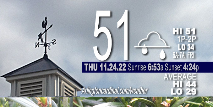
THURSDAY Hi 51, mostly cloudy, slight chance of rain 9a to 10a and 2p to 4p, winds SW to W to NW, 7 to 10 MPH
NWS CHGO | NWS HRLY | /NWSchicago | 🌡
ARLINGTON HEIGHTS WEATHER
▴ forecast7 (Arl. Hts.) | RADAR | WIDE RADAR
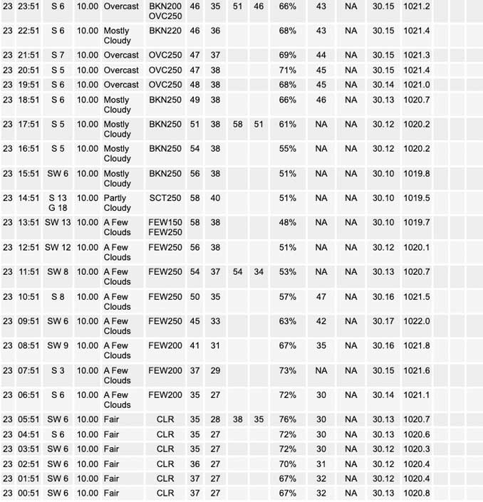
⏪ Hrly Data Table | Hrly Future Graph ⏩
IMPORTANT NOTE ON NWS DATA
⏪ Hrly Data Table | Hrly Future Graph ⏩
======================
Thursday and Thursday Night …
No Weather Hazards expected…
This Weather Outlook is for portions of North Central Illinois … Northeast Illinois and Northwest Indiana.
DISCUSSION…
Seasonably moist air mass is streaming north toward the area early this morning with a few showers more likely southeast of I-55.
A cold front will move across the area this evening bringing an end to the showers late afternoon and early evening. Not much chance of significant precipitation, but rain is mostly likely from 2:00 p.m. to 4:00 p.m. Thanksgiving afternoon. The air mass behind the cold front is of Pacific origin, so the air moving in is drier and not much cooler. With more sunshine, Friday temps might be warmer than Thursday, even though some forecasts indicated a high temp slightly lower or about the same. We might see mid 50s instead 49 or 50.
Third consecutive morning low above freezing forecast for O’Hare on Friday morning.
Hello mobile users! If you encounter mobile “unfriendly” weather page, turn your phone sideways for a better view.
======================
O’HARE FORECAST …
Forecast Beginning Thursday, Nov. 24, 2022
Thanksgiving Day: A slight chance of showers before 11am, then scattered showers after 2pm. Cloudy, with a high near 52. Southwest wind 5 to 10 mph. Chance of precipitation is 30%.
Thursday Night: Mostly cloudy, with a low around 33. Southwest wind around 10 mph becoming northwest after midnight. Winds could gust as high as 15 mph.
Friday: Sunny, with a high near 51. West wind 5 to 10 mph.
Friday Night: Mostly clear, with a low around 32. West southwest wind 5 to 10 mph.
Saturday: Sunny, with a high near 55. Southwest wind 10 to 15 mph, with gusts as high as 20 mph.
Saturday Night: Rain likely, mainly after midnight. Mostly cloudy, with a low around 39. Chance of precipitation is 70%.
Sunday: Rain, mainly before noon. High near 45. Chance of precipitation is 80%.
Sunday Night: Mostly cloudy, with a low around 29.
Monday: Mostly sunny, with a high near 44.
Monday Night: Partly cloudy, with a low around 35.
Tuesday: A chance of rain. Mostly cloudy, with a high near 52.
Tuesday Night: Rain likely. Mostly cloudy, with a low around 40.
Wednesday: A chance of rain and snow. Mostly cloudy, with a high near 45.


CHICAGOWEATHERSTATION.COM

ChicagoWeatherStation.com I O’Hare Normal Temps/Precip I O’Hare Record Temps, Precip, Snow
LIVE RADAR | STORM TRACKS | UNISYS US IR SAT | UNISYS Midwest IR SAT | UNISYS More IR SAT
WunderMap® with Temperature/Wind Data || Google: Arlington Heights Area Temps | US TEMPS
Full Screen Motion Weather Radar (Wunderground.com)
Midwest Cloud Cover with Arlington Heights Weather Forecast
ChicagoWeatherStation.com I O’Hare Normal Temps/Precip I O’Hare Record Temps, Precip, Snow
SUNLIGHT DATA FOR SECURITY, TRAFFIC SAFETY, AND SPORTS
SunCalc.net data with solar azimuth and trajectory, times for dawn, sunrise, solar noon, sunset, dusk …
NIGHT SKY THIS MONTH …
Backyard stargazers get a monthly guide to the northern hemisphere’s skywatching events with “Tonight’s Sky.” Check the night sky objects for this month and past months in the playlist from the Space Telescope Science Institute YouTube channel (Musical track The Far River written by Jonn Serrie, from the album And the Stars Go With You courtesy of New World Music Ltd).
Get updates from The Cardinal ALL NEWS FEEDS on Facebook. Just ‘LIKE’ the ‘Arlington Cardinal Page (become a fan of our page). The updates cover all posts and sub-category posts from The Cardinal — Arlingtoncardinal.com. You can also limit feeds to specific categories. See all of The Cardinal Facebook fan pages at Arlingtoncardinal.com/about/facebook …
Help fund The Cardinal Arlingtoncardinal.com/sponsor
Area Forecast Discussion
National Weather Service Chicago/Romeoville, IL
542 AM CST Thu Nov 24 2022
.SHORT TERM… Issued at 213 AM CST Thu Nov 24 2022
Through Friday…
Seasonably moist air mass is streaming north toward the area early this morning with a few showers accompanying the moisture return and likely aided by southern stream short wave passing south of the area this morning. Have introduced some small precip chances this morning with this initial band of widely scattered showers. More showers are expected later this afternoon as northern stream trough and associated cold front approach. Deeper moisture should reside over our southeastern CWA, mainly southeast of I-55, which is where showers are forecast to blossom as forcing from the approaching wave encounters this moisture. Northwest of I-55, particularly out toward northwest IL the best chance of showers looks to be this morning with the lead wave and theta-e advection and then likely dry this afternoon and tonight.
Cold front will move across the area this evening bringing an end to the showers by mid-late evening across our northwest Indiana Counties. Air mass behind the front is of Pacific origin, so drier and not much cooler. In fact, with more sunshine Friday temps will probably end up warmer than they will be today. Trended highs warmer than guidance toward the 925mb climo MaxT, which is generally lower 50s. Given the expected full sunshine and warm air advection it is quite possible it could end up mostly in the mid 50s.
– Izzi/NWS Chicago
