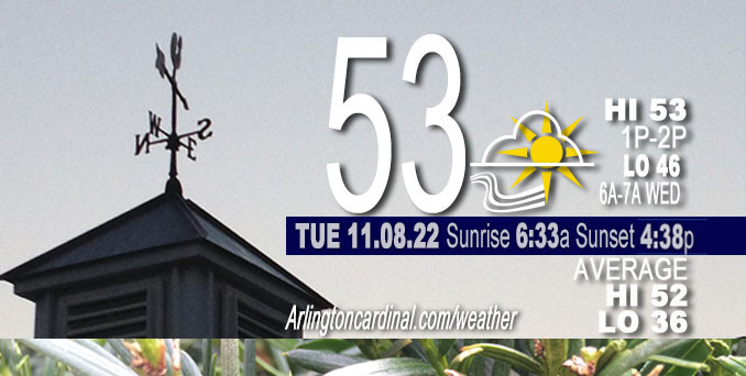
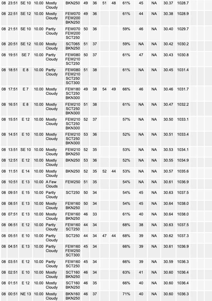
TUESDAY Hi 56, partly cloudy then mostly cloudy, winds E, 8 to 10 to 15 MPH, G15 after 8p

NWS CHGO | NWS HRLY | /NWSchicago | 🌡
ARLINGTON HEIGHTS WEATHER
▴ forecast7 (Arl. Hts.) | RADAR | WIDE RADAR
⏪ Hrly Data Table | Hrly Future Graph ⏩
IMPORTANT NOTE ON NWS DATA
⏪ Hrly Data Table | Hrly Future Graph ⏩
======================
Tuesday …
No weather hazards expected…
DISCUSSION…
A little warmer than Monday with two more warm days ahead, before temperatures drop.
Clear skies allowed an awesome Total Eclipse display, and then the Moon set while still eclipsed in the earth’s shadow as the sun rose.
Hello mobile users! If you encounter mobile “unfriendly” weather page, turn your phone sideways for a better view.
======================
O’HARE FORECAST …
Forecast Beginning Tuesday, Nov. 08, 2022
Tuesday Mostly sunny, with a high near 56. East southeast wind 10 to 15 mph, with gusts as high as 20 mph.
Tuesday Night Mostly cloudy, with a low around 45. East southeast wind around 10 mph.
Wednesday Mostly sunny, with a high near 66. South wind around 10 mph, with gusts as high as 15 mph.
Wednesday Night Partly cloudy, with a low around 57. South wind around 10 mph, with gusts as high as 20 mph.
Thursday Mostly sunny, with a high near 72. South wind 10 to 15 mph, with gusts as high as 30 mph.
Thursday Night A 40 percent chance of rain. Mostly cloudy, with a low around 38.
Veterans Day Mostly sunny, with a high near 47.
Friday Night Partly cloudy, with a low around 28.
Saturday Mostly cloudy, with a high near 35.
Saturday Night Mostly cloudy, with a low around 24.
Sunday Mostly sunny, with a high near 35.
Sunday Night Partly cloudy, with a low around 22.
Monday Mostly sunny, with a high near 38.


CHICAGOWEATHERSTATION.COM
ChicagoWeatherStation.com I O’Hare Normal Temps/Precip I O’Hare Record Temps, Precip, Snow
LIVE RADAR | STORM TRACKS | UNISYS US IR SAT | UNISYS Midwest IR SAT | UNISYS More IR SAT
WunderMap® with Temperature/Wind Data || Google: Arlington Heights Area Temps | US TEMPS
Full Screen Motion Weather Radar (Wunderground.com)
Midwest Cloud Cover with Arlington Heights Weather Forecast
ChicagoWeatherStation.com I O’Hare Normal Temps/Precip I O’Hare Record Temps, Precip, Snow
SUNLIGHT DATA FOR SECURITY, TRAFFIC SAFETY, AND SPORTS
SunCalc.net data with solar azimuth and trajectory, times for dawn, sunrise, solar noon, sunset, dusk …
NIGHT SKY THIS MONTH …
Backyard stargazers get a monthly guide to the northern hemisphere’s skywatching events with “Tonight’s Sky.” Check the night sky objects for this month and past months in the playlist from the Space Telescope Science Institute YouTube channel (Musical track The Far River written by Jonn Serrie, from the album And the Stars Go With You courtesy of New World Music Ltd).
Get updates from The Cardinal ALL NEWS FEEDS on Facebook. Just ‘LIKE’ the ‘Arlington Cardinal Page (become a fan of our page). The updates cover all posts and sub-category posts from The Cardinal — Arlingtoncardinal.com. You can also limit feeds to specific categories. See all of The Cardinal Facebook fan pages at Arlingtoncardinal.com/about/facebook …
Help fund The Cardinal Arlingtoncardinal.com/sponsor
Area Forecast Discussion
National Weather Service Chicago/Romeoville, IL
515 AM CST Tue Nov 8 2022
.SHORT TERM…
Issued at 113 AM CST Tue Nov 8 2022
Through Wednesday…
Quiet weather is forecast through the short term period, with moderating temperatures into midweek.
Surface high pressure across the Upper Great Lakes will slide eastward across New England into Wednesday. As it does so, winds will veer from the east-southeast today, to the south for Wednesday. The net result for us will be a rather notable jump in high temperatures for Wednesday as we begin to mix into a rather warm airmass aloft. Unfortunately, we are unlikely to mix into this warmer airmass overhead today as the east-southeasterly wind component will continue to maintain a thermal inversion off the surface through the day. For this reason high temperatures are once again expected to remain the 50s this afternoon.
Winds turn southerly early Wednesday as low pressure begins to take shape over the Plains into the Upper Midwest. This is expected to lead to a much warmer day for our area as deeper afternoon mixing will push temperatures into the mid to upper 60s. This warm temperatures should occur in spite of the fact that early morning cloud cover is likely in association with a weak mid-level disturbance expected to track northeastward across the area. There is even a non-zero chance that a deep enough cloud layer develops beneath some steeper mid-level lapse rates to support a few widely scattered showers or sprinkles. If these light showers were to materialize, they would be limited to the early morning hours. Dry weather with mostly sunny skies are expected Wednesday afternoon.
KJB/NWS Chicago


