
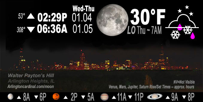
🌔 🌕 🌗 🌑 Waxing Gibbous Moon, freezing drizzle, snow, sky cover overnight Wed. to Thu. 100%, winds SW, 10 to 11 to 9 MPH, G15 to 18 to 15 MPH, Low 30, 7a to 8a
NWS CHGO | NWS HRLY | /NWSchicago | 🌡
ARLINGTON HEIGHTS WEATHER
▴ forecast7 (Arl. Hts.) | RADAR | WIDE RADAR
IMPORTANT NOTE ON NWS DATA
======================
NIGHT FORECASTS …
NOTE 1: Forecast and information text below may refer to a previous night on Arlingtoncardinal.com, and might not be updated until late afternoon, evening, or overnight. However, Night Sky archives on CARDINAL NEWS Magazine include text forecasts that correspond to the lunar phase graphic above.
NOTE 2: Keep in mind lunar rise and set times don’t always correspond with night weather and early morning lows because on some days during the month the moon is visible in the sky predominantly during the daytime hours.
Overnight Wednesday/Thursday …
Weather Hazards expected …
Limited Ice Accumulation Risk.
DISCUSSION…
Snow, mixing with freezing drizzle Wednesday night, may result in the development of patchy slick spots where temperatures fall below freezing, particularly across parts of the Fox River Valley. Arlington Heights and nearby suburbs may see freezing drizzle around 11:00 p.m. to 1:00 a.m.
Hello mobile users! If you encounter mobile “unfriendly” weather page, turn your phone sideways for a better view.
======================
O’HARE FORECAST …
Forecast Beginning Wednesday Night, Jan. 04, 2023 …
Wednesday Night: A chance of rain and snow showers before 11pm, then a chance of drizzle, snow showers, and freezing drizzle between 11pm and 2am, then scattered snow showers after 2am. Cloudy, with a low around 30. Southwest wind around 10 mph, with gusts as high as 15 mph. Chance of precipitation is 40%.
Thursday: Snow showers likely, mainly before 3pm. Cloudy, with a high near 33. Southwest wind around 10 mph, with gusts as high as 20 mph. Chance of precipitation is 70%. New snow accumulation of less than a half inch possible.
Thursday Night: Scattered snow showers before midnight, then scattered flurries between midnight and 3am. Cloudy, with a low around 30. West northwest wind around 10 mph, with gusts as high as 15 mph. Chance of precipitation is 30%.
Friday: Mostly cloudy, with a high near 34. West wind 5 to 10 mph.
Friday Night: Partly cloudy, with a low around 25. West wind around 5 mph becoming calm in the evening.
Saturday: Mostly sunny, with a high near 37.
Saturday Night: A 40 percent chance of snow. Mostly cloudy, with a low around 30.
Sunday: Mostly cloudy, with a high near 36.
Sunday Night: Mostly cloudy, with a low around 27.
Monday: Mostly sunny, with a high near 39.
Monday Night: Mostly cloudy, with a low around 30.
Tuesday: Mostly cloudy, with a high near 39.
Tuesday Night: Mostly cloudy, with a low around 28.
Wednesday: Partly sunny, with a high near 36.
O’Hare forecast archive and hourly weather observations archive are available HERE on the CARDINAL NEWS Magazine.
Arlingtoncardinal.com/moonphases
Arlingtoncardinal.com/nightsky
NIGHT SKY THIS MONTH …
Check the night sky objects for this month and past months in the playlist from the Space Telescope Science Institute YouTube channel Backyard stargazers get a monthly guide to the northern hemisphere’s skywatching events with “Tonight’s Sky” (Musical track The Far River written by Jonn Serrie, from the album And the Stars Go With You courtesy of New World Music Ltd. Musical track The Far River written by Jonn Serrie, from the album And the Stars Go With You courtesy of New World Music Ltd).
Telephoto lens, ISO 100, f/11, Shutter Speed 1/100 to 1/125 for the Moon.
Get updates from The Cardinal ALL NEWS FEEDS on Facebook. Just ‘LIKE’ the ‘Arlington Cardinal Page (become a fan of our page). The updates cover all posts and sub-category posts from The Cardinal — Arlingtoncardinal.com. You can also limit feeds to specific categories. See all of The Cardinal Facebook fan pages at Arlingtoncardinal.com/about/facebook …
Help fund The Cardinal Arlingtoncardinal.com/sponsor
Telephoto lens, ISO 1600, f/11, Shutter Speed 2.5″ for the skyline. The skyline exposure was toned down, and brightness and contrast was adjusted in Photoshop.
Area Forecast Discussion
National Weather Service Chicago/Romeoville, IL
534 PM CST Wed Jan 4 2023
.SHORT TERM… Issued at 300 PM CST Wed Jan 4 2023
Through Thursday night…
Main forecast messages and concerns:
* Patchy freezing drizzle potential this evening through early overnight, with slick spots possible on some roads
* Waves of light snow/snow showers/flurries tonight, with minimal if any accumulation
* Waves of light to moderate snow/snow showers on Thursday with minor accumulations, periodic reduced visibility, and slippery travel on some roads
Another expansive well defined closed mid-upper level low pressure will affect the area through Thursday evening. This evening, at least to start, the issue is marginal saturation into the DGZ (dendritic/snow growth zone), as low as -10C. As of this writing, multiple observation sites are showing BR with reduced visibility, with a few spots of explicit drizzle being reported. These obs at non- manned automated sites can be indicative of drizzle, with freezing drizzle where temps are at or below 32F. This is despite sufficiently cold IR temps on GOES-East.
With the marginal saturation depth, it can be a fine line between mainly light snow/flurries, snizzle (a mix of light snow and drizzle), and primarily drizzle/freezing drizzle. With temperatures in the Fox Valley and points west already down in the 32-33F range and temperatures expected to slowly fall tonight, this is the primary of concern for slick spots due to patchy freezing drizzle. Another factor to keep in mind is that prior road treatments were likely washed away by the waves of rain the past few days. Will have to keep a close eye on observations through this evening.
Expecting the column to trend to more snow supportive with time (deeper saturation in the DGZ and isothermal near -10C), so if freezing drizzle or a mix with light snow occurs this evening, it should go to primarily snow. Regarding the snow through Thursday, our feature of note is a stout vort max circulating around the upper low gyre, currently centered near the IA/MN border and producing decent coverage of snow in that area and points north. There are liable to be pockets of modestly enhanced snow showers later this evening and overnight pending sufficient DGZ saturation.
Then on Thursday, the core of the aforementioned vorticity maxima will translate eastward and produce good forcing for ascent amidst a by then saturated DGZ and cold advection. Snow/snow shower coverage should increase fairly quickly after sunrise, peaking in the mid- late morning through mid afternoon (~8am-3pm CST), and then easing to scattered coverage after sunset as the daytime wave shifts east. Snow showers should taper to flurries and end late evening and overnight following one last mid-level short-wave. With relatively steep mid-level lapse rates paired with the peak of snow coverage, envision occasional moderate snow rates with visibility as low as a bit under 1 mile. Temperatures will generally be near to a couple degrees below freezing with the snow, so pavement accums will be tied to prior treatment, pavement temps, and how heavily traveled the roads are. Thus, would appear bridges, overpasses, less traveled roads and side streets would be most susceptible to being coated with snow. Minor accumulations generally of a coating to a few/several tenths are forecast, though localized 1″ totals wouldn`t be surprising where duration of higher snow rates maximizes.
Cloudy skies will be the rule until perhaps late Thursday night after the flurries end, so should be another limited diurnal range, though a bit colder (mid-upper 20s northwest CWA) to around 30F east.
Castro/NWS Chicago
