
🌑 🌓 🌕 🌗 New Moon, sky cover overnight Sun. to Mon. 43% to 80% to 43%, winds WSW to NW, 11 to 5 MPH, G22 to 14 MPH end 2a, Low 30, 6a to 7a
NWS CHGO | NWS HRLY | /NWSchicago | 🌡
ARLINGTON HEIGHTS WEATHER
▴ forecast7 (Arl. Hts.) | RADAR | WIDE RADAR
IMPORTANT NOTE ON NWS DATA
======================
NIGHT FORECASTS …
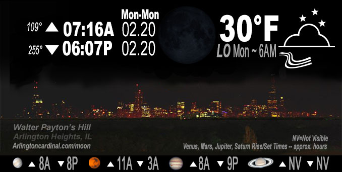
NOTE: Keep in mind lunar rise and set times don’t always correspond with night weather and early morning lows because on some days during the month the moon is visible in the sky predominantly during the daytime hours.
Overnight Sunday/Monday …
No Weather Hazards expected
Gusty winds drop from about 21 MPH at sunset to 13 MPH at 2:00 a.m.
DISCUSSION…
Expect an increase in cloud cover and overnight behind the cold front. Overnight temperatures will be dependent upon the coverage of low clouds and how long they persist through the early morning hours. If coverage is higher temperatures may not dip much below 30 degrees. However, with any clearing, temps quickly dip into the mid 20s, especially northwest. There is a weak signal for some patchy fog development mainly away from the Chicago metro area across interior Illinois.
Hello mobile users! If you encounter mobile “unfriendly” weather page, turn your phone sideways for a better view.
======================
O’HARE FORECAST …
Forecast Beginning Sunday Night, Feb. 19, 2023 …
Sunday Night: Mostly cloudy, with a low around 30. West southweast wind 5 to 15 mph becoming north northwest after midnight. Winds could gust as high as 20 mph.
Monday Washington’s Birthday: Partly sunny, with a high near 45. Northwest wind 5 to 10 mph becoming south in the morning. Winds could gust as high as 15 mph.
Monday Night: Partly cloudy, with a low around 29. South southwest wind 10 to 15 mph becoming west after midnight. Winds could gust as high as 30 mph.
Tuesday: Mostly sunny, with a high near 38. West northwest wind 10 to 15 mph decreasing to 5 to 10 mph in the afternoon. Winds could gust as high as 30 mph.
Tuesday Night: A slight chance of rain and snow after 1am. Mostly cloudy, with a low around 31.
Wednesday: A slight chance of rain and snow before 7am, then rain. Cloudy, with a high near 36. Breezy. Chance of precipitation is 90%.
Wednesday Night: Rain mainly before 1am. Cloudy, with a low around 33. Breezy.
Thursday: A chance of rain before 7am. Mostly cloudy, with a high near 45. Breezy.
Thursday Night: Mostly cloudy, with a low around 18. Breezy.
Friday: Partly sunny, with a high near 31.
Friday Night: A chance of snow. Mostly cloudy, with a low around 27.
Saturday: Mostly cloudy, with a high near 40.
Saturday Night: Partly cloudy, with a low around 29.
O’Hare forecast archive and hourly weather observations archive are available HERE on the CARDINAL NEWS Magazine.
Arlingtoncardinal.com/moonphases
Arlingtoncardinal.com/nightsky
NIGHT SKY THIS MONTH …
Check the night sky objects for this month and past months in the playlist from the Space Telescope Science Institute YouTube channel Backyard stargazers get a monthly guide to the northern hemisphere’s skywatching events with “Tonight’s Sky” (Musical track The Far River written by Jonn Serrie, from the album And the Stars Go With You courtesy of New World Music Ltd. Musical track The Far River written by Jonn Serrie, from the album And the Stars Go With You courtesy of New World Music Ltd).
Telephoto lens, ISO 100, f/11, Shutter Speed 1/100 to 1/125 for the Moon.
Get updates from The Cardinal ALL NEWS FEEDS on Facebook. Just ‘LIKE’ the ‘Arlington Cardinal Page (become a fan of our page). The updates cover all posts and sub-category posts from The Cardinal — Arlingtoncardinal.com. You can also limit feeds to specific categories. See all of The Cardinal Facebook fan pages at Arlingtoncardinal.com/about/facebook …
Help fund The Cardinal Arlingtoncardinal.com/sponsor
Telephoto lens, ISO 1600, f/11, Shutter Speed 2.5″ for the skyline. The skyline exposure was toned down, and brightness and contrast was adjusted in Photoshop.
Area Forecast Discussion
National Weather Service Chicago/Romeoville, IL
344 AM CST Mon Feb 20 2023
.SHORT TERM… Issued at 344 AM CST Mon Feb 20 2023
Through Tuesday…
Winds have turned northerly across the area in the wake of a weak cold frontal passage. While a slightly cooler airmass is working southward into the area and resulting in subfreezing temperatures across parts of the area early this morning, temperatures look to rebound nicely today. We should see the winds go light and variable for a period this morning before they settle back to a southerly direction this afternoon. This should help temperatures rebound back into the 40s this afternoon under partly sunny skies.
A clipper system moving across the Dakotas this morning will quickly shift eastward across the Upper Midwest later today, and into the Upper Great Lakes region tonight. This system will push a trailing cold front eastward across our area around, or shortly after midnight tonight. While conditions will turn colder as blustery northwesterly winds develop in the wake of the front overnight, conditions should remain relatively mild (lower 40s) in advance of the front this evening. Gusty northwest winds (up to 35 mph) overnight will then drive temperatures back down into the 20s into early Tuesday morning. Most, if not all, of precipitation associated with the clipper system will remain north of the area, so we continue a mainly dry forecast for the area through Tuesday.
Winds will abate across the area during the day Tuesday as a weak surface high quickly shifts across the area in advance of the next storm system expected to impact the region Wednesday into Thursday. Expect high temperatures Tuesday to be cooler, with readings likely to range from the lower 30s far north, to around 40 far south.
KJB/NWS Chicago
