
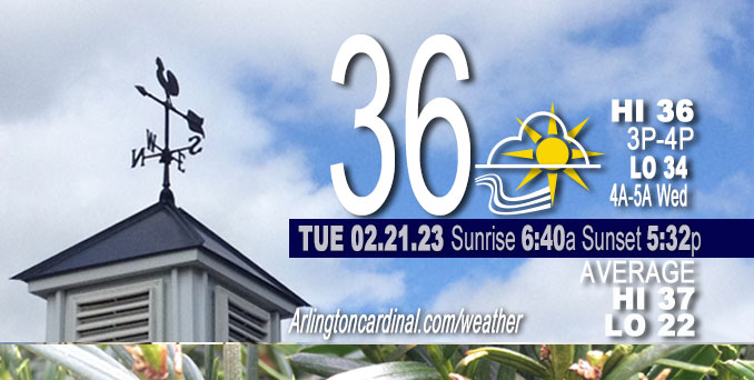
Tuesday Hi 37, partly cloudy to mostly cloudy, winds WNW to W to SE to E, 20 to 6 to 11 MPH, G32 to 34 to 14 MPH end 12p
NWS CHGO | NWS HRLY | /NWSchicago | 🌡
ARLINGTON HEIGHTS WEATHER
▴ forecast7 (Arl. Hts.) | RADAR | WIDE RADAR
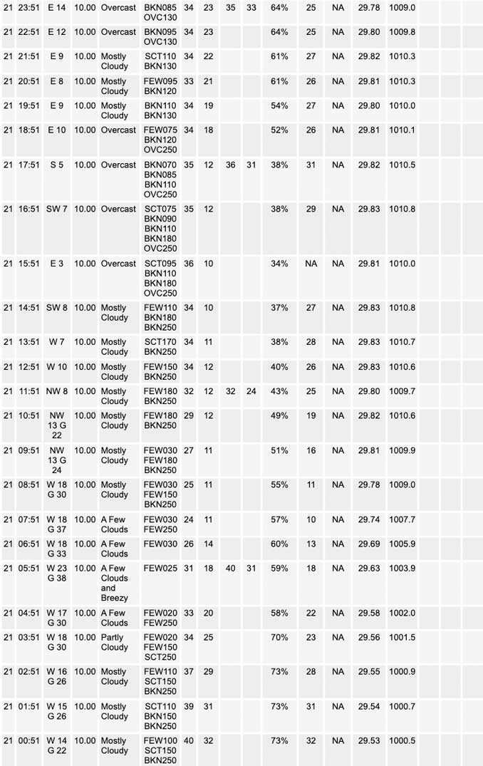
⏪ Hrly Data Table | Hrly Future Graph ⏩
IMPORTANT NOTE ON NWS DATA
⏪ Hrly Data Table | Hrly Future Graph ⏩
======================
Tuesday and Tuesday Evening …
Weather Hazards expected …
Limited Non Thunderstorm Wind Risk in the morning.
DISCUSSION…
A cold front moving in across Chicagoland overnight Monday to Tuesday, resulted in a period of gusty west-northwesterly winds. These gusty winds are expected to abate across the area during the mid to late morning hours Tuesday as the surface gradient eases with the approach of a surface ridge of high pressure. While these winds will become light across the area into the afternoon, a colder airmass shifting into the area early this morning will keep temperatures from warming above the 30s Tuesday.
Gusty westerly winds upwards of 30 mph will continue through mid- morning before gusts quickly ease by early afternoon. A gust of 38 MPH was reported just before 6:00 a.m.
Daily low temperatures and daily high temperatures are on the way up. We’re gaining about 2 minutes of daylight every day in the progression toward vernal equinox, March 20, 2023.
======================
O’HARE FORECAST …
Forecast Beginning Tuesday, Feb. 21, 2023
Tuesday: Partly sunny, with a high near 37. West wind around 5 mph becoming south southeast.
Tuesday Night: Cloudy, with a low around 32. East wind 5 to 15 mph, with gusts as high as 25 mph.
Wednesday: A chance of rain and sleet before 9am, then rain. The rain could be heavy at times. High near 37. East northeast wind around 15 mph, with gusts as high as 30 mph. Chance of precipitation is 100%. Little or no sleet accumulation expected.
Wednesday Night: Rain, mainly before midnight. Low around 33. Breezy, with a northeast wind 10 to 20 mph, with gusts as high as 30 mph. Chance of precipitation is 90%.
Thursday: A 20 percent chance of rain before noon. Partly sunny, with a high near 45. Windy, with an east wind 10 to 20 mph becoming west 20 to 30 mph in the morning. Winds could gust as high as 45 mph.
Thursday Night: Mostly cloudy, with a low around 16. Breezy.
Friday: Partly sunny, with a high near 26.
Friday Night: Mostly cloudy, with a low around 21.
Saturday: Mostly sunny, with a high near 40.
Saturday Night: Partly cloudy, with a low around 26.
Sunday: Mostly sunny, with a high near 42.
Sunday Night: A chance of snow. Partly cloudy, with a low around 29.
Monday: Rain likely. Mostly cloudy, with a high near 47. Breezy.


CHICAGOWEATHERSTATION.COM

ChicagoWeatherStation.com I O’Hare Normal Temps/Precip I O’Hare Record Temps, Precip, Snow
LIVE RADAR | STORM TRACKS | UNISYS US IR SAT | UNISYS Midwest IR SAT | UNISYS More IR SAT
WunderMap® with Temperature/Wind Data || Google: Arlington Heights Area Temps | US TEMPS
Full Screen Motion Weather Radar (Wunderground.com)
Midwest Cloud Cover with Arlington Heights Weather Forecast
ChicagoWeatherStation.com I O’Hare Normal Temps/Precip I O’Hare Record Temps, Precip, Snow
SUNLIGHT DATA FOR SECURITY, TRAFFIC SAFETY, AND SPORTS
SunCalc.net data with solar azimuth and trajectory, times for dawn, sunrise, solar noon, sunset, dusk …
NIGHT SKY THIS MONTH …
Backyard stargazers get a monthly guide to the northern hemisphere’s skywatching events with “Tonight’s Sky.” Check the night sky objects for this month and past months in the playlist from the Space Telescope Science Institute YouTube channel (Musical track The Far River written by Jonn Serrie, from the album And the Stars Go With You courtesy of New World Music Ltd).
Get updates from The Cardinal ALL NEWS FEEDS on Facebook. Just ‘LIKE’ the ‘Arlington Cardinal Page (become a fan of our page). The updates cover all posts and sub-category posts from The Cardinal — Arlingtoncardinal.com. You can also limit feeds to specific categories. See all of The Cardinal Facebook fan pages at Arlingtoncardinal.com/about/facebook …
Help fund The Cardinal Arlingtoncardinal.com/sponsor
Area Forecast Discussion
National Weather Service Chicago/Romeoville, IL
554 AM CST Tue Feb 21 2023
.SHORT TERM… Issued at 342 AM CST Tue Feb 21 2023
Through Wednesday night…
The ingredients are set to come together on Wednesday for a significant precipitation event across the area. With this event, the primary concerns are:
* Heightened hydro concerns Wednesday afternoon into at least the early evening due to the increasing likelihood for a period of steady heavy rainfall, which is likely to be aided by a period of training elevated convection. Potential exists for an east-northeastward oriented corridor of 2-3″ rainfall amounts from this roughly near, or just southeast of the I-55 corridor.
* Heightened concern for ice and sleet accumulation across far northern IL especially along and north of the IL-WI state line.
Prior to the onset of our well advertised midweek storm system, we currently have a cold front shifting across the area, resulting in a period of gusty west-northwesterly winds. These gusty winds are expected to abate across the area during the mid to late morning hours as the surface gradient eases with the approach of a surface ridge of high pressure. While these winds will become light across the area into the afternoon, a colder airmass shifting into the area early this morning will keep temperatures from warming out of the 30s today.
A sharp west-to-east oriented lower level baroclinic zone will sag over the area today in the wake of this mornings cold frontal passage. Ultimately this will help fuel a large expansive area of precipitation across the Midwest eastward across the Great Lakes region late tonight through Wednesday night as a large upper trough digging into the western CONUS today drives a pair of surface lows eastward across Mid-Mississippi Valley through Thursday.
The main feature of interest for our heavy rain threat (and potential icing event far north) Wednesday afternoon is the upper low currently over the Baja of California. Forecast and ensemble guidance has been consist with this feature getting ejected east- northeastward across the southern Rockies tonight as the main upper level trough digs into the Desert Southwest. As this occurs, a strengthening southerly low-level jet across the baroclinic zone will result in a region of strong warm air advection driven precipitation across the Upper Midwest tonight. The precipitation type with this should be snow, but the main focus for this will be primarily north of our area. However, I did maintain a small chance for a period of light snow this evening over my northern tier IL counties. Otherwise, our main area of precipitation is expected to develop northward across the area Wednesday morning as the lead impulse ejecting across the southern Rockies begins to shift towards the Mid-Mississippi Valley.
…Heavy rain and flooding threat Wednesday afternoon into early evening…
The primary period of concern for heavy rain and elevated thunderstorms continues to be favored during the afternoon through the early evening period on Wednesday. A fairly classic cold season heavy rain setup still is favored to set up overhead thanks to strong upper level dynamic forcing from coupled upper level jets coinciding with a band of strong low-to-mid level frontogenesis developing along the north side of a surface warm front as the low-level jet noses into the lower-level baroclinic zone. Also of note is the near record amounts of atmospheric moisture (PWATS in excess of 1.4″), which is expected to accompany the airmass nosing into, and on the cold side of the surface warm frontal boundary Wednesday afternoon. All together this will support a period of heavy rainfall across the area. The heaviest rainfall is likely to fall within the training embedded elevated convection along the north side of the surface warm front. While there continues to be some uncertainty with the exact areas that experience these 2-3″ rain amounts, there continues to be strong support that this could be along, or just southeast of the I-55 corridor. Conditions will need to be monitored for the possibility of a flash flood watch as we approach this event, especially if it appears this heavy rainfall axis continues to be favored to extend into the Chicago metro area. At the present time, we will continue to highlight this threat in an ESF.
…Icing potential in far northern IL Wednesday into Wednesday night…
The potential for near, or even subfreezing temperatures across far northern IL (especially across my northern tier counties near the WI state line) Wednesday afternoon into Wednesday night will potentially support periods of freezing rain and sleet as a substantial warm layer aloft noses overhead. Guidance continues to be in agreement that blustery east-northeasterly winds here will keep temperatures fairly steady around freezing into Wednesday evening during the main period of precipitation. However, confidence on exact surface temperatures continues to be of somewhat low confidence, especially since 1 or 2 degrees will potentially make all the difference between a rain event and one the results in notable icing. Nevertheless, there continues to be concern that some notable icing from freezing rain and sleet may occur across far inland sections of far northern IL near the WI state line, and with gusty east-northeasterly winds this could cause impacts.
The one aspect (aside from temperature uncertainties) that makes us hesitant to issue a winter storm watch for this area for potential icing is the heavier rain rates expected. Typically, higher rain rates within marginal thermal environments results in very poor ice to liquid ratios, meaning that ice accretion is much less efficient due to increased run off. With this in mind, total icing amounts could remain somewhat limited (<0.25") thus making a winter weather advisory more appropriate for my northern tier IL counties. This is something we will have to keep an eye on, however. KJB/NWS Chicago
