
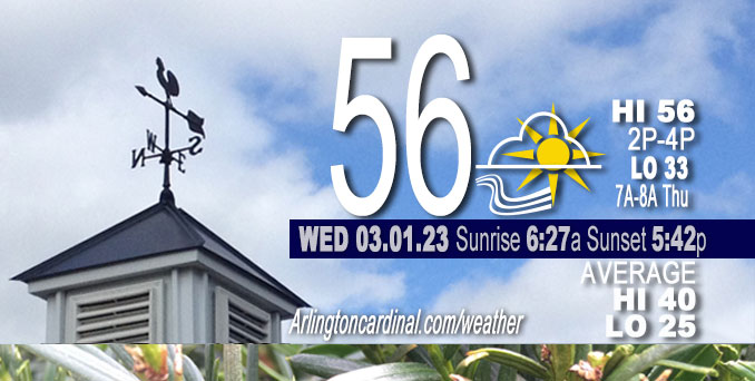
Wednesday Hi 56, partly sunny to partly cloudy, winds ESE to SE to S to SW to WNW, 6 to 11 to 7 to 13 MPH, G15 to 17 to 15, 12p to 4p
NWS CHGO | NWS HRLY | /NWSchicago | 🌡
ARLINGTON HEIGHTS WEATHER
▴ forecast7 (Arl. Hts.) | RADAR | WIDE RADAR
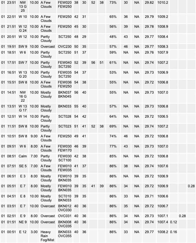
⏪ Hrly Data Table | Hrly Future Graph ⏩
IMPORTANT NOTE ON NWS DATA
⏪ Hrly Data Table | Hrly Future Graph ⏩
======================
Wednesday and Wednesday Evening …
No Weather Hazards expected …
Total rainfall reported at O’Hare International Airport from 11:00 p.m. Tuesday, February 28, 2023 until 3:00 a.m. Wednesday, March 1, 2023 was 0.28 inch.
DISCUSSION…
Somewhat uncertain cloud forecast for Wednesday morning farther north, with lingering modest warm advection potentially facilitating the development of lower stratus. However, recent trends in guidance are leaning a bit more away from this stratus forecast now. Either way, it appears that where skies become clear, the temperatures will respond nicely by jumping into the 50s and even lower 60s as a push of westerly breezes develops based on local 925 mb temperature climatology.
======================
O’HARE FORECAST …
Forecast Beginning Wednesday, Mar. 01, 2023
Wednesday: Mostly sunny, with a high near 56. East wind 5 to 10 mph becoming west in the afternoon. Winds could gust as high as 15 mph.
Wednesday Night: Mostly cloudy, with a low around 33. West northwest wind 5 to 15 mph, with gusts as high as 25 mph.
Thursday: Cloudy, with a high near 38. North wind around 10 mph, with gusts as high as 15 mph.
Thursday Night: A chance of rain and snow after 1am. Mostly cloudy, with a low around 33. East wind 10 to 15 mph, with gusts as high as 25 mph. Chance of precipitation is 40%.
Friday: Rain and snow, mainly after 7am. High near 37. Breezy, with an east northeast wind 15 to 25 mph, with gusts as high as 40 mph. Chance of precipitation is 90%.
Friday Night: Rain and snow before 10pm, then a chance of snow between 10pm and 1am. Low around 29. Blustery. Chance of precipitation is 90%.
Saturday: Partly sunny, with a high near 40.
Saturday Night: Mostly cloudy, with a low around 28.
Sunday: Mostly sunny, with a high near 44.
Sunday Night: Mostly cloudy, with a low around 33.
Monday: Mostly cloudy, with a high near 47.
Monday Night: Mostly cloudy, with a low around 36.
Tuesday: Partly sunny, with a high near 43.


CHICAGOWEATHERSTATION.COM

ChicagoWeatherStation.com I O’Hare Normal Temps/Precip I O’Hare Record Temps, Precip, Snow
LIVE RADAR | STORM TRACKS | UNISYS US IR SAT | UNISYS Midwest IR SAT | UNISYS More IR SAT
WunderMap® with Temperature/Wind Data || Google: Arlington Heights Area Temps | US TEMPS
Full Screen Motion Weather Radar (Wunderground.com)
Midwest Cloud Cover with Arlington Heights Weather Forecast
ChicagoWeatherStation.com I O’Hare Normal Temps/Precip I O’Hare Record Temps, Precip, Snow
SUNLIGHT DATA FOR SECURITY, TRAFFIC SAFETY, AND SPORTS
SunCalc.net data with solar azimuth and trajectory, times for dawn, sunrise, solar noon, sunset, dusk …
NIGHT SKY THIS MONTH …
Backyard stargazers get a monthly guide to the northern hemisphere’s skywatching events with “Tonight’s Sky.” Check the night sky objects for this month and past months in the playlist from the Space Telescope Science Institute YouTube channel (Musical track The Far River written by Jonn Serrie, from the album And the Stars Go With You courtesy of New World Music Ltd).
Get updates from The Cardinal ALL NEWS FEEDS on Facebook. Just ‘LIKE’ the ‘Arlington Cardinal Page (become a fan of our page). The updates cover all posts and sub-category posts from The Cardinal — Arlingtoncardinal.com. You can also limit feeds to specific categories. See all of The Cardinal Facebook fan pages at Arlingtoncardinal.com/about/facebook …
Help fund The Cardinal Arlingtoncardinal.com/sponsor
Area Forecast Discussion
National Weather Service Chicago/Romeoville, IL
552 AM CST Wed Mar 1 2023
.SHORT TERM… Issued at 200 AM CST Wed Mar 1 2023
Through Thursday…
Small/intense region of mid-level frontogenesis continues to push north and east along the leading edge of an elongated vort lobe and will continue to carry showers out of the region. Across our south, skies will continue to clear out as an associated surface trough drifts northward. This will result in a slackening low- level wind field and with dewpoint depressions running only a few degrees, have added in a little swath of patchy fog where BUFKIT soundings show sufficient decoupling for some BR formation.
Somewhat of an uncertain cloud forecast for this morning farther north, with lingering modest warm advection potentially facilitating the development of lower stratus although recent trends in guidance are leaning a bit more away from this solution now. Either way, it looks like where skies do clear that temperatures will respond nicely by jumping into the 50s and even lower 60s as a push of westerly breezes develops based on local 925 mb temperature climatology. Went along with the higher end of guidance for temperatures today as a result, especially across the southern 2/3rds of the area. Stronger gradient wind flow will initially hold up any lake breeze, but should see this peel off the NE IL shoreline late this afternoon and evening resulting in a bit of a late-day temperature drop. Pushed the warmer temps all the way to the lake front through mid afternoon.
A fairly compact/vigorous wave which is just now pushing out of the Dakotas will translate across central and northern Wisconsin this evening. Low-levels down this way appear fairly dry, with a shallow lingering moist layer so no precipitation chances with this. One trend in the guidance has been to show an increased mass response behind this wave and surface reflection into the overnight and Thursday morning. Should be good enough for some gusts towards 25 mph tonight which will escort a cooler airmass into the area.
Noting a good deal of spread regarding the staying power of attendant stratus/near-surface moisture into Thursday morning and afternoon. HRRR, RAP, NAM, and even the GFS to a degree seem to keep low cloud cover in place through much of the day. Have commensurately knocked high temperatures down a smidge with this in mind, although have not bitten off on the most aggressive/coldest guidance at this point.
Carlaw/NWS Chicago
