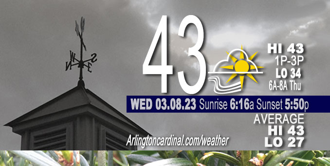
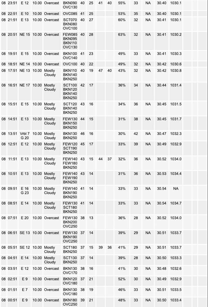
Wednesday Hi 43, partly sunny, winds E to ENE, 8 to 11 MPH, G13 to 17 to 22 to 18 MPH into Thursday

NWS CHGO | NWS HRLY | /NWSchicago | 🌡
ARLINGTON HEIGHTS WEATHER
▴ forecast7 (Arl. Hts.) | RADAR | WIDE RADAR
⏪ Hrly Data Table | Hrly Future Graph ⏩
IMPORTANT NOTE ON NWS DATA
⏪ Hrly Data Table | Hrly Future Graph ⏩
======================
Wednesday and Wednesday Evening …
No Weather Hazards expected …
Quiet weather is expected through Wednesday night ahead of an approaching winter system arriving Thursday afternoon.
DISCUSSION…
Despite the cloudy skies today, temperatures are expected to warm into the mid to upper 40s for most of Chicagoland
======================
O’HARE FORECAST …
Forecast Beginning Wednesday, Mar. 08, 2023
Wednesday: Mostly cloudy, with a high near 44. East wind around 10 mph, with gusts as high as 15 mph.
Wednesday Night: Mostly cloudy, with a low around 33. East wind around 10 mph, with gusts as high as 20 mph.
Thursday: A slight chance of snow between noon and 3pm, then snow likely, possibly mixed with rain. Cloudy, with a high near 38. East wind 10 to 15 mph, with gusts as high as 25 mph. Chance of precipitation is 60%. New snow accumulation of less than a half inch possible.
Thursday Night: Snow, possibly mixed with rain before midnight, then snow between midnight and 3am, then snow, possibly mixed with rain after 3am. Low around 32. Breezy, with an east wind 15 to 20 mph, with gusts as high as 25 mph. Chance of precipitation is 100%. New snow accumulation of 2 to 4 inches possible.
Friday: A 50 percent chance of snow before noon. Cloudy, with a high near 34. North wind around 15 mph, with gusts as high as 25 mph.
Friday Night: Mostly cloudy, with a low around 27.
Saturday: Mostly cloudy, with a high near 35.
Saturday Night: A chance of snow after midnight. Mostly cloudy, with a low around 30.
Sunday: A chance of snow before noon. Mostly cloudy, with a high near 36.
Sunday Night: Mostly cloudy, with a low around 29.
Monday: Mostly cloudy, with a high near 37.
Monday Night: Partly cloudy, with a low around 23.
Tuesday: Mostly sunny, with a high near 35.


CHICAGOWEATHERSTATION.COM
ChicagoWeatherStation.com I O’Hare Normal Temps/Precip I O’Hare Record Temps, Precip, Snow
LIVE RADAR | STORM TRACKS | UNISYS US IR SAT | UNISYS Midwest IR SAT | UNISYS More IR SAT
WunderMap® with Temperature/Wind Data || Google: Arlington Heights Area Temps | US TEMPS
Full Screen Motion Weather Radar (Wunderground.com)
Midwest Cloud Cover with Arlington Heights Weather Forecast
ChicagoWeatherStation.com I O’Hare Normal Temps/Precip I O’Hare Record Temps, Precip, Snow
SUNLIGHT DATA FOR SECURITY, TRAFFIC SAFETY, AND SPORTS
SunCalc.net data with solar azimuth and trajectory, times for dawn, sunrise, solar noon, sunset, dusk …
NIGHT SKY THIS MONTH …
Backyard stargazers get a monthly guide to the northern hemisphere’s skywatching events with “Tonight’s Sky.” Check the night sky objects for this month and past months in the playlist from the Space Telescope Science Institute YouTube channel (Musical track The Far River written by Jonn Serrie, from the album And the Stars Go With You courtesy of New World Music Ltd).
Get updates from The Cardinal ALL NEWS FEEDS on Facebook. Just ‘LIKE’ the ‘Arlington Cardinal Page (become a fan of our page). The updates cover all posts and sub-category posts from The Cardinal — Arlingtoncardinal.com. You can also limit feeds to specific categories. See all of The Cardinal Facebook fan pages at Arlingtoncardinal.com/about/facebook …
Help fund The Cardinal Arlingtoncardinal.com/sponsor
Area Forecast Discussion
National Weather Service Chicago/Romeoville, IL
535 AM CST Wed Mar 8 2023
.SHORT TERM… Issued at 315 AM CST Wed Mar 8 2023
Through Wednesday night…
Quiet weather is expected through Wednesday night ahead of our approaching winter system arriving Thursday (more on that below). Upper ridging remains overhead with the influence of the Canadian surface high pressure keeping us dry and winds generally easterly. On the southwestern fringes of this feature there is just enough low- to-mid level moisture advection and frontogenesis associated with a weak shortwave moving beneath the ridge for light precipitation to develop along the mid-Mississippi River Valley. This may try to sneak eastward into southwestern periphery of our forecast area this morning, though am fairly confident the dry low-levels keep this as virga or at most a stray sprinkle reaches the ground.
Despite the cloudy skies today, temperatures are expected to warm into the mid to upper 40s across much of the area, with the exception being far northeast Illinois and shoreline areas where warming likely stalls near or just above 40 thanks to lake cooled air influences.
Petr/NWS Chicago


