
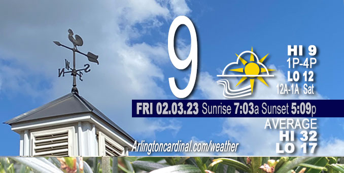
Friday Hi 9, mostly sunny, increasing clouds after 1p, winds NW to SW to SSW, 10 to 5 to 9 MPH, G21 to 15 MPH, ending 6a
NWS CHGO | NWS HRLY | /NWSchicago | 🌡
ARLINGTON HEIGHTS WEATHER
▴ forecast7 (Arl. Hts.) | RADAR | WIDE RADAR
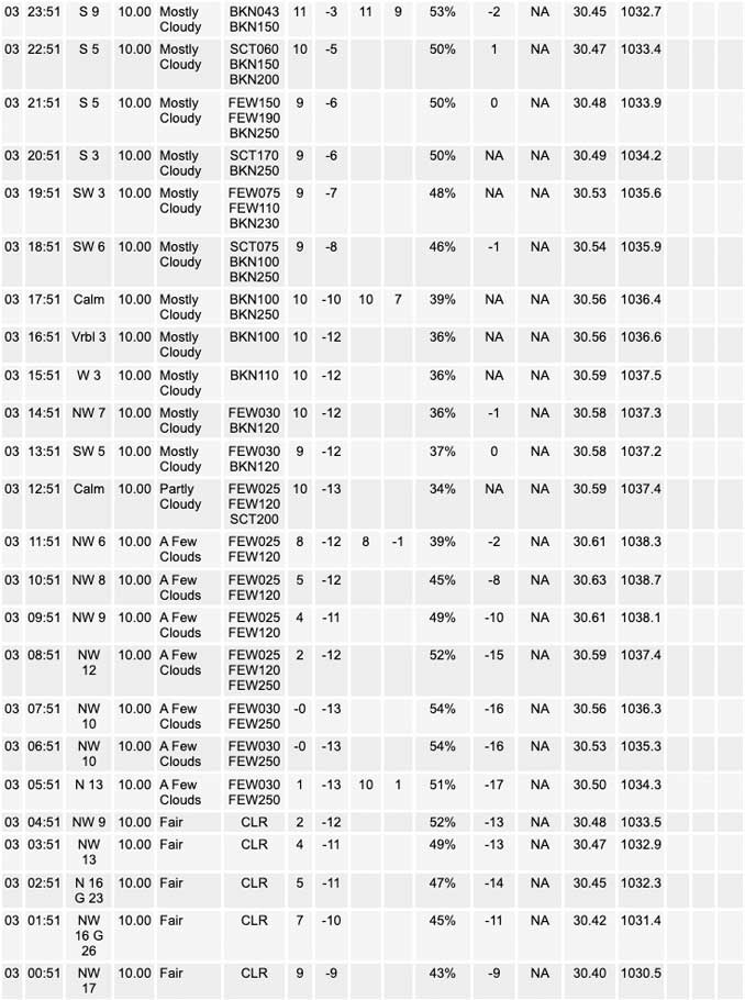
⏪ Hrly Data Table | Hrly Future Graph ⏩
IMPORTANT NOTE ON NWS DATA
⏪ Hrly Data Table | Hrly Future Graph ⏩
======================
Friday and Friday Night …
Weather Hazards expected …
Wind Chill Advisory issued February 03 at 9:35AM CST until February 03 at 10:00AM CST by NWS: …WIND CHILL ADVISORY WILL EXPIRE AT 10 AM CST FRIDAY MORNING… Wind chills will continue to improve late Friday morning as winds ease and temperatures gradually warm above zero. *The Wind Chill Advisory was initially issued Thursday, February 02 at 2:53AM CST.
DISCUSSION…
Temperatures will not warm much over the snow-covered areas of north central Illinois this afternoon where single digits should be it for highs. High pressure of 1038 mb will move over the area late today and this evening resulting in near calm winds and wind chill values just slightly below temperatures. A well-agreed upon thickening mid cloud passing this evening should limit an otherwise sharp temperature drop.
Daily low temperatures and daily high temperatures are on the way up. We’re gaining about 2 minutes of daylight every day in the progression toward vernal equinox, March 20, 2023.
======================
O’HARE FORECAST …
Forecast Beginning Friday, Feb. 03, 2023
O’HARE FORECAST …
Friday: Increasing clouds, with a high near 12. Wind chill values as low as -18. Northwest wind 5 to 15 mph, with gusts as high as 20 mph.
Friday Night: Mostly cloudy, then gradually becoming mostly clear, with a temperature rising to around 12 by 5am. Wind chill values as low as -5. West wind 5 to 15 mph becoming south in the evening. Winds could gust as high as 25 mph.
Saturday: Mostly sunny, with a high near 36. Wind chill values as low as -3. Breezy, with a south southwest wind 15 to 20 mph, with gusts as high as 35 mph.
Saturday Night: Mostly cloudy, with a low around 31. Breezy, with a southwest wind 20 to 25 mph, with gusts as high as 35 mph.
Sunday: Partly sunny, with a high near 38.
Sunday Night: Mostly cloudy, with a low around 25.
Monday: Partly sunny, with a high near 46. Breezy.
Monday Night: A chance of showers. Cloudy, with a low around 38. Breezy.
Tuesday: Mostly cloudy, with a high near 42. Breezy.
Tuesday Night: Partly cloudy, with a low around 27.
Wednesday: Mostly sunny, with a high near 42.
Wednesday Night: A chance of rain. Partly cloudy, with a low around 32.
Thursday: A chance of rain. Mostly cloudy, with a high near 43.


CHICAGOWEATHERSTATION.COM

ChicagoWeatherStation.com I O’Hare Normal Temps/Precip I O’Hare Record Temps, Precip, Snow
LIVE RADAR | STORM TRACKS | UNISYS US IR SAT | UNISYS Midwest IR SAT | UNISYS More IR SAT
WunderMap® with Temperature/Wind Data || Google: Arlington Heights Area Temps | US TEMPS
Full Screen Motion Weather Radar (Wunderground.com)
Midwest Cloud Cover with Arlington Heights Weather Forecast
ChicagoWeatherStation.com I O’Hare Normal Temps/Precip I O’Hare Record Temps, Precip, Snow
SUNLIGHT DATA FOR SECURITY, TRAFFIC SAFETY, AND SPORTS
SunCalc.net data with solar azimuth and trajectory, times for dawn, sunrise, solar noon, sunset, dusk …
NIGHT SKY THIS MONTH …
Backyard stargazers get a monthly guide to the northern hemisphere’s skywatching events with “Tonight’s Sky.” Check the night sky objects for this month and past months in the playlist from the Space Telescope Science Institute YouTube channel (Musical track The Far River written by Jonn Serrie, from the album And the Stars Go With You courtesy of New World Music Ltd).
Get updates from The Cardinal ALL NEWS FEEDS on Facebook. Just ‘LIKE’ the ‘Arlington Cardinal Page (become a fan of our page). The updates cover all posts and sub-category posts from The Cardinal — Arlingtoncardinal.com. You can also limit feeds to specific categories. See all of The Cardinal Facebook fan pages at Arlingtoncardinal.com/about/facebook …
Help fund The Cardinal Arlingtoncardinal.com/sponsor
Area Forecast Discussion
National Weather Service Chicago/Romeoville, IL
536 AM CST Fri Feb 3 2023
.SHORT TERM… Issued at 257 AM CST Fri Feb 3 2023
Through Saturday…
The key short term forecast messages:
* Very cold wind chills this morning then easing winds this afternoon
* A cold evening ahead but with little to no wind, then moderating temperatures overnight into Saturday
* Breezy Saturday with gusts to 30 to 35 mph
A markedly deep and cold closed upper low over Quebec is the core of a long wave trough across much of eastern North America. Despite the cold magnitude of this (-48C at 500 mb and -41C at 850 mb sampled on 00Z eastern Canadian raobs), this trough is only providing a glancing blow of cold to the Great Lakes region.
A Wind Chill Advisory remains in effect for a large part of northern Illinois this morning. Northwest winds continue to steer in colder air, with the 0F isotherm inching its way into the CWA as of 230 AM. Wind chills look to bottom out at -10F to -23F from 6 to 9 AM, with coldest readings north of I-80 and west of the Chicago metro. The infiltrating colder air will also result in lake effect clouds into far northwest Indiana. The advection is equally dry as it is cold, and that combined with the inversion will limit cloud depths to 3,500 ft or less per lake-adjusted forecast soundings. With the saturation still in the dendritic growth zone (DGZ) though, it will not take much for flurries or light snow showers as far west as Porter County, Indiana this morning. A light coating is possible in northern and eastern parts of the county, with worst case (unlikely) up to an inch.
Temperatures will not warm much over the snow-covered areas of north central Illinois this afternoon where single digits should be it for highs. High pressure of 1038 mb will move over the area late today and this evening resulting in near calm winds and wind chill values just slightly below temperatures. A well-agreed upon thickening mid cloud passing this evening should limit an otherwise sharp temperature drop. As southwest low-level winds increase overnight into Saturday morning, temperatures will slowly rise too, Wind chills at daybreak Saturday are forecast to be as low as 0 to -10F, but only briefly.
The 925 mb temperatures will warm Saturday to 0C to +5C, which is 20C to 25C warmer than this morning! This will support highs in the lower 40s in the snow-free locations of the far southern forecast area and such readings might even creep further north with some melt. Locations in north central Illinois are favored to remain around 30F for highs. The quickly tightening pressure gradient on the backside of the departing high will result in a breezy day Saturday. Confidence is somewhat low on how high gusts will reach, as those locations that hang onto snow cover will probably have a reduction from forecast peak mixing. At least the southern forecast area is likely to experience gusts to 35 mph.
MTF/NWS Chicago
