
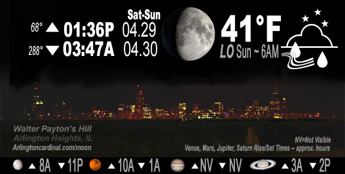
🌔 🌕 🌗 🌑 Waxing Gibbous Moon, sky cover overnight Sat. to Sun. 82% to 61% to 66%, light rain ending 2a, winds WNW to W, 12 to 10 to 11 MPH, G26 to 15 to 20 MPH, Low 41, 6a to 7a
NWS CHGO | NWS HRLY | /NWSchicago | 🌡
ARLINGTON HEIGHTS WEATHER
▴ forecast7 (Arl. Hts.) | RADAR | WIDE RADAR
IMPORTANT NOTE ON NWS DATA
Hello mobile users! If you encounter a mobile “unfriendly” weather page, turn your phone sideways for a better view.
======================
NIGHT FORECASTS …
NOTE: Keep in mind lunar rise and set times don’t always correspond with night weather and early morning lows because on some days during the month the moon is visible in the sky predominantly during the daytime hours.
Overnight Saturday to Sunday …
No Weather Hazards expected …
Light showers ending by 2:00 a.m.
DISCUSSION…
Low-level instability will build in the post-frontal airmass, with forecast soundings showing about 100-150 J/kg of SBCAPE (all under about 600 mb) developing mainly near and north of I-80. This should be sufficient to pop some isolated to perhaps widely scattered showers through sunset and just beyond.
======================
O’HARE FORECAST …
Forecast Beginning Saturday Night, Apr. 29, 2023 …
Saturday Night: A 30 percent chance of showers, mainly before 9pm. Mostly cloudy, with a low around 41. West wind 10 to 15 mph, with gusts as high as 25 mph.
Sunday: Rain likely, possibly mixed with snow showers before 1pm, then rain showers. High near 44. Breezy, with a west wind 15 to 20 mph, with gusts as high as 30 mph. Chance of precipitation is 80%. Little or no snow accumulation expected.
Sunday Night: Showers likely. Cloudy, with a low around 39. Breezy, with a west northwest wind 15 to 20 mph, with gusts as high as 30 mph. Chance of precipitation is 70%. New precipitation amounts of less than a tenth of an inch possible.
Monday: Showers likely. Cloudy, with a high near 46. Breezy, with a west northwest wind 20 to 25 mph, with gusts as high as 45 mph. Chance of precipitation is 70%.
Monday Night: A 30 percent chance of showers before 1am. Mostly cloudy, with a low around 40. Breezy, with a northwest wind 20 to 25 mph, with gusts as high as 40 mph.
Tuesday: Partly sunny, with a high near 52.
Tuesday Night: Partly cloudy, with a low around 36.
Wednesday: Mostly sunny, with a high near 62.
Wednesday Night: Partly cloudy, with a low around 46.
Thursday: Mostly sunny, with a high near 65.
Thursday Night: Partly cloudy, with a low around 45.
Friday: Partly sunny, with a high near 59.
Friday Night: Partly cloudy, with a low around 45.
Saturday: Mostly sunny, with a high near 62.
O’Hare forecast archive and hourly weather observations archive are available HERE on the CARDINAL NEWS Magazine.
Arlingtoncardinal.com/moonphases
Arlingtoncardinal.com/nightsky
NIGHT SKY THIS MONTH …
Check the night sky objects for this month and past months in the playlist from the Space Telescope Science Institute YouTube channel Backyard stargazers get a monthly guide to the northern hemisphere’s skywatching events with “Tonight’s Sky” (Musical track The Far River written by Jonn Serrie, from the album And the Stars Go With You courtesy of New World Music Ltd. Musical track The Far River written by Jonn Serrie, from the album And the Stars Go With You courtesy of New World Music Ltd).
Telephoto lens, ISO 100, f/11, Shutter Speed 1/100 to 1/125 for the Moon.
Get updates from The Cardinal ALL NEWS FEEDS on Facebook. Just ‘LIKE’ the ‘Arlington Cardinal Page (become a fan of our page). The updates cover all posts and sub-category posts from The Cardinal — Arlingtoncardinal.com. You can also limit feeds to specific categories. See all of The Cardinal Facebook fan pages at Arlingtoncardinal.com/about/facebook …
Help fund The Cardinal Arlingtoncardinal.com/sponsor
Telephoto lens, ISO 1600, f/11, Shutter Speed 2.5″ for the skyline. The skyline exposure was toned down, and brightness and contrast was adjusted in Photoshop.
/////////////>
Area Forecast Discussion
National Weather Service Chicago/Romeoville, IL
644 PM CDT Sat Apr 29 2023
.SHORT TERM… Issued at 220 PM CDT Sat Apr 29 2023
Through Sunday night…
A surface cold front continues to head east early this afternoon and has just about cleared our forecast area. In its wake, deeper mixing will result in the development of gusty west to northwest winds the rest of the afternoon. Low-level instability will build in the post-frontal airmass, with forecast soundings showing about 100-150 J/kg of SBCAPE (all under about 600 mb) developing mainly near and north of I-80. This should be sufficient to pop some isolated to perhaps widely scattered showers through sunset and just beyond. Not sure how robust these will get given the subsidence inversion upstairs, but with the stronger flow within the deeply-mixed PBL, suppose some gustier cores can`t be entirely ruled out. Farther south, a trailing 700 mb wave (currently seen pushing out of central Iowa) will track across central Illinois. Intensifying upper jet divergence will facilitate a rather intense mid-level f-gen response as this wave approaches. Current track takes most of the forcing/moisture just to our south, but have increased PoPs for locales roughly south and east of a Pontiac to Portage line to account for another wave of precipitation with these features.
Tomorrow looks downright miserable for the last day of April. Guidance has continued to trend cooler, and with a series of fairly strong vort lobes transiting the region, expecting showers to increase rapidly in coverage through the morning and afternoon. Wetbulb zero heights are now near or maybe just a smidge higher than they were during our previous graupel-fest (around 1500-2000 feet). Have expanded the mention of a rain/snow mix a bit farther south tomorrow morning when profiles look the “coldest”. As instability builds, rain and at times graupel showers will be the norm. Winds will gust into the 25-35 mph range (higher the farther south and west you go) which will just add to the raw feel of things with temperatures only in the 40s. Temperatures won`t move much tomorrow night, and while precipitation coverage will diminish, at least scattered showers look to persist.
Carlaw/NWS Chicago
