
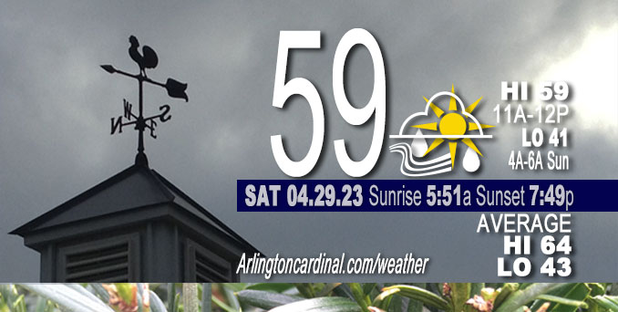
Saturday Hi 59, mostly cloudy to partly sunny, winds WSW to W to NW to W, 5 to 14 to 8 MPH, G13 to 22 to 13 MPH, 10a into Sunday
NWS CHGO | NWS HRLY | /NWSchicago | 🌡
ARLINGTON HEIGHTS WEATHER
▴ forecast7 (Arl. Hts.) | RADAR | WIDE RADAR
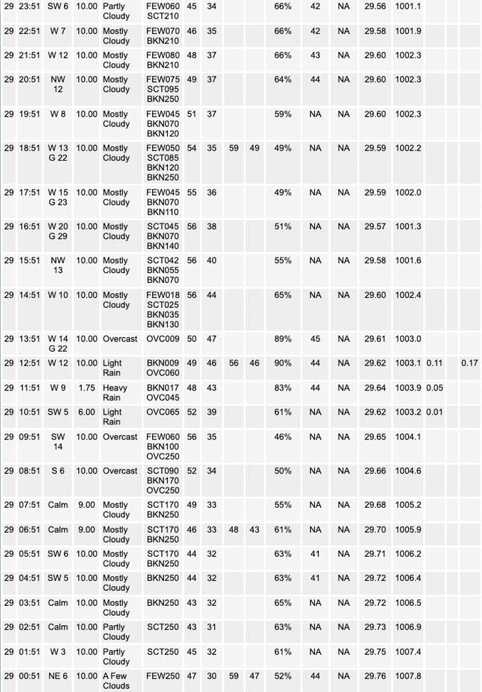
⏪ Hrly Data Table | Hrly Future Graph ⏩
IMPORTANT NOTE ON NWS DATA
⏪ Hrly Data Table | Hrly Future Graph ⏩
Hello mobile users! If you encounter a mobile “unfriendly” weather page, turn your phone sideways for a better view.
======================
Saturday and Saturday Evening …
Weather Hazards expected …
Limited Thunderstorm Risk East of I-55.
DISCUSSION…
There is a small chance for a couple of thunderstorms east of I-55 this afternoon. Severe weather is not expected.
======================
O’HARE FORECAST …
Forecast Beginning Saturday, Apr. 29, 2023
Today: Showers, mainly before 3pm. High near 59. West wind 5 to 15 mph, with gusts as high as 20 mph. Chance of precipitation is 80%. New precipitation amounts between a tenth and quarter of an inch possible.
Tonight: A 30 percent chance of showers, mainly between 7pm and 10pm. Mostly cloudy, with a low around 41. West wind 10 to 15 mph, with gusts as high as 20 mph.
Sunday: Showers likely, mainly after 1pm. Mostly cloudy, with a high near 46. West wind 10 to 15 mph, with gusts as high as 25 mph. Chance of precipitation is 70%. New precipitation amounts of less than a tenth of an inch possible.
Sunday Night: Rain showers likely before 4am, then rain likely, possibly mixed with snow showers. Cloudy, with a low around 39. West northwest wind around 15 mph, with gusts as high as 30 mph. Chance of precipitation is 60%. Little or no snow accumulation expected.
Monday: Rain likely, possibly mixed with snow showers, becoming all rain after 7am. Cloudy, with a high near 47. Breezy, with a west northwest wind 20 to 25 mph, with gusts as high as 40 mph. Chance of precipitation is 70%.
Monday Night: A 20 percent chance of showers before 1am. Mostly cloudy, with a low around 40. Breezy.
Tuesday: Partly sunny, with a high near 53.
Tuesday Night: Partly cloudy, with a low around 37.
Wednesday: Mostly sunny, with a high near 63.
Wednesday Night: Partly cloudy, with a low around 46.
Thursday: A chance of showers. Mostly sunny, with a high near 66.
Thursday Night: Partly cloudy, with a low around 47.
Friday: Mostly sunny, with a high near 62.


CHICAGOWEATHERSTATION.COM

ChicagoWeatherStation.com I O’Hare Normal Temps/Precip I O’Hare Record Temps, Precip, Snow
WunderMap® with Temperature/Wind Data || Google: Arlington Heights Area Temps | US TEMPS
Midwest Cloud Cover with Arlington Heights Weather Forecast
ChicagoWeatherStation.com I O’Hare Normal Temps/Precip I O’Hare Record Temps, Precip, Snow
SUNLIGHT DATA FOR SECURITY, TRAFFIC SAFETY, AND SPORTS
SunCalc.net data with solar azimuth and trajectory, times for dawn, sunrise, solar noon, sunset, dusk …
NIGHT SKY THIS MONTH …
Backyard stargazers get a monthly guide to the northern hemisphere’s skywatching events with “Tonight’s Sky.” Check the night sky objects for this month and past months in the playlist from the Space Telescope Science Institute YouTube channel (Musical track The Far River written by Jonn Serrie, from the album And the Stars Go With You courtesy of New World Music Ltd).
Get updates from The Cardinal ALL NEWS FEEDS on Facebook. Just ‘LIKE’ the ‘Arlington Cardinal Page (become a fan of our page). The updates cover all posts and sub-category posts from The Cardinal — Arlingtoncardinal.com. You can also limit feeds to specific categories. See all of The Cardinal Facebook fan pages at Arlingtoncardinal.com/about/facebook …
Help fund The Cardinal Arlingtoncardinal.com/sponsor
/////////////>
Area Forecast Discussion
National Weather Service Chicago/Romeoville, IL
614 AM CDT Sat Apr 29 2023
.SHORT TERM… Issued at 313 AM CDT Sat Apr 29 2023
Through Sunday…
* Line of showers moves across area behind a cold front this morning into the afternoon from west to east. A few storms possible east of I-55 in the afternoon along the front.
* Continued rain chances into the evening and overnight, especially west and south of Chicago metro
* Scattered to numerous gusty showers develop Sunday morning and continue through the afternoon. Snow and/or graupel may mix in at times in the morning, especially toward the WI/IL state line.
All is quiet early this morning with light to near calm winds and patches of cirrus overhead. Even with some clouds around temperatures have managed to dip into the upper 30s outside of the urban core of Chicago. A surface cold front is also making its way toward the area, recently having moved across the Mississippi River into northwest IL. In its wake, a band of showers is pushing across northeast IA/southwest WI. These showers will gradually shift east toward the area, moving into the Rockford area after daybreak and reaching Chicago toward noon. Showers should only last about 2-4 hours in any given location. The initial band of showers will be primarily anafrontal (behind the front), though it does look like heading into the afternoon a few showers may try to develop closer to the front in the “warm sector” along/east of I-55 where temperatures may manage to warm into the low to mid 60s. There may be just enough instability in this area to support a slight chance (20 percent) for thunder as well.
By this evening the closed upper low will begin to settle in across the western Great Lakes. On the western periphery of the low a 700 mb vort max currently over North Dakota will push southeast across Iowa into central Illinois by this evening which will bring increasing chances for showers, especially west and south of the Chicago metro. These may sneak as far north as Chicago. This is definitely a weekend to have a strong umbrella (gusty winds) or rain jacket handy just in case!
Heading into Sunday the upper low becomes quite wound up with the central vort max pivoting overhead. This will set the stage for scattered to numerous showers to develop across the area. Forecast soundings suggest cloud top temperatures may be cool enough toward the WI/IL state line to support some snow and/or graupel mixing in at times in the morning. Later in the day and further south, cannot rule out some graupel mixing in though think chances are on the lower end. The gusty northwest winds and higher coverage of showers will hold high temperatures in the 40s (closer to our typical low temperature for this time of year) making for a quite cool end to April!
Petr/NWS Chicago
