
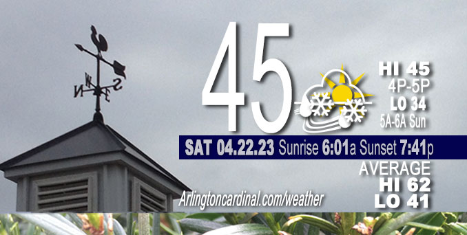
Saturday Hi 45, partly sunny, scattered rain, snow showers, winds W to WNW, 8 to 15 to 10 MPH, G20 to 23 to 16 MPH until 8p
NWS CHGO | NWS HRLY | /NWSchicago | 🌡
ARLINGTON HEIGHTS WEATHER
▴ forecast7 (Arl. Hts.) | RADAR | WIDE RADAR
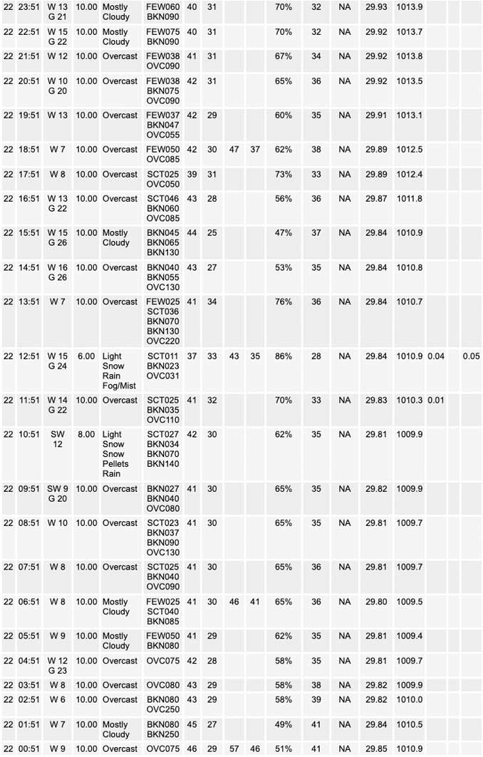
⏪ Hrly Data Table | Hrly Future Graph ⏩
IMPORTANT NOTE ON NWS DATA
⏪ Hrly Data Table | Hrly Future Graph ⏩
Hello mobile users! If you encounter a mobile “unfriendly” weather page, turn your phone sideways for a better view.
======================
Saturday and Saturday Evening …
Weather Hazards expected …
Elevated Freeze Risk.
DISCUSSION…
Freezing temperatures are possible tonight outside the core of the Chicago metro area, with overnight lows in the lower 30s.
======================
O’HARE FORECAST …
Forecast Beginning Saturday, Apr. 22, 2023
Saturday: Scattered rain and snow showers before 3pm, then scattered rain showers. Mostly cloudy, with a high near 46. West wind around 15 mph, with gusts as high as 25 mph. Chance of precipitation is 50%.
Saturday Night: Scattered rain showers, mixing with snow after 7pm, then gradually ending. Mostly cloudy, with a low around 34. West northwest wind around 10 mph, with gusts as high as 20 mph. Chance of precipitation is 30%.
Sunday: A 20 percent chance of showers after 1pm. Partly sunny, with a high near 47. West wind around 10 mph, with gusts as high as 15 mph.
Sunday Night: Areas of frost after 5am. Otherwise, partly cloudy, with a low around 35. West wind 5 to 10 mph.
Monday: Areas of frost before 7am. Otherwise, mostly sunny, with a high near 54. West wind 5 to 10 mph, with gusts as high as 15 mph.
Monday Night: A 20 percent chance of showers after 1am. Mostly cloudy, with a low around 38.
Tuesday: Partly sunny, with a high near 51.
Tuesday Night: Partly cloudy, with a low around 38.
Wednesday: Mostly sunny, with a high near 52.
Wednesday Night: Partly cloudy, with a low around 38.
Thursday: Mostly sunny, with a high near 57.
Thursday Night: Partly cloudy, with a low around 42.
Friday: A chance of showers. Partly sunny, with a high near 60.


CHICAGOWEATHERSTATION.COM

ChicagoWeatherStation.com I O’Hare Normal Temps/Precip I O’Hare Record Temps, Precip, Snow
WunderMap® with Temperature/Wind Data || Google: Arlington Heights Area Temps | US TEMPS
Midwest Cloud Cover with Arlington Heights Weather Forecast
ChicagoWeatherStation.com I O’Hare Normal Temps/Precip I O’Hare Record Temps, Precip, Snow
SUNLIGHT DATA FOR SECURITY, TRAFFIC SAFETY, AND SPORTS
SunCalc.net data with solar azimuth and trajectory, times for dawn, sunrise, solar noon, sunset, dusk …
NIGHT SKY THIS MONTH …
Backyard stargazers get a monthly guide to the northern hemisphere’s skywatching events with “Tonight’s Sky.” Check the night sky objects for this month and past months in the playlist from the Space Telescope Science Institute YouTube channel (Musical track The Far River written by Jonn Serrie, from the album And the Stars Go With You courtesy of New World Music Ltd).
Get updates from The Cardinal ALL NEWS FEEDS on Facebook. Just ‘LIKE’ the ‘Arlington Cardinal Page (become a fan of our page). The updates cover all posts and sub-category posts from The Cardinal — Arlingtoncardinal.com. You can also limit feeds to specific categories. See all of The Cardinal Facebook fan pages at Arlingtoncardinal.com/about/facebook …
Help fund The Cardinal Arlingtoncardinal.com/sponsor
/////////////>
Area Forecast Discussion
National Weather Service Chicago/Romeoville, IL
629 AM CDT Sat Apr 22 2023
.SHORT TERM… Issued at 310 AM CDT Sat Apr 22 2023
Through Sunday…
Forecast concerns for the short term forecast… *Scattered showers this afternoon, stronger showers could contain a mix of rain, snow, and/or graupel
*Well below normal temperatures through Sunday, chance for sub- freezing temperatures overnight tonight
A broad upper-low continues to reside over the upper Midwest with a vorticity maxima rotating along the southern periphery across northern Iowa. This vort max has allowed for some shower activity to fester across portions of central and eastern Iowa overnight, but coverage has been rather limited. However, as the vort pivots into northern Illinois later this morning shower coverage is expected to expand as low-level instability increases and linger through early evening. While most showers will be in the form of rain, forecast soundings are showing a deep sub-freezing layer aloft (wet bulb zero heights around 1000 ft) which will support some snow flakes mixing in especially under more robust showers. Additionally, the presence of steep low-level lapse rates (on the order of 7 to 8 C/km) and weak CAPE of 50 to 100 J/kg may even allow for periods of graupel this afternoon as well. Given that surface temperatures are forecast to remain above freezing no accumulation is expected with any snow showers, but brief periods of reduced visibility are possible.
Aside from the showers, blustery westerly winds are also expected this afternoon with gusts around 20 to 25 mph. However, higher gusts may accompany the more robust showers that are able to ta Pinto stronger winds aloft and pull them to the surface. Otherwise, well below normal temperatures are expected through Sunday as the upper-low continues to keep cold air locked in place. Highs each afternoon are only forecast to reach into the mid to upper 40s which is roughly 15 to 20 degrees below normal for late April. This also means that overnight lows tonight will be rather chilly with values in the low to mid 30s. While these setups usually are a cause for frost and sub-freezing conditions, the combination of lingering cloud cover and elevated winds should curtail the most effective cooling and may keep temperatures across much of the area at or just above freezing tonight. Given the more marginal setup, I have decided to hold off on any frost or freeze headlines at this time, but we will continue to monitor trends in case these products are needed with future updates.
Lastly, there is also a small chance for a few showers Sunday afternoon. While a weaker impulse is expected to be traversing across central Illinois during this time, a rather shallow mid- level moisture layer is forecast to be in place which looks to limit any shower activity. However, some hi-res guidance is showing sufficient moisture lingering with steep low-level lapse rates which may overcome the lack of strong synoptic ascent. Given this potential I did decided to add in a 15 percent POP, but this is a low confidence scenario on coverage with a good chance most areas remain dry.
Yack/NWS Chicago
