
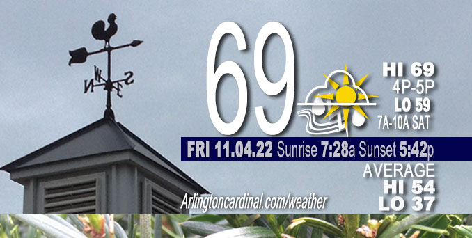
FRIDAY Hi 69, mostly cloudy, chance showers and thunderstorm, winds SSW to S, 16 to 18 to 20 MPH, G26 to 30 to 32 MPH
NWS CHGO | NWS HRLY | /NWSchicago | 🌡
ARLINGTON HEIGHTS WEATHER
▴ forecast7 (Arl. Hts.) | RADAR | WIDE RADAR
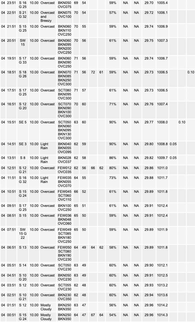
⏪ Hrly Data Table | Hrly Future Graph ⏩
IMPORTANT NOTE ON NWS DATA
⏪ Hrly Data Table | Hrly Future Graph ⏩
======================
Weather hazards expected Friday…
Limited Thunderstorm Risk.
Elevated Non Thunderstorm Wind Risk.
DISCUSSION…
FRIDAY: Showers and a few thunderstorms are expected from late morning to early afternoon primarily along and northwest of Interstate 55. No severe weather is expected.
South winds will become breezy overnight and especially toward daybreak Saturday.
SATURDAY: Strong and potentially damaging winds are expected from early morning to sunset on Saturday. Wind gusts of 45 to 55 mph will down tree limbs and move lawn furniture, and may lead to scattered power outages.
Hello mobile users! If you encounter mobile “unfriendly” weather page, turn your phone sideways for a better view.
======================
Wind Advisory
URGENT – WEATHER MESSAGE
National Weather Service Chicago IL
318 AM CDT Fri Nov 4 2022
ILZ003>006-008-010>013-103>105-INZ001-002-041630-
/O.NEW.KLOT.WI.Y.0011.221105T0900Z-221106T0000Z/
Winnebago-Boone-McHenry-Lake IL-Ogle-Lee-De Kalb-Kane-DuPage-Northern Cook-Central Cook-Southern Cook-Lake IN-Porter-
Including the municipalities of Arlington Heights, Rockford, Belvidere, Crystal Lake, Algonquin, McHenry, Woodstock, Waukegan, Buffalo Grove, Mundelein, Gurnee, Rochelle, Oregon, Byron, Dixon, DeKalb, Sycamore, Aurora, Elgin, Naperville, Wheaton, Downers Grove, Lombard, Carol Stream, Evanston, Des Plaines, Schaumburg, Palatine, Northbrook, Chicago, Cicero, Oak Lawn, Oak Park, La Grange, Calumet City, Oak Forest, Lemont, Orland Park, Park Forest, Gary, Hammond, Merrillville, Portage, Valparaiso, and Chesterton
318 AM CDT Fri Nov 4 2022
…WIND ADVISORY IN EFFECT FROM 4 AM TO 7 PM CDT SATURDAY…
* WHAT…South winds 25 to 30 mph with gusts up to 55 mph expected.
* WHERE…Portions of north central and northeast Illinois and northwest Indiana.
* WHEN…From 4 AM to 7 PM CDT Saturday.
* IMPACTS…Prepare for downed tree limbs and scattered power outages. Unsecured objects such as decorations and lawn furniture may blow away.
PRECAUTIONARY/PREPAREDNESS ACTIONS…
Use extra caution when driving, especially if operating a high profile vehicle. Secure outdoor objects.
O’HARE FORECAST …
Forecast Beginning Friday, Nov. 04, 2022
Friday: A chance of rain and thunderstorms before 11am, then scattered showers and thunderstorms, mainly between 11am and 5pm. Mostly cloudy, with a high near 70. Breezy, with a south wind 15 to 20 mph, with gusts as high as 30 mph. Chance of precipitation is 50%.
Friday Night: Scattered showers and thunderstorms, then showers and possibly a thunderstorm after 2am. Low around 58. Breezy, with a south wind 15 to 25 mph, with gusts as high as 40 mph. Chance of precipitation is 80%. New rainfall amounts between a tenth and quarter of an inch, except higher amounts possible in thunderstorms.
Saturday: Showers and thunderstorms before noon, then isolated showers between noon and 4pm. Temperature falling to around 48 by 5pm. Windy, with a southwest wind 25 to 30 mph, with gusts as high as 50 mph. Chance of precipitation is 80%. New precipitation amounts between a tenth and quarter of an inch, except higher amounts possible in thunderstorms.
Saturday Night: Mostly clear, with a low around 45. Breezy, with a southwest wind 20 to 25 mph decreasing to 15 to 20 mph after midnight. Winds could gust as high as 35 mph.
Sunday: Sunny, with a high near 63. South southwest wind 10 to 15 mph, with gusts as high as 25 mph.
Sunday Night: Mostly clear, with a low around 44.
Monday: Sunny, with a high near 57.
Monday Night: Mostly cloudy, with a low around 45.
Tuesday: Partly sunny, with a high near 59.
Tuesday Night: Mostly cloudy, with a low around 48.
Wednesday: Mostly sunny, with a high near 67.
Wednesday Night: Partly cloudy, with a low around 51.
Thursday: Partly sunny, with a high near 65.


CHICAGOWEATHERSTATION.COM

ChicagoWeatherStation.com I O’Hare Normal Temps/Precip I O’Hare Record Temps, Precip, Snow
LIVE RADAR | STORM TRACKS | UNISYS US IR SAT | UNISYS Midwest IR SAT | UNISYS More IR SAT
WunderMap® with Temperature/Wind Data || Google: Arlington Heights Area Temps | US TEMPS
Full Screen Motion Weather Radar (Wunderground.com)
Midwest Cloud Cover with Arlington Heights Weather Forecast
ChicagoWeatherStation.com I O’Hare Normal Temps/Precip I O’Hare Record Temps, Precip, Snow
SUNLIGHT DATA FOR SECURITY, TRAFFIC SAFETY, AND SPORTS
SunCalc.net data with solar azimuth and trajectory, times for dawn, sunrise, solar noon, sunset, dusk …
NIGHT SKY THIS MONTH …
Backyard stargazers get a monthly guide to the northern hemisphere’s skywatching events with “Tonight’s Sky.” Check the night sky objects for this month and past months in the playlist from the Space Telescope Science Institute YouTube channel (Musical track The Far River written by Jonn Serrie, from the album And the Stars Go With You courtesy of New World Music Ltd).
Get updates from The Cardinal ALL NEWS FEEDS on Facebook. Just ‘LIKE’ the ‘Arlington Cardinal Page (become a fan of our page). The updates cover all posts and sub-category posts from The Cardinal — Arlingtoncardinal.com. You can also limit feeds to specific categories. See all of The Cardinal Facebook fan pages at Arlingtoncardinal.com/about/facebook …
Help fund The Cardinal Arlingtoncardinal.com/sponsor
Area Forecast Discussion
National Weather Service Chicago/Romeoville, IL
333 AM CDT Thu Nov 3 2022
.SHORT TERM…
Issued at 333 AM CDT Thu Nov 3 2022
Through Friday…
Forecast focus is on unseasonably warm and breezy/windy conditions today, then continued very mild weather with increasing shower and embedded thunderstorm chances on Friday.
Early morning surface analysis depicts a broad area of elongated high pressure from New England to the lower Mississippi Valley, while a trough of low pressure stretched from western Ontario through the central Rockies. In between these features, was a gradually tightening surface pressure gradient providing south winds across the upper Midwest and western Great lakes region. These south winds will become increasingly gusty across the forecast area today, as a deep upper level trough continues to develop across the western CONUS and induces further surface pressure falls and a strengthening low level jet. By this afternoon, forecast soundings support gusts in the 30-35 mph range across much of northwest/northern IL within the stronger gradient. Further east/southeast winds will be slightly weaker but still breezy. Unseasonably warm temperatures will again be seen today, with highs in the low-mid 70s expected. This will be near record levels for Chicago today (see climate section below), though increasing afternoon high cloudiness may be a limiting factor. Record high-minimum temperatures will also be within reach tonight, as breezy winds and increasing cloud cover prevent readings from falling off too much. Temps particularly within the city of Chicago may not dip below 60 overnight, which is 5 degrees above our average highs for this time of year.
A slow moving cold front will very slowly approach the region from the west Friday, but will stall before reaching the forecast area. Shower and embedded thunderstorm chances will increase in advance of this boundary Friday morning however, as a subtle lead mid-level short wave ripples northeast across the region. Highest precip chances will be over far west/northwest parts of the forecast area during the morning through midday hours, decreasing somewhat during the afternoon hours as the wave lifts northeast of the area. Steep mid-level lapse rates (7.5+ C/km above 600 mb) will support some thunder potential, and some of these showers and thunderstorms may be gusty given 40 kt low level jet winds ~2000 feet above the ground. Farther to the southeast, rain chances will decrease fairly rapidly into east-central IL and northwest IN.
Despite more cloud cover, Friday will also be unseasonably warm with highs again expected to be in the low-mid 70s. Thicker clouds and precipitation across north/northwest IL will likely kee Preadings in the low 70s for Rockford and Chicago, with the warmest readings across our south/southeast cwa.
Ratzer/NWS Chicago
