
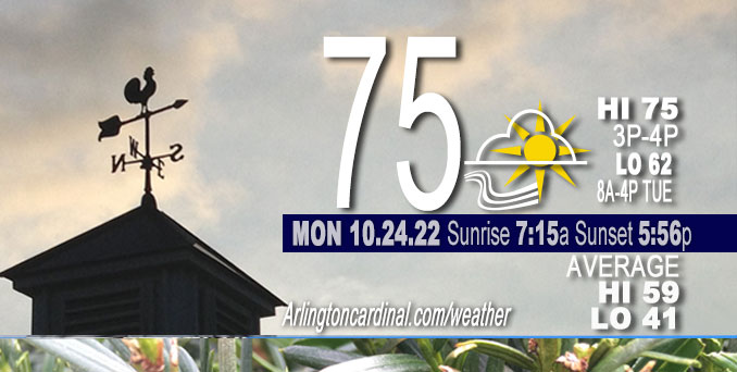
MONDAY Hi 75°F, partly sunny, mostly cloudy, winds S to SSE, 16 to 20 to 16 MPH, G28 to 30 to 28 to 30 MPH
NWS CHGO | NWS HRLY | /NWSchicago | 🌡
ARLINGTON HEIGHTS WEATHER
▴ forecast7 (Arl. Hts.) | RADAR | WIDE RADAR
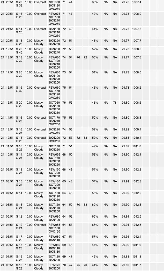
⏪ Hrly Data Table | Hrly Future Graph ⏩
IMPORTANT NOTE ON NWS DATA
⏪ Hrly Data Table | Hrly Future Graph ⏩
======================
No watches or warnings issued near O’Hare at 9:00 a.m. Monday.
Updates at Arlingtoncardinal.com/NWSChicago
Chicagoland Weather hazards expected…
Wildfire risk is elevated in Chicagoland, but no Red Flag Warnings were activated in Northern Illinois as of 9:20 AM Monday.
NOTES: PREPARE GUTTERS AND STORM DRAINAGE FOR TUESDAY RAINY PERIOD: Periods of soaking rain will occur in parts of the area Tuesday and Tuesday night. Some of the rainfall could be locally heavy. A storm system will bring waves of soaking rain to portions of the area Tuesday and Tuesday night. Between 1 to 2 inches of rain is expected which may lead to localized flooding due to poor drainage. Make sure downspouts are connected to keep water away from the house to avoid basement flooding. Be sure to clear any leaves from drains before the rain begins after 1:00 AM overnight.
Hazardous Weather Outlook
National Weather Service Chicago/Romeoville IL
412 AM CDT Mon Oct 24 2022
Winnebago-Boone-McHenry-Lake IL-Ogle-Lee-De Kalb-Kane-DuPage- La Salle-Kendall-Grundy-Kankakee-Livingston-Iroquois-Ford- Northern Cook-Central Cook-Southern Cook-Northern Will- Southern Will-Eastern Will-Lake IN-Porter-Newton-Jasper-Benton- 412 AM CDT Mon Oct 24 2022 /512 AM EDT Mon Oct 24 2022/
This Hazardous Weather Outlook is for portions of North Central Illinois…Northeast Illinois and Northwest Indiana.
Today and Tonight.
Weather hazards expected…
Limited Fire Weather Risk.
DISCUSSION…
Wind gusts around 30 to 35 mph will lead to an increased risk for
brush and grass fire spread this afternoon. Be cautious with
burning materials today.
Hello mobile users! If you encounter mobile “unfriendly” weather page, turn your phone sideways for a better view.
======================
O’HARE FORECAST …
Forecast Beginning Monday, Oct. 24, 2022
Monday: Mostly cloudy, with a high near 75. Breezy, with a south wind 15 to 20 mph, with gusts as high as 30 mph.
Monday Night: A 30 percent chance of showers after 2am. Mostly cloudy, with a low around 59. Breezy, with a south wind 15 to 20 mph, with gusts as high as 30 mph.
Tuesday: Showers, mainly after 8am. Steady temperature around 61. South wind 5 to 15 mph, with gusts as high as 20 mph. Chance of precipitation is 90%. New precipitation amounts between a half and three quarters of an inch possible.
Tuesday Night: Showers. Low around 46. Northeast wind 5 to 15 mph becoming north northwest after midnight. Winds could gust as high as 20 mph. Chance of precipitation is 90%.
Wednesday: Showers likely, mainly before 8am. Mostly sunny, with a high near 57. North northwest wind around 15 mph, with gusts as high as 30 mph. Chance of precipitation is 60%.
Wednesday Night: Mostly clear, with a low around 40.
Thursday: Partly sunny, with a high near 55.
Thursday Night: Mostly cloudy, with a low around 43.
Friday: Partly sunny, with a high near 58.
Friday Night: Partly cloudy, with a low around 42.
Saturday: Mostly sunny, with a high near 58.
Saturday Night: Partly cloudy, with a low around 44.
Sunday: A chance of showers. Mostly cloudy, with a high near 59.


CHICAGOWEATHERSTATION.COM

ChicagoWeatherStation.com I O’Hare Normal Temps/Precip I O’Hare Record Temps, Precip, Snow
LIVE RADAR | STORM TRACKS | UNISYS US IR SAT | UNISYS Midwest IR SAT | UNISYS More IR SAT
WunderMap® with Temperature/Wind Data || Google: Arlington Heights Area Temps | US TEMPS
Full Screen Motion Weather Radar (Wunderground.com)
Midwest Cloud Cover with Arlington Heights Weather Forecast
ChicagoWeatherStation.com I O’Hare Normal Temps/Precip I O’Hare Record Temps, Precip, Snow
SUNLIGHT DATA FOR SECURITY, TRAFFIC SAFETY, AND SPORTS
SunCalc.net data with solar azimuth and trajectory, times for dawn, sunrise, solar noon, sunset, dusk …
NIGHT SKY THIS MONTH …
Backyard stargazers get a monthly guide to the northern hemisphere’s skywatching events with “Tonight’s Sky.” Check the night sky objects for this month and past months in the playlist from the Space Telescope Science Institute YouTube channel (Musical track The Far River written by Jonn Serrie, from the album And the Stars Go With You courtesy of New World Music Ltd).
Get updates from The Cardinal ALL NEWS FEEDS on Facebook. Just ‘LIKE’ the ‘Arlington Cardinal Page (become a fan of our page). The updates cover all posts and sub-category posts from The Cardinal — Arlingtoncardinal.com. You can also limit feeds to specific categories. See all of The Cardinal Facebook fan pages at Arlingtoncardinal.com/about/facebook …
Help fund The Cardinal Arlingtoncardinal.com/sponsor
Area Forecast Discussion…CORRECTED
National Weather Service Chicago/Romeoville, IL
644 AM CDT Mon Oct 24 2022
.SHORT TERM…
Issued at 356 AM CDT Mon Oct 24 2022
Through Tuesday night…
An area of showers and embedded thunderstorms associated with the warm advection wing of a strong 987 mb surface low over central North Dakota continue to move northeastward across the area this morning. These showers and isolated storms are expected to move north of our forecast area by sunrise which will allow for a mostly dry but cloudy Monday. Despite the cloud cover, the continued warm advection will allow temperatures to remain unseasonably warm with highs topping out in the mid-70s this afternoon. Winds will also continue to be breezy today with gusts around 30 mph expected, but there is a chance that a few higher gusts could develop late this afternoon as a cold front begins to move into the area.
The aforementioned cold front is currently being analyzed from the eastern Dakotas southward into the southern Plains and is expected to continue its eastward trajectory today with an estimated arrival in northwestern Illinois this evening. However, guidance has continued to show some uncertainty in the speed of the front as it moves into our area, but an evening arrival does seem to be a reasonable “middle of the road” solution. The strong southerly winds ahead of the front will continue to advect in ample amounts of moisture (PWATs around 1.0-1.5 inches) which will create widespread showers across northeastern Illinois and northwest Indiana as the front moves through during the night tonight and into Tuesday morning. This moisture rich environment will also allow some of these showers to produce heavy downpours at times which could lead to some ponding.
As the front begins to move through our area tonight, the dee Pupper-level trough currently over the central Rockies will continue to push eastward with the southern end of the trough expected to develop into a closed upper low over the southern plains later tonight. This upper low is then expected to eject into the Ohio river valley late in the day on Tuesday which will cause it to interact with the aforementioned cold front moving across our area. This will lead to continuous showers for northeastern Illinois and northwest Indiana for Tuesday and Tuesday night some of which could produce heavy downpours at times. While guidance continues to be in decent agreement that most of our forecast area will see on the order of 1 to 2 inches of rainfall by Wednesday morning, the dry spell that we have been experiencing the past few weeks should help keep flooding concerns to a minimum although some ponding may occur if storm drains become clogged with leaves. Furthermore, guidance is also hinting at some marginal instability developing under the upper low across central and southern Illinois which may allow for an isolated storm or two to develop along and south of the Kankakee river valley with other areas seeing predominant showers through the period.
Rain chances will gradually diminish Tuesday night as the system departs the area. Behind this system much more seasonable fall temperatures are expected with lows Tuesday night expected to be in the low to mid 40s.
Yack/NWS Chicago
