
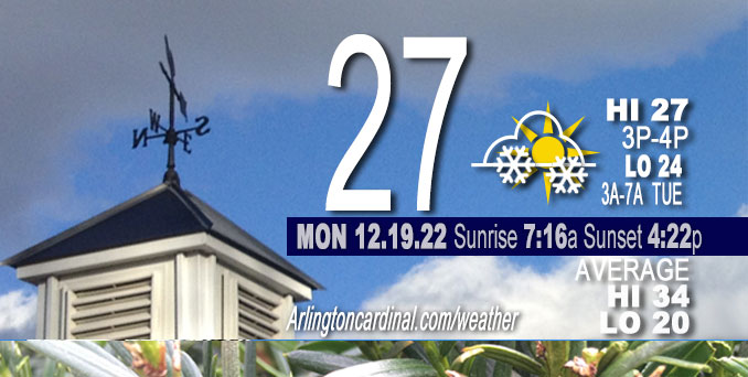
Monday Hi 27, partly cloudy to mostly cloudy by 2p, light snow after 4p, winds NW to W to SW to SE to S, 5 to 3 to 5 to 6 MPH
NWS CHGO | NWS HRLY | /NWSchicago | 🌡
ARLINGTON HEIGHTS WEATHER
▴ forecast7 (Arl. Hts.) | RADAR | WIDE RADAR
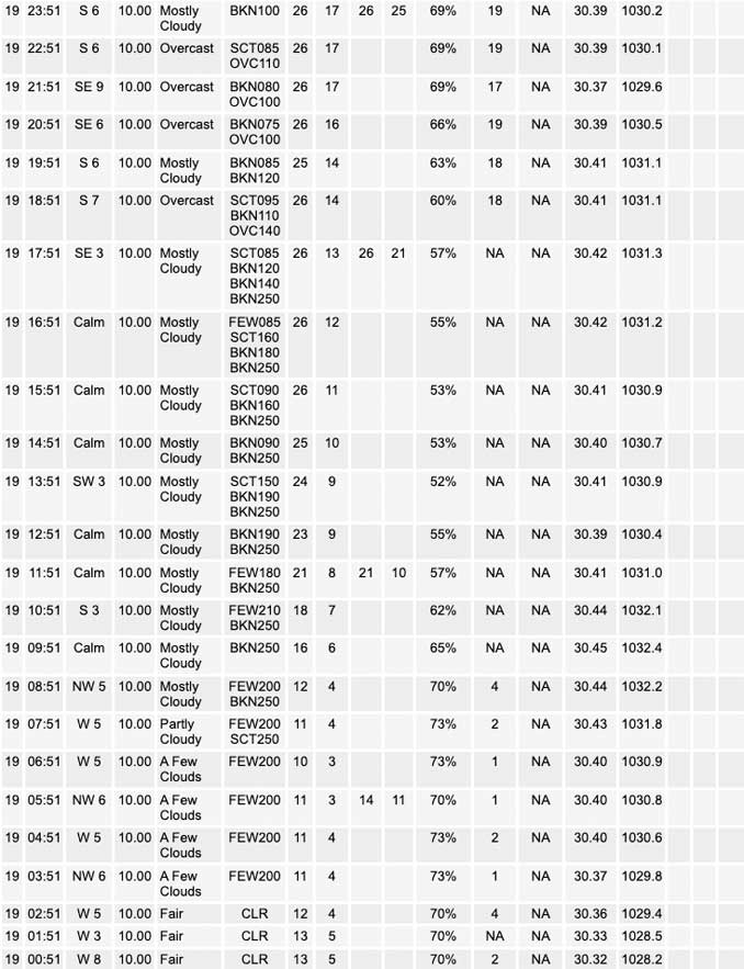
⏪ Hrly Data Table | Hrly Future Graph ⏩
IMPORTANT NOTE ON NWS DATA
⏪ Hrly Data Table | Hrly Future Graph ⏩
======================
Monday and Monday Night …
No Weather Hazards expected…
However, get prepared for …
Major storm system affecting the area Thursday through Saturday, with the most significant impacts from accumulating and blowing snow and very strong winds late Thursday afternoon into Friday night, and a low 12°F Friday morning with a high of 17°F, and then a low of 1°F Saturday morning with a high near 9°F Saturday. Christmas morning (Sunday morning) -2°F.
DISCUSSION…
Clouds return gradually on Monday.
Potential for mainly flurries this evening and overnight, but chance for a dusting of snow across far northwest counties.
Threat for spotty flurries and/or drizzle (freezing drizzle where temperatures remain below freezing) on Tuesday morning and into the afternoon north and west of I-55 (Arlington Heights morning low Tuesday about 24°F from 3:00 a.m. to 7:00 a.m., and no precipitation forecast for the morning rush hour).
Hello mobile users! If you encounter a mobile “unfriendly” weather page, turn your phone sideways for a better view.
======================
O’HARE FORECAST …
Forecast Beginning Monday, Dec. 19, 2022
Monday: A chance of flurries after 5pm. Increasing clouds, with a high near 27. Northwest wind around 5 mph becoming southeast in the afternoon.
Monday Night: A chance of flurries before 9pm, then a slight chance of snow between 9pm and 3am. Cloudy, with a low around 23. East southeast wind around 5 mph becoming south southwest after midnight. Chance of precipitation is 20%.
Tuesday: Patchy flurries and freezing drizzle after 3pm. Mostly cloudy, with a high near 32. South southwest wind around 5 mph becoming northwest in the afternoon.
Tuesday Night: Mostly cloudy, with a low around 16. North northwest wind around 5 mph, with gusts as high as 10 mph.
Wednesday: Mostly cloudy, with a high near 27. North northwest wind around 5 mph becoming northeast in the afternoon. Winds could gust as high as 10 mph.
Wednesday Night: Snow likely, mainly after midnight. Cloudy, with a low around 23. Chance of precipitation is 60%.
Thursday: Snow. High near 30. Chance of precipitation is 90%.
Thursday Night: Snow. Areas of blowing snow after midnight. Cloudy, with a low around 12. Blustery.
Friday: Snow. Areas of blowing snow. Cloudy, with a high near 17. Windy.
Friday Night: Snow likely, mainly before midnight. Areas of blowing snow. Mostly cloudy, with a low around 1. Windy.
Saturday: Partly sunny and cold, with a high near 9. Blustery.
Saturday Night: Partly cloudy, with a low around -2. Breezy.
Christmas Day: Mostly sunny, with a high near 11.


CHICAGOWEATHERSTATION.COM

ChicagoWeatherStation.com I O’Hare Normal Temps/Precip I O’Hare Record Temps, Precip, Snow
LIVE RADAR | STORM TRACKS | UNISYS US IR SAT | UNISYS Midwest IR SAT | UNISYS More IR SAT
WunderMap® with Temperature/Wind Data || Google: Arlington Heights Area Temps | US TEMPS
Full Screen Motion Weather Radar (Wunderground.com)
Midwest Cloud Cover with Arlington Heights Weather Forecast
ChicagoWeatherStation.com I O’Hare Normal Temps/Precip I O’Hare Record Temps, Precip, Snow
SUNLIGHT DATA FOR SECURITY, TRAFFIC SAFETY, AND SPORTS
SunCalc.net data with solar azimuth and trajectory, times for dawn, sunrise, solar noon, sunset, dusk …
NIGHT SKY THIS MONTH …
Backyard stargazers get a monthly guide to the northern hemisphere’s skywatching events with “Tonight’s Sky.” Check the night sky objects for this month and past months in the playlist from the Space Telescope Science Institute YouTube channel (Musical track The Far River written by Jonn Serrie, from the album And the Stars Go With You courtesy of New World Music Ltd).
Get updates from The Cardinal ALL NEWS FEEDS on Facebook. Just ‘LIKE’ the ‘Arlington Cardinal Page (become a fan of our page). The updates cover all posts and sub-category posts from The Cardinal — Arlingtoncardinal.com. You can also limit feeds to specific categories. See all of The Cardinal Facebook fan pages at Arlingtoncardinal.com/about/facebook …
Help fund The Cardinal Arlingtoncardinal.com/sponsor
Area Forecast Discussion
National Weather Service Chicago/Romeoville, IL
541 AM CST Mon Dec 19 2022
SHORT TERM… Issued at 240 AM CST Mon Dec 19 2022
Through Tuesday…
The key weather messages through Tuesday consist of:
* Potential for mainly flurries this evening and overnight, but chance for a dusting of snow across far northwest counties.
* Threat for spotty flurries and/or drizzle (freezing drizzle where temperatures remain below freezing) on Tuesday morning and into the afternoon north and west of I-55.
While it was lovely seeing the sun after a nearly two week hiatus, we`ll be losing it to the clouds again through today and tonight. A thickening cirrus canopy will develop northward through the day, and clouds will eventually begin to build down in advance of a deamplifying wave (currently pushing across Oklahoma). While there will be some interaction with a more potent northern stream disturbance, model guidance seems to have trended ever-so- slightly farther north and west with this feature. As such, an already glancing blow of ascent looks even more subdued in latest guidance tonight.
Latest expectations are for cloud bases to steadily build downwards under about 8 kft through late this afternoon with plenty of higher-level radar returns that won`t be reaching the surface (virga). By this evening, it looks like sufficient saturation will have taken place to allow some flurries to make it to the surface, but this window will be pretty brief for areas south of I-80 as deeper level moisture will rapidly be whisked away on increasing southwesterly winds. Farther to the north, ensemble output still suggests some light snow and up to a dusting of snow is possible overnight. The altogether modest nature of ascent and only very brief spatiotemporal overlap of deeper moisture and any forcing of consequence indicates this likely won`t be much of a travel issue for our far northwest locales.
As these initial waves depart, the leading edge of a colder airmass will begin to ooze into the region through the day on Tuesday. This process will likely take some time, and it`s possible that temperatures rise back into the mid 30s, especially south and east of I-55/57 during the afternoon.
Additionally, seeing some potential for pockets of flurries or freezing drizzle to develop through Tuesday morning and afternoon as a series of subtle waves traverse the incoming surface boundary with cloud top temperatures near or warmer than about -10 C. Noting plenty of variability in moisture depths across the guidance suite, but with the GFS, NAM, RAP, HRRR, and RGEM looking pretty saturated up through 750 mb or so with hints of isentropic ascent. Elected to throw in a mention of flurries or patchy freezing drizzle for areas closest to the incoming boundary to the northwest of I-55.
Carlaw/NWS Chicago
