
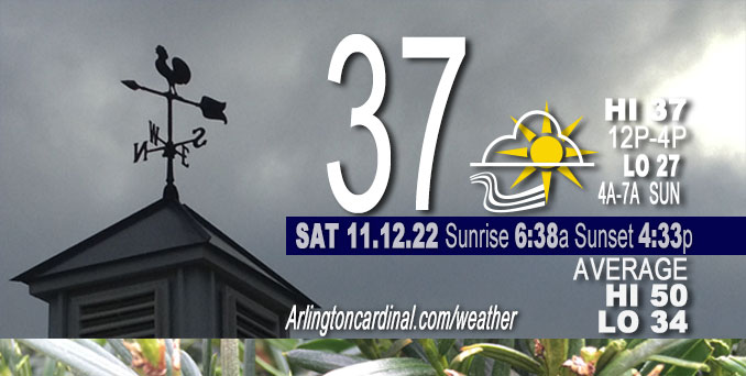
SATURDAY Hi 37, mostly cloudy, decreasing clouds after 3p, winds to NW, 10 to 13 to 9 MPH, G17 to 21 to 20 MPH
NWS CHGO | NWS HRLY | /NWSchicago | 🌡
ARLINGTON HEIGHTS WEATHER
▴ forecast7 (Arl. Hts.) | RADAR | WIDE RADAR
⏪ Hrly Data Table | Hrly Future Graph ⏩
IMPORTANT NOTE ON NWS DATA
⏪ Hrly Data Table | Hrly Future Graph ⏩
======================
Saturday …
No weather hazards expected…
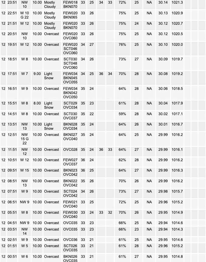
Greater than forecasted cloud cover overnight probably held temperatures above the forecast lows for Saturday morning. Official Chicago O’Hare and Chicago Executive Airport did not come close to the forecast low of 26°F for early Saturday morning … instead hourly readings reported at O’Hare after midnight were 33°F from 12:51 a.m. to 6:51 a.m., and hourly readings reported at Chicago Executive Airport after midnight were 34°F from 12:52 a.m. to 6:52 a.m.
O’Hare had a 32°F reading at 11:51 p.m. Friday, and Chicago Executive Airport had readings at 33°F from 8:52 p.m. to 11:52 p.m. Friday.
DISCUSSION…
The main points of interest in the short term period consist of:
* Brief potential for some spotty flurries or freezing drizzle across NW Illinois early this morning.
* Transition to scattered snow showers this afternoon and early evening with no road impacts.
* Lake effect snow showers increasing in coverage and intensity, mainly into Michigan this afternoon and evening.
* More quiescent period to close out the weekend on Sunday.
Hello mobile users! If you encounter mobile “unfriendly” weather page, turn your phone sideways for a better view.
======================
O’HARE FORECAST …
Forecast Beginning Saturday, Nov. 12, 2022
Saturday: Scattered flurries before 10am, then scattered snow showers, mainly after noon. Cloudy, with a high near 37. Northwest wind 10 to 15 mph, with gusts as high as 20 mph. Chance of precipitation is 30%.
Saturday Night: Isolated snow showers before 9pm. Mostly cloudy, then gradually becoming mostly clear, with a low around 27. Northwest wind around 10 mph, with gusts as high as 20 mph. Chance of precipitation is 20%.
Sunday: Sunny, with a high near 39. Northwest wind 5 to 10 mph, with gusts as high as 20 mph.
Sunday Night: Mostly cloudy, with a low around 26. West northwest wind around 5 mph becoming calm in the evening.
Monday: Mostly cloudy, with a high near 41. Calm wind becoming south around 5 mph in the morning. Winds could gust as high as 10 mph.
Monday Night: A 40 percent chance of snow after midnight. Mostly cloudy, with a low around 31.
Tuesday: Snow likely, possibly mixed with rain. Cloudy, with a high near 40. Chance of precipitation is 70%.
Tuesday Night: Snow likely, possibly mixed with rain before midnight, then a chance of snow. Cloudy, with a low around 30.
Wednesday: A chance of rain and snow. Mostly cloudy, with a high near 38.
Wednesday Night: A chance of snow before midnight. Mostly cloudy, with a low around 23.
Thursday: Partly sunny, with a high near 34.
Thursday Night: Mostly cloudy, with a low around 21.
Friday: Mostly cloudy, with a high near 33.


CHICAGOWEATHERSTATION.COM

ChicagoWeatherStation.com I O’Hare Normal Temps/Precip I O’Hare Record Temps, Precip, Snow
LIVE RADAR | STORM TRACKS | UNISYS US IR SAT | UNISYS Midwest IR SAT | UNISYS More IR SAT
WunderMap® with Temperature/Wind Data || Google: Arlington Heights Area Temps | US TEMPS
Full Screen Motion Weather Radar (Wunderground.com)
Midwest Cloud Cover with Arlington Heights Weather Forecast
ChicagoWeatherStation.com I O’Hare Normal Temps/Precip I O’Hare Record Temps, Precip, Snow
SUNLIGHT DATA FOR SECURITY, TRAFFIC SAFETY, AND SPORTS
SunCalc.net data with solar azimuth and trajectory, times for dawn, sunrise, solar noon, sunset, dusk …
NIGHT SKY THIS MONTH …
Backyard stargazers get a monthly guide to the northern hemisphere’s skywatching events with “Tonight’s Sky.” Check the night sky objects for this month and past months in the playlist from the Space Telescope Science Institute YouTube channel (Musical track The Far River written by Jonn Serrie, from the album And the Stars Go With You courtesy of New World Music Ltd).
Get updates from The Cardinal ALL NEWS FEEDS on Facebook. Just ‘LIKE’ the ‘Arlington Cardinal Page (become a fan of our page). The updates cover all posts and sub-category posts from The Cardinal — Arlingtoncardinal.com. You can also limit feeds to specific categories. See all of The Cardinal Facebook fan pages at Arlingtoncardinal.com/about/facebook …
Help fund The Cardinal Arlingtoncardinal.com/sponsor
Area Forecast Discussion…CORRECTED
National Weather Service Chicago/Romeoville, IL
552 AM CST Sat Nov 12 2022
.SHORT TERM… Issued at 228 AM CST Sat Nov 12 2022
Through Sunday…
The main points of interest in the short term period consist of:
* Brief potential for some spotty flurries or freezing drizzle across NW Illinois early this morning.
* Transition to scattered snow showers this afternoon and early evening with no road impacts.
* Lake effect snow showers increasing in coverage and intensity, mainly into Michigan this afternoon and evening.
* More quiescent period to close out the weekend on Sunday.
A well-defined shortwave is zipping northeastward into southern Illinois early this morning, with the hallmarks of at least transient f-gen banding displayed in radar imagery. Guidance has continued to subtly tick closer to our area with the northwestern terminus of the precipitation shield, although any precipitation will be fighting a wedge of notably drier air in the 800-650 mb layer. Theta-e lapse rates are progged to fall towards 0 or even briefly negative just outside the forecast area–indicative of the presence of upright instability upstairs. Not too surprising, then, to see an expanding area of sub 1 mile visibilities (and even a few brief obs towards a quarter mile) downstate at this hour. Have maintained the inherited slight chance PoPs south and east of a Paxton to Rensselaer line early this morning to account for a potential that light system snow spreads that far northwest. Latest RAP does lay down a few hundredths of an inch of liquid equivalent across far SE Benton county. Will continue to monitor, but think we remain far enough northwest that any impacts will be minimal or nil.
To our northwest, have been noting observations indicating Unknown Precipitation (usually an indication of drizzle) along with some earlier mPing reports of freezing drizzle. This seems to be occurring as the stratus layer is deepening a bit, while cloud tops remain above about -11 C (per soundings and a sampling of IR imagery). Hires guidance indicates some convective-looking splotches in simulated reflectivity towards 12z, which hopefully means some additional UVV to help saturate and cool the top of the cloud canopy a bit to assist with heterogeneous nucleation probabilities a bit. That said, cloud tops are currently warm enough that some spotty freezing drizzle can`t be ruled out early this morning before the boundary layer deepens. This doesn`t appear widespread and hefty enough to warrant concern for roadways, however.
Should see any spotty precipitation trend to flurries with time as cloud tops cool under -12 C, with an expansion of scattered snow showers this afternoon as a series of vort lobes pinwheel overhead. Thermodynamics aren`t “off the charts” by any means, but HRRR, RAP, and ECMWF soundings do show a bit deeper moistening by late this afternoon towards -15 to -18 C with a little bit of CAPE, especially after about 2-3 PM as cooler air arrives aloft. If this is realistic, could envision seeing a few convective bursts. At worst, think there could be some very patchy dustings on grassy surfaces, with air temperatures generally in the mid and upper 30s.
As colder air spills in from the north, LES parameters increase through the afternoon and evening. Latest soundings are saturated perhaps just a bit too shallow to really crank out the larger dendrites, and mild lake temperatures will mute any accumulation potentially right at the lakeshore. That said, still seeing a signal in guidance suggesting a dusting a inland from the lake across far NE parts of Porter County through tonight before winds back sufficiently to push snow showers east of the region. High- end potential is maybe an inch near the La Porte/Porter county lines. Quieter conditions develop on Sunday as high pressure begins to build more notably into the region.
Carlaw/NWS Chicago
