
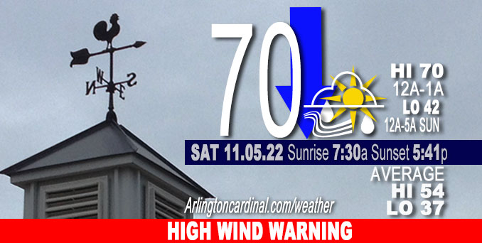
SATURDAY Hi 70 was at 1a, temps drop to 42 by 9p, mostly cloudy, clearing after 7p, chance showers, winds SSE to S to SSW to SW, 18 to 28 to 16 MPH, G38 to 52 to 24 MPH
NWS CHGO | NWS HRLY | /NWSchicago | 🌡
ARLINGTON HEIGHTS WEATHER
▴ forecast7 (Arl. Hts.) | RADAR | WIDE RADAR
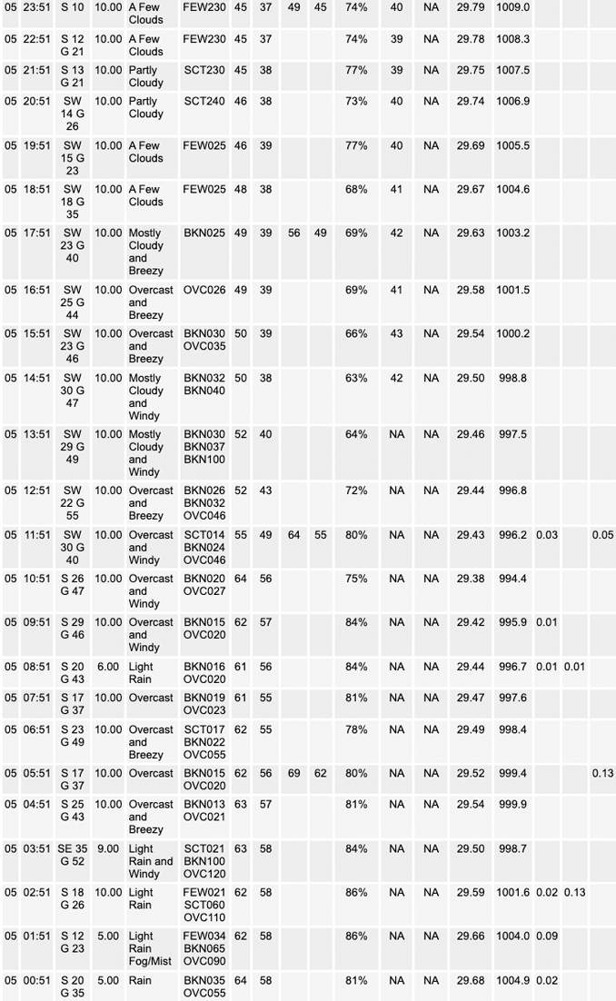
⏪ Hrly Data Table | Hrly Future Graph ⏩
IMPORTANT NOTE ON NWS DATA
⏪ Hrly Data Table | Hrly Future Graph ⏩
======================
Weather hazards expected Saturday…
Hazardous Weather Outlook is for portions of North Central Illinois…Northeast Illinois and Northwest Indiana.
Saturday and Saturday night
Significant Non Thunderstorm Wind Risk.
DISCUSSION…
Strong winds will develop rapidly toward daybreak and persist through sunset. Peak gusts of 45 to 55 are expected areawide throughout the day with a period of 55 to 60 mph gusts along and east of Interstate 55 this morning. Prepare for downed tree limbs and scattered power outages, especially along and east of Interstate 55.
Hello mobile users! If you encounter mobile “unfriendly” weather page, turn your phone sideways for a better view.
======================
High Wind Warning
URGENT – WEATHER MESSAGE
National Weather Service Chicago IL
221 AM CDT Sat Nov 5 2022
Lake IL-DuPage-Northern Cook-Central Cook-Southern Cook-Lake IN- Porter- Including the municipalities of Arlington Heights, Waukegan, Buffalo Grove, Mundelein, Gurnee, Naperville, Wheaton, Downers Grove, Lombard, Carol Stream, Evanston, Des Plaines, Schaumburg, Palatine, Northbrook, Chicago, Cicero, Oak Lawn, Oak Park, La Grange, Calumet City, Oak Forest, Lemont, Orland Park, Park Forest, Gary, Hammond, Merrillville, Portage, Valparaiso, and Chesterton
221 AM CDT Sat Nov 5 2022
HIGH WIND WARNING IN EFFECT UNTIL 7 PM CDT THIS EVENING…
* WHAT…South winds or 25 to 35 mph with gusts in excess of 60 mph expected.
* WHERE…In Illinois, Lake IL, DuPage, Northern Cook, Central Cook and Southern Cook Counties. In Indiana, Lake IN and Porter Counties.
* WHEN…Until 7 PM CDT this evening.
* IMPACTS…Damaging winds will blow down trees and power lines. Scattered power outages are expected. Travel will be difficult, especially for high profile vehicles.
* ADDITIONAL DETAILS…The strongest winds with gusts up to 65 mph are expected from daybreak to noon. Thereafter, gusts up to 55 MPH will continue through sunset.
[PEAK WINDS 9AM to 11 AM]
PRECAUTIONARY/PREPAREDNESS ACTIONS…
People should avoid being outside in forested areas and around trees and branches. If possible, remain in the lower levels of your home during the windstorm, and avoid windows. Use caution if you must drive.
O’HARE FORECAST …
Forecast Beginning Saturday, Nov. 05, 2022
Saturday: Rain, mainly before 3pm. Temperature falling to around 46 by 5pm. Windy, with a south wind 15 to 20 mph increasing to 25 to 30 mph in the afternoon. Winds could gust as high as 50 mph. Chance of precipitation is 90%. New precipitation amounts between a tenth and quarter of an inch possible.
Saturday Night: Mostly cloudy, then gradually becoming mostly clear, with a low around 42. Breezy, with a southwest wind 20 to 25 mph decreasing to 10 to 15 mph after midnight. Winds could gust as high as 45 mph.
Sunday: Sunny, with a high near 62. South southwest wind 10 to 15 mph, with gusts as high as 30 mph.
Sunday Night: Mostly clear, with a low around 41. West southwest wind 5 to 10 mph becoming northwest after midnight.
Monday: Sunny, with a high near 54. North northwest wind 5 to 10 mph becoming northeast in the afternoon.
Monday Night: Partly cloudy, with a low around 43.
Tuesday: Partly sunny, with a high near 57.
Tuesday Night: Mostly cloudy, with a low around 47.
Wednesday: Mostly sunny, with a high near 66.
Wednesday Night: Partly cloudy, with a low around 53.
Thursday: Mostly sunny, with a high near 65.
Thursday Night: A chance of rain. Mostly cloudy, with a low around 41.
Veterans Day: A chance of rain. Partly sunny, with a high near 49.


CHICAGOWEATHERSTATION.COM

ChicagoWeatherStation.com I O’Hare Normal Temps/Precip I O’Hare Record Temps, Precip, Snow
LIVE RADAR | STORM TRACKS | UNISYS US IR SAT | UNISYS Midwest IR SAT | UNISYS More IR SAT
WunderMap® with Temperature/Wind Data || Google: Arlington Heights Area Temps | US TEMPS
Full Screen Motion Weather Radar (Wunderground.com)
Midwest Cloud Cover with Arlington Heights Weather Forecast
ChicagoWeatherStation.com I O’Hare Normal Temps/Precip I O’Hare Record Temps, Precip, Snow
SUNLIGHT DATA FOR SECURITY, TRAFFIC SAFETY, AND SPORTS
SunCalc.net data with solar azimuth and trajectory, times for dawn, sunrise, solar noon, sunset, dusk …
NIGHT SKY THIS MONTH …
Backyard stargazers get a monthly guide to the northern hemisphere’s skywatching events with “Tonight’s Sky.” Check the night sky objects for this month and past months in the playlist from the Space Telescope Science Institute YouTube channel (Musical track The Far River written by Jonn Serrie, from the album And the Stars Go With You courtesy of New World Music Ltd).
Get updates from The Cardinal ALL NEWS FEEDS on Facebook. Just ‘LIKE’ the ‘Arlington Cardinal Page (become a fan of our page). The updates cover all posts and sub-category posts from The Cardinal — Arlingtoncardinal.com. You can also limit feeds to specific categories. See all of The Cardinal Facebook fan pages at Arlingtoncardinal.com/about/facebook …
Help fund The Cardinal Arlingtoncardinal.com/sponsor
Area Forecast Discussion
National Weather Service Chicago/Romeoville, IL
624 AM CDT Sat Nov 5 2022
.SHORT TERM…
Issued at 250 AM CDT Sat Nov 5 2022
Through Sunday…
…Strong Fall System to Impact our Area Today…
The main forecast points are as follows:
* Strong winds remain on track today. Gusts will increase rapidly at sunrise and last through sunset.
* Confidence has increased in a period of damaging wind gusts (>60 mph) this morning generally along and east Interstate 55 where a High Wind Warning is now in effect. Elsewhere, gusts are expected to remain between 45-55 mph as covered by a Wind Advisory.
* With strong winds lasting through much of the day, downed tree limbs and scattered power outages appear likely especially within and in close proximity to the High Wind Warning.
* Arcs of showers will continue to move through the area with drying expected by early afternoon. Severe weather currently appears unlikely (<2%) along the cold front owing to little to no instability. * Conditions will improve quickly after sunset with weakening winds and clearing skies. Discussion: Regional satellite imagery, observations, and surface analyses confirm a surface low pressure system currently in central Missouri is in the process of rapidly deepening as a sharpening upper-level trough passes overhead. Recent high resolution model data suggest the system will drop some 10-12 mb in the next 8 hours while lifting toward La Crosse, WI. In response to continued pressure falls in the Great Lakes, a low-level jet is in the process of rapidly intensifying directly over our heads as confirmed by recent VWP scans from both KLOT/KILX displaying 50kt+ at 1000-2000 feet and 70-80-kt at 4000-5000 feet. In fact, surface wind gusts already hit 40 to 45 mph across the Chicago area before showers began, which is impressive considering the time of day. Speaking of showers, the intense WAA regime will continue to support a band of showers across the region through sunrise. As a testament to the strength of the rapidly deepening low pressure system, narrow convective elements that originally developed near the AR/MO border yesterday evening continue to survive within the messy stratiform regime now entering central Illinois. A sharp back edge to the showers is present in far western Illinois, and will progress eastward over the next few hours. High resolution model guidance is in agreement that the southerly LLJ will peak between sunrise and noon with 850mb flow of 70-75kt (80+mph), right as the showers are pushing east into Michigan. Accordingly, there now appears to be a window of opportunity to mix into the base of the intense low-level jet before the cold front sweeps across the area toward noon. Such a threat appears highest along and east of Interstate 55, and is highlighted in recent iterations of both high resolution and global guidance with nearly ubiquitous depictions of 50-55 kt (60+ mph) wind gusts for several hours this morning. In addition, the 51-member EPS mean peak wind gusts range between 55 and 60 mph along and east of I-55, with several individual members producing local gusts of nearly 70 mph. For these reasons, we opted to upgrade a portion of the Wind Advisory to a High Wind Warning where confidence has increased in warning-level impacts of numerous downed trees and power outages. It must be stressed that winds will increase abruptly at sunrise, going from simply breezy within the rain to strong enough to down tree limbs. The cold front will sweep across the area between 10 am and noon, ushering in a modest wind shift toward the southwest. Anytime one finds themselves within the warm sector of a rapidly deepening low pressure system, they must watch out for surprise severe weather events anytime of day and even with meager instability. High resolution model guidance continues to advocate for a strongly force band of showers along the cold front, which may locally augment wind gusts. Given the literal bare-bones meager CAPE expected, convective updrafts along the front will likely be of limited width and strength. With this in mind, updrafts may very well get ripped apart as they grow upward, limiting their overall longevity and "sucking" power. As a result, the threat for a surprise tornado event along the front appears to be low (<2%). If more instability develops to sustain low-level updrafts than currently expected, the threat for tornadoes would increase. Sometimes, we can`t tell whether we have enough instability until, well, tornadoes start developing. At any rate, the most likely scenario is the front sweeps through as an arcing band of showers with locally higher wind gusts. Behind the cold front, winds will remain strong as cold air advection steepens low-level lapse rates and allows for mixing into the strong wind field along the backside of the departing low pressure system. Wind gusts of 45 to 55 mph thus appear poised to continue through sunset, especially near the Illinois and Wisconsin state line. After sunset, winds will quickly relax and skies will clear, leading to a relatively cool night with lows in the low to mid 40s. In spite of the passage of a strong fall storm system, tomorrow will be surprisingly pleasant with mostly sunny skies and above-average highs in the upper 50s to lower 60s. Winds will remain breezy with gusts in the 25 to 30 mph range. Borchardt/NWS Chicago
