
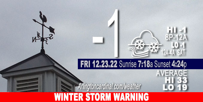
Friday Hi -1, mostly cloudy, 0.4″ snow, winds W to WNW, 29 to 24 to 25 MPH, G45 to 47 to 39 MPH, continuing Saturday
NWS CHGO | NWS HRLY | /NWSchicago | 🌡
ARLINGTON HEIGHTS WEATHER
▴ forecast7 (Arl. Hts.) | RADAR | WIDE RADAR
⏪ Hrly Data Table | Hrly Future Graph ⏩
IMPORTANT NOTE ON NWS DATA
⏪ Hrly Data Table | Hrly Future Graph ⏩
======================
Friday and Friday Night …
Weather Hazards expected…
Extreme Excessive Cold Risk.
Elevated Non Thunderstorm Wind Risk.
Significant Blowing Snow Risk.
Limited Ice Jam Flooding Risk.
WINTER STORM WARNING: Major storm system since Thursday continues through Saturday, with continued difficult travel conditions with very strong winds occurring Friday afternoon, peaking at 47 MPH 2:00 p.m. to 4:00 p.m.
Air temperature will rise very slowly all day Friday with afternoon and evening temperatures ranging from -2°F to -1°F.
Low -1°F Saturday morning from 12am to 4am with a high of 8°F Saturday from 2pm to 7pm.
Low 3°F Sunday morning from 5am to 7am with a high near 13°F Sunday at 3pm.
Low 7°F Monday 12am to 3am with a high of 20°F Monday at 3pm.
DISCUSSION…
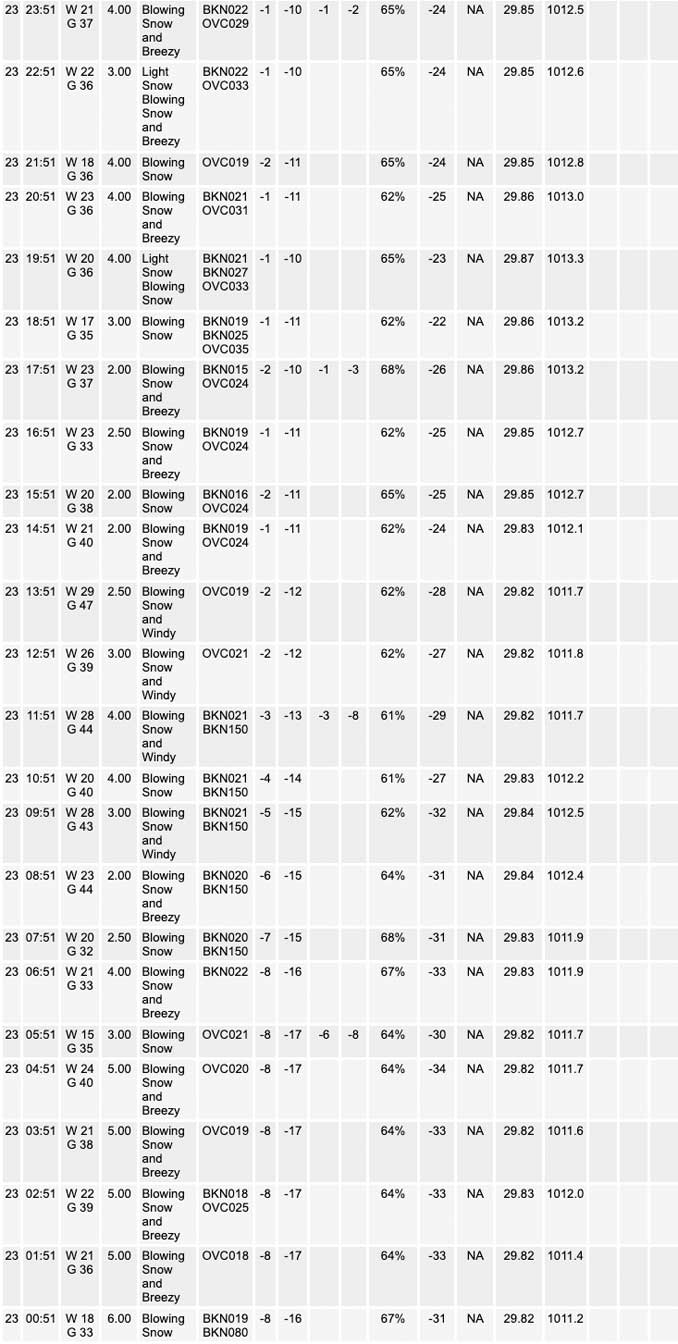
Dangerous travel conditions are expected to continue through tonight due to a combination of falling snow, blowing snow, and bitterly cold temperatures. Near-blizzard conditions are possible today and tonight, especially in open areas. Conditions may become life-threatening for anyone who becomes stranded. These cold temperatures may also lead to ice jams on area rivers which could cause flooding.
Very strong winds Friday may result in some tree damage and power outages. Dangerously low wind chills are expected today.
Hello mobile users! If you encounter a mobile “unfriendly” weather page, turn your phone sideways for a better view.
======================
O’HARE FORECAST …
Forecast Beginning Friday, Dec. 23, 2022
Friday: Occasional flurries with intermittent snow. Widespread blowing snow. Cloudy and cold, with a high near -2. Wind chill values as low as -36. Windy, with a west wind around 30 mph, with gusts as high as 45 mph. Chance of precipitation is 30%.
Friday Night: Occasional snow or flurries. Widespread blowing snow. Low around -2. Wind chill values as low as -27. Breezy, with a west wind around 25 mph, with gusts as high as 45 mph. Chance of precipitation is 80%. New snow accumulation of less than a half inch possible.
Saturday: A chance of flurries. Areas of blowing snow. Partly sunny and cold, with a high near 8. Wind chill values as low as -24. Breezy, with a west wind 20 to 25 mph, with gusts as high as 35 mph.
Saturday Night: Mostly cloudy, with a low around 2. Wind chill values as low as -15. Blustery, with a west northwest wind 15 to 20 mph, with gusts as high as 30 mph.
Christmas Day: Mostly sunny, with a high near 13. West wind 10 to 15 mph, with gusts as high as 20 mph.
Sunday Night: A 40 percent chance of snow after midnight. Mostly cloudy, with a low around 7.
Monday: A 40 percent chance of snow before noon. Mostly cloudy, with a high near 20.
Monday Night: Mostly cloudy, with a low around 8.
Tuesday: Partly sunny, with a high near 25.
Tuesday Night: Mostly cloudy, with a low around 20.
Wednesday: Mostly cloudy, with a high near 41.
Wednesday Night: A chance of rain. Cloudy, with a low around 35.
Thursday: A chance of rain. Cloudy, with a high near 47.
WINTER STORM WARNING …
Winter Storm Warning URGENT – WINTER WEATHER MESSAGE National Weather Service Chicago IL 354 AM CST Fri Dec 23 2022
COUNTIES: Winnebago-Boone-McHenry-Lake IL-Ogle-Lee-De Kalb-Kane-DuPage- La Salle-Kendall-Grundy-Kankakee-Livingston-Iroquois-Ford- Northern Cook-Central Cook-Southern Cook-Northern Will- Southern Will-Eastern Will-Lake IN-Newton-Jasper-Benton-
Including the municipalities of Arlington Heights, Rockford, Belvidere, Crystal Lake, Algonquin, McHenry, Woodstock, Waukegan, Buffalo Grove, Mundelein, Gurnee, Rochelle, Oregon, Byron, Dixon, DeKalb, Sycamore, Aurora, Elgin, Naperville, Wheaton, Downers Grove, Lombard, Carol Stream, Ottawa, Streator, La Salle, Mendota, Marseilles, Oswego, Yorkville, Plano, Morris, Coal City, Minooka, Kankakee, Bourbonnais, Bradley, Pontiac, Dwight, Fairbury, Watseka, Gilman, Paxton, Gibson City, Evanston, Des Plaines, Schaumburg, Palatine, Northbrook, Chicago, Cicero, Oak Lawn, Oak Park, La Grange, Calumet City, Oak Forest, Lemont, Orland Park, Park Forest, Joliet, Bolingbrook, Plainfield, Mokena, Channahon, Manhattan, Wilmington, Crete, Peotone, Beecher, Gary, Hammond, Merrillville, Roselawn, Kentland, Morocco, Rensselaer, DeMotte, Fowler, and Oxford 354 AM CST Fri Dec 23 2022 /454 AM EST Fri Dec 23 2022/
…WINTER STORM WARNING REMAINS IN EFFECT UNTIL 6 AM CST SATURDAY…
* WHAT…Winds gusting to 50 mph, blowing and drifting snow, and dangerously cold wind chills expected.
* WHERE…Portions of northern and central Illinois and northwest Indiana.
* WHEN…Until 6 AM CST Saturday.
* IMPACTS…Blowing snow will result in near white out conditions in rural and open areas along north to south oriented roadways. In additional to greatly reduced visibilities, snow will drift over north to south roads, resulting in snow covered roads and hazardous travel conditions. Some power outages could occur as well due to the strong winds today.
* ADDITIONAL DETAILS…Dangerously cold wind chills as low as 30 to 40 below zero through tonight can cause frostbite on exposed skin in as little as 10 minutes.
PRECAUTIONARY/PREPAREDNESS ACTIONS…
If you must travel, keep an extra flashlight, food, and water in your vehicle in case of an emergency.
The latest road conditions for Illinois can be obtained on the internet at www.gettingaroundillinois.com.
The latest road conditions for Indiana are available by calling 1- 800-261-7623.


CHICAGOWEATHERSTATION.COM

ChicagoWeatherStation.com I O’Hare Normal Temps/Precip I O’Hare Record Temps, Precip, Snow
LIVE RADAR | STORM TRACKS | UNISYS US IR SAT | UNISYS Midwest IR SAT | UNISYS More IR SAT
WunderMap® with Temperature/Wind Data || Google: Arlington Heights Area Temps | US TEMPS
Full Screen Motion Weather Radar (Wunderground.com)
Midwest Cloud Cover with Arlington Heights Weather Forecast
ChicagoWeatherStation.com I O’Hare Normal Temps/Precip I O’Hare Record Temps, Precip, Snow
SUNLIGHT DATA FOR SECURITY, TRAFFIC SAFETY, AND SPORTS
SunCalc.net data with solar azimuth and trajectory, times for dawn, sunrise, solar noon, sunset, dusk …
NIGHT SKY THIS MONTH …
Backyard stargazers get a monthly guide to the northern hemisphere’s skywatching events with “Tonight’s Sky.” Check the night sky objects for this month and past months in the playlist from the Space Telescope Science Institute YouTube channel (Musical track The Far River written by Jonn Serrie, from the album And the Stars Go With You courtesy of New World Music Ltd).
Get updates from The Cardinal ALL NEWS FEEDS on Facebook. Just ‘LIKE’ the ‘Arlington Cardinal Page (become a fan of our page). The updates cover all posts and sub-category posts from The Cardinal — Arlingtoncardinal.com. You can also limit feeds to specific categories. See all of The Cardinal Facebook fan pages at Arlingtoncardinal.com/about/facebook …
Help fund The Cardinal Arlingtoncardinal.com/sponsor
Area Forecast Discussion
National Weather Service Chicago/Romeoville, IL
1103 PM CST Fri Dec 23 2022
.SHORT TERM… Issued at 134 PM CST Fri Dec 23 2022
Through Saturday…
National satellite imagery paints an impressive winter scene with deep cyclonic flow across the eastern 2/3 of the United States, a mature surface low pressure system along the Ontario/Quebec borders, an expansive snow pack as far south as the the I-40 corridor, and cold-air advection-driven stratocumulus clouds screaming south across the Gulf of Mexico. The Great Lakes are firmly within the grip of the arctic airmass at press time as evident by temperatures at or below 0F and wind chills ranging from 25 to 35F below zero. Westerly winds at times gusting 45-50 mph (and even 60 mph as recently reported at Gary Airport) continue to lead to considerable blowing snow in open and rural areas, including outside our window where visibility has dropped below 1000 feet from time to time. Numerous interstate closures continue this afternoon primarily in northwestern Indiana due to blowing snow and, in the case of northeastern Porter County, bonafide blizzard conditions. Taken altogether, it`s a raw and uncomfortably cold day.
High resolution model guidance (most notably the RAP/NAM3) continue to suggest a lingering vort max along the backside of the cyclonic flow aloft will swing across northern IL and northwestern IN this evening. As a result, low-level saturation will build back into the base of the DGZ supporting an expansion of scattered if not numerous snow showers primarily along and east of Interstate 39 from 8 PM to 2 AM. Considering westerly winds will remain strong, stark visibility restrictions will continue in and around any snow shower with no meaningful (or frankly measurable by virtue of the wind) accumulations expected. Another cold night is in store with overnight lows a few degrees below 0F (wind chills of 25 to 30 below zero).
Even as the upper-level cyclonic flow gradually shifts eastward, tomorrow will offer a continuation of raw and cold conditions with wind gusts of 30 to 40 mph and temperatures of +2 to +10F giving way to wind chills of -15 to -20F. Areas of blowing snow will continue particularly in open and rural areas, though many areas should see pokes of the sun.
One last note – we will continue the current winter headlines (Winter Storm/Blizzard Warnings) until 6 AM Saturday for continued dangerously low wind chills, blustery westerly winds, and areas of blowing snow.
Borchardt/NWS Chicago
