
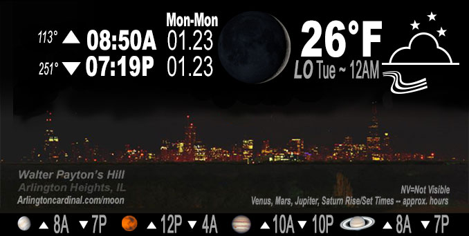
🌒 🌓 🌕 🌗 Waxing Crescent Moon, sky cover overnight Mon. to Tue. 78% to 90 to 70%, winds SW to W, 18 to 20 to 8 MPH, Low 26, 12a to 8a
NWS CHGO | NWS HRLY | /NWSchicago | 🌡
ARLINGTON HEIGHTS WEATHER
▴ forecast7 (Arl. Hts.) | RADAR | WIDE RADAR
IMPORTANT NOTE ON NWS DATA
======================
NIGHT FORECASTS …
NOTE 1: Forecast and information text below may refer to a previous night on Arlingtoncardinal.com, and might not be updated until late afternoon, evening, or overnight. However, Night Sky archives on CARDINAL NEWS Magazine include text forecasts that correspond to the lunar phase graphic above.
NOTE 2: Keep in mind lunar rise and set times don’t always correspond with night weather and early morning lows because on some days during the month the moon is visible in the sky predominantly during the daytime hours.
Overnight Monday/Tuesday …
No Weather Hazards expected …
Wind gusts near 30 MPH; threat of patchy freezing drizzle.
DISCUSSION…
Nightly low below freezing at 26°F, but not even close to the normal low of 16°F. However, winds of 29 MPH just before midnight will bring the Wind Chill down to 13°F.
Hello mobile users! If you encounter mobile “unfriendly” weather page, turn your phone sideways for a better view.
======================
O’HARE FORECAST …
Forecast Beginning Monday Night, Jan. 24, 2023 …
Monday Night: A slight chance of freezing drizzle between midnight and 4am. Mostly cloudy, with a low around 29. West southwest wind 10 to 15 mph, with gusts as high as 30 mph.
Tuesday: Mostly cloudy, with a high near 33. West southwest wind around 5 mph, with gusts as high as 15 mph.
Tuesday Night: A 30 percent chance of snow after midnight. Cloudy, with a low around 29. South southwest wind around 5 mph becoming east northeast after midnight. Winds could gust as high as 10 mph.
Wednesday: Snow. High near 33. Northeast wind 10 to 15 mph, with gusts as high as 25 mph. Chance of precipitation is 90%. New snow accumulation of 1 to 3 inches possible.
Wednesday Night: A 30 percent chance of snow showers, mainly before midnight. Cloudy, with a low around 26. Northwest wind 10 to 15 mph, with gusts as high as 25 mph.
Thursday: A 20 percent chance of snow showers. Cloudy, with a high near 31.
Thursday Night: Mostly cloudy, with a low around 20.
Friday: A chance of snow showers after noon. Cloudy, with a high near 35. Breezy.
Friday Night: Mostly cloudy, with a low around 23.
Saturday: Mostly cloudy, with a high near 31.
Saturday Night: A chance of snow. Cloudy, with a low around 22.
Sunday: A chance of snow. Cloudy, with a high near 28.
Sunday Night: Mostly cloudy, with a low around 10.
Monday: Mostly cloudy, with a high near 19.
O’Hare forecast archive and hourly weather observations archive are available HERE on the CARDINAL NEWS Magazine.
Arlingtoncardinal.com/moonphases
Arlingtoncardinal.com/nightsky
NIGHT SKY THIS MONTH …
Check the night sky objects for this month and past months in the playlist from the Space Telescope Science Institute YouTube channel Backyard stargazers get a monthly guide to the northern hemisphere’s skywatching events with “Tonight’s Sky” (Musical track The Far River written by Jonn Serrie, from the album And the Stars Go With You courtesy of New World Music Ltd. Musical track The Far River written by Jonn Serrie, from the album And the Stars Go With You courtesy of New World Music Ltd).
Telephoto lens, ISO 100, f/11, Shutter Speed 1/100 to 1/125 for the Moon.
Get updates from The Cardinal ALL NEWS FEEDS on Facebook. Just ‘LIKE’ the ‘Arlington Cardinal Page (become a fan of our page). The updates cover all posts and sub-category posts from The Cardinal — Arlingtoncardinal.com. You can also limit feeds to specific categories. See all of The Cardinal Facebook fan pages at Arlingtoncardinal.com/about/facebook …
Help fund The Cardinal Arlingtoncardinal.com/sponsor
Telephoto lens, ISO 1600, f/11, Shutter Speed 2.5″ for the skyline. The skyline exposure was toned down, and brightness and contrast was adjusted in Photoshop.
Area Forecast Discussion
National Weather Service Chicago/Romeoville, IL
127 AM CST Tue Jan 24 2023
.UPDATE… Issued at 940 PM CST Mon Jan 23 2023
The main item of note for the overnight hours is any threat for patchy freezing drizzle. An area of very light radar echoes has been advancing into the Quad Cities metro area this evening, and observations associated with this have shown cloud bases dropping below 1000 feet and visibility in the 4-5 mile range. This type of observational trend paired with light radar reflectivity can be indicative of light freezing drizzle occurrence. However, WFO DVN had no reports of any freezing drizzle in the Cedar Rapids area, which is part of their most populous county. It`s quite possible that saturation depths won`t be sufficient into northern Illinois to support drizzle development. Thus, the already low threat for freezing drizzle appears to be lower still as of this writing. Nonetheless, opted to hold onto a slight chance of freezing drizzle in the grids near and north of the IL and Kankakee Rivers through the overnight rather than rule it out altogether.
Looking ahead to our winter system for overnight Tuesday night and Wednesday, the early 00z guidance, including the latest NAM (which had been a northerly/stronger/wetter outlier on previous runs), is now generally in line with the overall global consensus. Our area of greatest concern continues to be in the southeast CWA for heavy snowfall rates overlapping the Wednesday morning commute. The ECMWF and GFS suites both favor a heavy band stretching from central and southern Illinois across central Indiana, with main question being exact location (GFS/GEFS a bit farther north than ECMWF/EPS), and a reason why we hadn`t included any of our far southern CWA counties in a watch yet. The ingredients are there for a several hour burst of heavy wet snow given steep lapse rates in the DGZ and strong omega well aligned with the DGZ. However, confidence is lower in the duration of this, affecting snowfall totals. Do expect the early Tuesday morning forecast package to go out with winter headlines for particularly the south half or so of the CWA for this event.
Castro/NWS Chicago
