
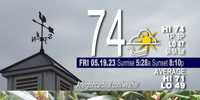
Friday Hi 69, partly cloudy, winds SW to W to NW to N, 10 to 8 to 13 MPH, G16 to 14 to 18 MPH into Saturday
NWS CHGO | NWS HRLY | /NWSchicago | 🌡
ARLINGTON HEIGHTS WEATHER
▴ forecast7 (Arl. Hts.) | RADAR | WIDE RADAR
⏪ Hrly Data Table | Hrly Future Graph ⏩
IMPORTANT NOTE ON NWS DATA
⏪ Hrly Data Table | Hrly Future Graph ⏩
Hello mobile users! If you encounter a mobile “unfriendly” weather page, turn your phone sideways for a better view.
======================
Friday and Friday Evening …
No (?) Weather Hazards …
Showers and possibly a thunderstorm before 1pm, then a chance of showers and thunderstorms, mainly between 1pm and 4pm. High near 70. Southwest wind around 10 mph becoming northwest in the afternoon. Winds could gust as high as 15 mph. Chance of precipitation is 90%.
DISCUSSION…
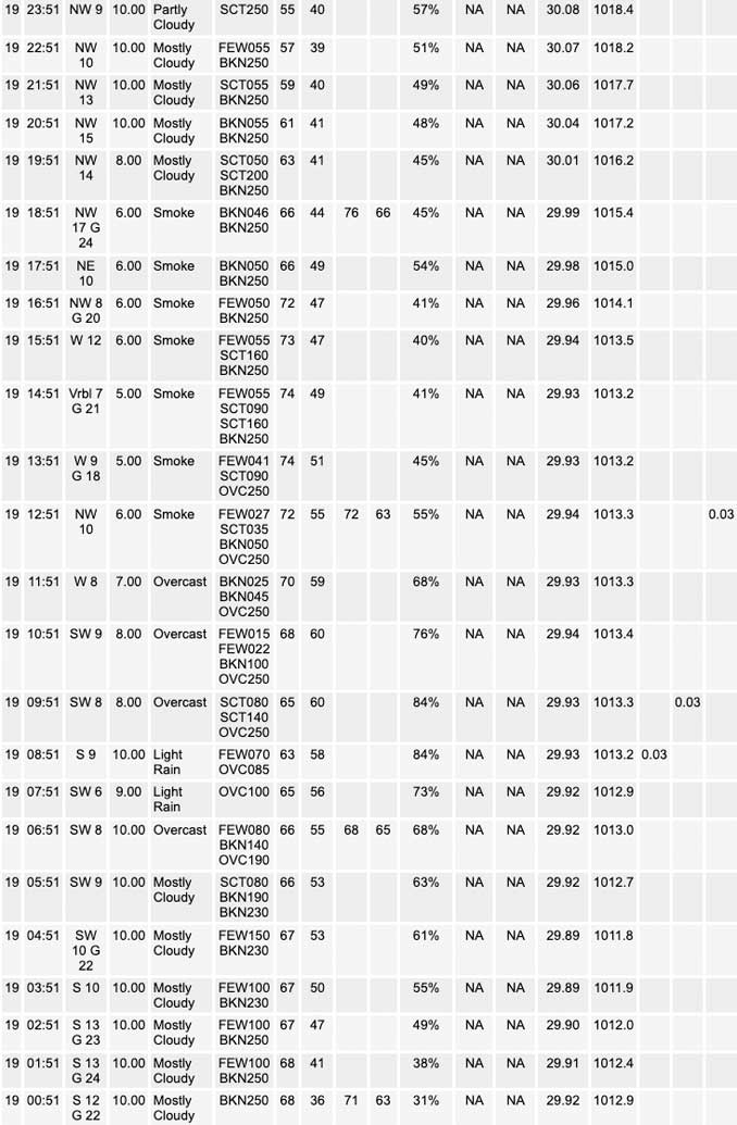
Behind the cold front, breezy northwest winds will settle into the region with partially clearing skies. Experimental RAP-SMOKE output continues to advertise downward mixing of Canadian wildfire smoke toward the ground right behind the front from mid-morning to early afternoon, which seems plausible given upstream observations of visibility ranging from 7 to 9 miles. It`s tough to say whether the smoke will really be noticeable at the ground as the simulated total vertically integrated plume appears to lessen in concentration into northern Illinois and northwestern Indiana. Regardless, any remaining smoke should clear out tonight as a surface high pressure system builds into the area and crashes mixing heights and associated surface winds.
======================
O’HARE FORECAST …
Forecast Beginning Friday, May 19, 2023
Sorry, incomplete forecast, built from Thursday.
Friday: Showers and possibly a thunderstorm before 1pm, then a chance of showers and thunderstorms, mainly between 1pm and 4pm. High near 70. Southwest wind around 10 mph becoming northwest in the afternoon. Winds could gust as high as 15 mph. Chance of precipitation is 90%.
Friday Night: A 10 percent chance of showers before 7pm. Partly cloudy, with a low around 49. North northwest wind around 10 mph, with gusts as high as 20 mph.
Saturday: Sunny, with a high near 68.
Saturday Night: Mostly clear, with a low around 52.
Sunday: Sunny, with a high near 76.
Sunday Night: Mostly clear, with a low around 49.
Monday: Sunny, with a high near 69.
Monday Night: Mostly clear, with a low around 52.
Tuesday: Sunny, with a high near 77.
Tuesday Night: Mostly clear, with a low around 56.
Wednesday: Sunny, with a high near 81.


CHICAGOWEATHERSTATION.COM

ChicagoWeatherStation.com I O’Hare Normal Temps/Precip I O’Hare Record Temps, Precip, Snow
WunderMap® with Temperature/Wind Data || Google: Arlington Heights Area Temps | US TEMPS
Midwest Cloud Cover with Arlington Heights Weather Forecast
ChicagoWeatherStation.com I O’Hare Normal Temps/Precip I O’Hare Record Temps, Precip, Snow
SUNLIGHT DATA FOR SECURITY, TRAFFIC SAFETY, AND SPORTS
SunCalc.net data with solar azimuth and trajectory, times for dawn, sunrise, solar noon, sunset, dusk …
NIGHT SKY THIS MONTH …
Backyard stargazers get a monthly guide to the northern hemisphere’s skywatching events with “Tonight’s Sky.” Check the night sky objects for this month and past months in the playlist from the Space Telescope Science Institute YouTube channel (Musical track The Far River written by Jonn Serrie, from the album And the Stars Go With You courtesy of New World Music Ltd).
Get updates from The Cardinal ALL NEWS FEEDS on Facebook. Just ‘LIKE’ the ‘Arlington Cardinal Page (become a fan of our page). The updates cover all posts and sub-category posts from The Cardinal — Arlingtoncardinal.com. You can also limit feeds to specific categories. See all of The Cardinal Facebook fan pages at Arlingtoncardinal.com/about/facebook …
Help fund The Cardinal Arlingtoncardinal.com/sponsor
/////////////>
Area Forecast Discussion
National Weather Service Chicago/Romeoville, IL
626 AM CDT Fri May 19 2023
.SHORT TERM… Issued at 217 AM CDT Fri May 19 2023
Through Saturday…
A recent hand surface analysis places a baggy trough axis along a weak cold front stretching from central Wisconsin to far northwestern Illinois and into the Southern Plains. Low- to mid- level moisture ahead of the front is fairly scant with surface dew points only in the low to mid 50s and mean 700-300mb relative humidity values of only around 30-40% (re: 00Z DVN RAOB). As the front drifts eastward slowly this morning, so should the ongoing scattered showers from eastern Iowa into northern Illinois while gradually decreasing in intensity and coverage given the aforementioned antecedent dry airmass in place. However, the temporal intersection of the approaching upper-level shortwave and afternoon “daytime” heating should support an increase in shower coverage this afternoon primarily near and east of I-55. In fact, shallow low-level moisture advection ahead of the front may provide just enough low-level instability to support a thunderstorm or two as equilibrium levels nose toward -20C. In spite of appreciable deep-layer shear afforded by a 50kt 500mb jet along the periphery of the upper-level shortwave, the low- centroid and marginal character of instability suggests thunderstorm intensity should be rather weak (by the standards of May, at least) with threats for only locally gusty winds and occasional lightning strikes. Such threats appear greatest after 12 PM (and again, near and east of I-55).
Behind the cold front, breezy northwest winds will settle into the region with partially clearing skies. Experimental RAP-SMOKE output continues to advertise downward mixing of Canadian wildfire smoke toward the ground right behind the front from mid-morning to early afternoon, which seems plausible given upstream observations of visibility ranging from 7 to 9 miles. It`s tough to say whether the smoke will really be noticeable at the ground as the simulated total vertically integrated plume appears to lessen in concentration into northern Illinois and northwestern Indiana. Regardless, any remaining smoke should clear out tonight as a surface high pressure system builds into the area and crashes mixing heights and associated surface winds. Ideal radiational cooling conditions will allow for overnight lows to drop into the mid to upper 40s.
Saturday looks quiet with a surface high overhead leading to light winds and sunny skies (e.g. no smoke). Highs will climb into the upper 60s to lower 70s with locally cooler conditions along the Lake Michigan shore.
Borchardt/NWS Chicago
