
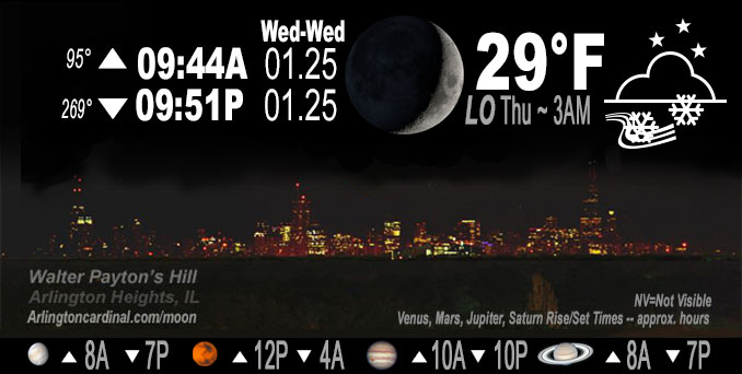
🌒 🌓 🌕 🌗 Waxing Crescent Moon, light snow, sky cover overnight Wed. to Thu. 100%, winds NW, 14 to 8 MPH, G18 to 14 MPH, Low 29, 3a to 5a
NWS CHGO | NWS HRLY | /NWSchicago | 🌡
ARLINGTON HEIGHTS WEATHER
▴ forecast7 (Arl. Hts.) | RADAR | WIDE RADAR
IMPORTANT NOTE ON NWS DATA
======================
NIGHT FORECASTS …
NOTE 1: Forecast and information text below may refer to a previous night on Arlingtoncardinal.com, and might not be updated until late afternoon, evening, or overnight. However, Night Sky archives on CARDINAL NEWS Magazine include text forecasts that correspond to the lunar phase graphic above.
NOTE 2: Keep in mind lunar rise and set times don’t always correspond with night weather and early morning lows because on some days during the month the moon is visible in the sky predominantly during the daytime hours.
Overnight Wednesday/Thursday …
Weather Hazards expected …
Elevated Snow Risk.
DISCUSSION…
Snow continues into Thursday until about 5 p.m.
Hello mobile users! If you encounter mobile “unfriendly” weather page, turn your phone sideways for a better view.
======================
O’HARE FORECAST …
Forecast Beginning Wednesday Night, Jan. 25, 2023 …
Wednesday Night: Snow showers likely, mainly after 5am. Cloudy, with a low around 29. Northwest wind 5 to 10 mph, with gusts as high as 15 mph. Chance of precipitation is 70%. Total nighttime snow accumulation of less than a half inch possible.
Thursday: Snow showers. High near 33. Northwest wind 5 to 10 mph. Chance of precipitation is 80%. New snow accumulation of around an inch possible.
Thursday Night: Isolated snow showers before midnight. Mostly cloudy, with a low around 18. West wind 10 to 15 mph becoming south southwest after midnight. Winds could gust as high as 25 mph. Chance of precipitation is 20%.
Friday: Snow likely, mainly after 9am. Cloudy, with a high near 35. Breezy, with a south southwest wind 20 to 25 mph, with gusts as high as 35 mph. Chance of precipitation is 70%. New snow accumulation of less than one inch possible.
Friday Night: Mostly cloudy, with a low around 19. Breezy, with a west wind 15 to 20 mph decreasing to 5 to 10 mph after midnight. Winds could gust as high as 30 mph.
Saturday: Snow likely, mainly after noon. Cloudy, with a high near 27. Chance of precipitation is 70%.
Saturday Night: Snow likely, mainly before midnight. Cloudy, with a low around 20. Chance of precipitation is 70%.
Sunday: Mostly cloudy, with a high near 26.
Sunday Night: Mostly cloudy, with a low around 13.
Monday: Mostly cloudy, with a high near 20.
Monday Night: Mostly cloudy, with a low around 6.
Tuesday: Mostly cloudy, with a high near 21.
Tuesday Night: A chance of snow. Cloudy, with a low around 10.
Wednesday: Mostly cloudy, with a high near 19.
O’Hare forecast archive and hourly weather observations archive are available HERE on the CARDINAL NEWS Magazine.
Arlingtoncardinal.com/moonphases
Arlingtoncardinal.com/nightsky
NIGHT SKY THIS MONTH …
Check the night sky objects for this month and past months in the playlist from the Space Telescope Science Institute YouTube channel Backyard stargazers get a monthly guide to the northern hemisphere’s skywatching events with “Tonight’s Sky” (Musical track The Far River written by Jonn Serrie, from the album And the Stars Go With You courtesy of New World Music Ltd. Musical track The Far River written by Jonn Serrie, from the album And the Stars Go With You courtesy of New World Music Ltd).
Telephoto lens, ISO 100, f/11, Shutter Speed 1/100 to 1/125 for the Moon.
Get updates from The Cardinal ALL NEWS FEEDS on Facebook. Just ‘LIKE’ the ‘Arlington Cardinal Page (become a fan of our page). The updates cover all posts and sub-category posts from The Cardinal — Arlingtoncardinal.com. You can also limit feeds to specific categories. See all of The Cardinal Facebook fan pages at Arlingtoncardinal.com/about/facebook …
Help fund The Cardinal Arlingtoncardinal.com/sponsor
Telephoto lens, ISO 1600, f/11, Shutter Speed 2.5″ for the skyline. The skyline exposure was toned down, and brightness and contrast was adjusted in Photoshop.
Area Forecast Discussion
National Weather Service Chicago/Romeoville, IL
1125 PM CST Wed Jan 25 2023
.UPDATE… Issued at 812 PM CST Wed Jan 25 2023
Made some minor adjustments to going forecast, mainly to increase pops for light snow to likely across the entire forecast area tonight. Also bumped QPF slightly across our west/southwest counties where light snow looks to be a little more widespread this evening than previously indicated, though snow amounts remain similar with relatively low snow to liquid ratios.
Early evening surface analysis depicts 997 mb low along the Ontario shore of Lake Erie, with a surface trough trailing back into the upper Mississippi Valley. A second weaker low has become indistinct within the western portion of this trough over the upper Mississippi Valley. While this second surface low was not obvious in the pressure/wind field, a fairly sharp low level thermal gradient was evident along the Mississippi River vicinity as noted by surface temps in the lower 30s across WI/IL and the teens/20s across central and eastern IA (and single digits farther upstream). Regional radar mosaic has shown a blossoming of returns in the vicinity of the Mississippi, likely associated with low-level frontogenetic forcing along the eastern periphery of the push of arctic air. RAP depicts this best around the 925 mb level from southeast MN into eastern IA and far western IL, and suggests this increase in f-gen forced light snow will continue to spread into our west and southwest counties over the next several hours. Light snow persists in cyclonic flow across much of the remainder of the forecast area as well, along with some lake-induced convective snow showers becoming evident across far southern Lake Michigan and the Lake/Porter county shores. Expectation is that light snow will continue across the area overnight as the mid-level wave over the upper Valley propagates southeast, with the potential for some additional minor accumulations. Greatest overnight amounts (perhaps an inch or a little more in spots) will likely be across those west/southwest counties where the aforementioned low-level f-gen forcing will be focused, as well as across Lake and especially Porter counties where lake effect snow showers eventually shift east. Elsewhere accums should remain generally less than an inch overnight.
Light snow will likely persist into Thursday morning as the mid- level wave transits the area. Forecast soundings indicate some mid- level drying behind this wave by afternoon, though persistent cold advection and steepening low level lapse rates will likely allow for at least scattered snow showers in the afternoon as yet another mid- level short wave trough drops across the area. No changes made beyond tonight at this point however, as going forecast appears to have these trends handled appropriately.
Ratzer/NWS Chicago
&&
.SHORT TERM… Issued at 315 PM CST Wed Jan 25 2023
Through Thursday night…
We have ended our winter weather advisory for all but Lake and Porter counties in IN with the update this afternoon. With temperatures hovering around freezing, impacts from the lingering light snow late this afternoon will be minimal at best.
The main forecast messages during the short term forecast are:
* Periodic light snow showers expected tonight, with any more vigorous showers tied to lake effect over portions of Lake and Porter counties in IN this evening.
* Snow showers continue on Thursday, with potentially more vigorous snow showers possible across parts of northeastern IL and far northwestern IN in the afternoon.
Snowfall rates continue to abate across the area early this afternoon as the main storm system responsible for this morning`s snowfall continues to shift northeastward into northwestern OH. While light snow will continue to fall across the area into this evening, surface temperatures will continue to hover around freezing, thus limiting additional accumulations and travel impacts. For this reason, we have opted to end the winter weather advisory early for all but Lake and Porter counties in IN, where the threat of additional accumulation from lake effect snow showers continues this evening.
Northerly winds, developing along the western periphery of the exiting area of low pressure, are expected to set up a favorable fetch on Lake Michigan to support lake effect snow showers into parts of Lake and Porter counties in IN tonight. While the thermodynamic setup over the lake is not expected to be all that impressive, lake induced inversion heights nearing 7,000 ft should be sufficient to support some accumulating snow showers tonight along the southern edge of the lake where the better lake induced convergence axis sets up. HIRES guidance continues to focus this convergence axis into parts of northeastern Lake IN and northern Porter county this evening as the lower level flow backs northwesterly. While this suggests this area will be favored for a period of accumulating lake effect snow showers this evening, it appears unlikely that this will be a significant event with a continuous dominant lake effect band as directional shear in the unstable layer looks to become somewhat unfavorable through the evening. Nevertheless, I cannot rule out some localized amounts of an inch or two this evening across northern parts of Porter county before the main focus shifts eastward into LaPorte.
Outside of the lake effect, additional periods of snow showers are expected across the area late tonight and especially on Thursday as a couple of smaller scale mid-level impulses track southeastward across the area. Minor additional accumulations are likely Thursday morning as the first of two waves shifts across the area. A period of potentially more robust snow showers also appears plausible across parts of northeastern IL and far northwestern IN Thursday afternoon as the second impulse approaches. Lower level lapse rates will steepen in the afternoon ahead of this second disturbance as a surface frontal trough shifts southward into northeastern IL. This should foster more robust snow showers for a period in the afternoon across parts of the Chicago metro, potentially leading to additional snow accumulations and reduced visibilities. Travel impacts from these snow showers is still somewhat unclear, as surface temperatures hovering close to freezing may act to limit accumulations on treated roads.
KJB/NWS Chicago
