
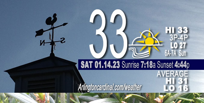
Saturday Hi 33, mostly cloudy to partly cloudy to partly sunny, winds SW to S to SSE, calm to 8 to 7 to 9 MPH, G13 to 16 MPH beginning 7p
NWS CHGO | NWS HRLY | /NWSchicago | 🌡
ARLINGTON HEIGHTS WEATHER
▴ forecast7 (Arl. Hts.) | RADAR | WIDE RADAR
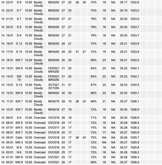
⏪ Hrly Data Table | Hrly Future Graph ⏩
IMPORTANT NOTE ON NWS DATA
⏪ Hrly Data Table | Hrly Future Graph ⏩
======================
Saturday and Saturday Night …
No Weather Hazards expected …
DISCUSSION…
Clouds had appeared poised to hold tight through most of the day and clear toward sunset from west to east. However clearing has occurred well before sunset allowing mostly sunny conditions before some high clouds approach from the west. We might get above the freezing mark before sunset. High temperatures this afternoon will depend on clear skies. Colder temperatures overnight and early morning Sunday will depend on lack of cloud cover overnight.
NWS at Chicago Executive Airport reported 32°F while NWS O’Hare reported 31°F just before 3:00 p.m. Saturday.
A low of 27°F is expected about 6:00 a.m. Sunday with a wind chill of about 18°F thanks to wind gusts increasing from 13 MPH to 17 MPH by 6:00 a.m. A low of 27°F is 11°F above the normal low temperature for January 15. Even our expected wind chill low is above the normal air temperature low of 16°F by 2°F.
======================
O’HARE FORECAST …
MIDWAY — problem with NWS O’Hare
Forecast Beginning Saturday, Jan. 14, 2023
Saturday: Partly sunny, with a high near 31. South wind 5 to 10 mph.
Saturday Night: Mostly cloudy, with a low around 27. South wind 5 to 10 mph, with gusts as high as 15 mph.
Sunday: Partly sunny, with a high near 40. South wind 10 to 15 mph, with gusts as high as 30 mph.
Sunday Night: A 30 percent chance of rain after 3am. Mostly cloudy, with a low around 36. South wind around 15 mph, with gusts as high as 30 mph.
M.L.King Day: Showers. High near 48. South wind around 15 mph, with gusts as high as 25 mph. Chance of precipitation is 100%.
Monday Night: A chance of showers and thunderstorms before 9pm, then a chance of showers between 9pm and midnight. Mostly cloudy, with a low around 39. Chance of precipitation is 40%.
Tuesday: A 30 percent chance of showers. Mostly cloudy, with a high near 43.
Tuesday Night: Mostly cloudy, with a low around 33.
Wednesday: Mostly cloudy, with a high near 40.
Wednesday Night: A chance of rain and snow after midnight. Cloudy, with a low around 34.
Thursday: Rain and snow likely. Mostly cloudy, with a high near 38.
Thursday Night: Mostly cloudy, with a low around 28.
Friday: Partly sunny, with a high near 36.


CHICAGOWEATHERSTATION.COM

ChicagoWeatherStation.com I O’Hare Normal Temps/Precip I O’Hare Record Temps, Precip, Snow
LIVE RADAR | STORM TRACKS | UNISYS US IR SAT | UNISYS Midwest IR SAT | UNISYS More IR SAT
WunderMap® with Temperature/Wind Data || Google: Arlington Heights Area Temps | US TEMPS
Full Screen Motion Weather Radar (Wunderground.com)
Midwest Cloud Cover with Arlington Heights Weather Forecast
ChicagoWeatherStation.com I O’Hare Normal Temps/Precip I O’Hare Record Temps, Precip, Snow
SUNLIGHT DATA FOR SECURITY, TRAFFIC SAFETY, AND SPORTS
SunCalc.net data with solar azimuth and trajectory, times for dawn, sunrise, solar noon, sunset, dusk …
NIGHT SKY THIS MONTH …
Backyard stargazers get a monthly guide to the northern hemisphere’s skywatching events with “Tonight’s Sky.” Check the night sky objects for this month and past months in the playlist from the Space Telescope Science Institute YouTube channel (Musical track The Far River written by Jonn Serrie, from the album And the Stars Go With You courtesy of New World Music Ltd).
Get updates from The Cardinal ALL NEWS FEEDS on Facebook. Just ‘LIKE’ the ‘Arlington Cardinal Page (become a fan of our page). The updates cover all posts and sub-category posts from The Cardinal — Arlingtoncardinal.com. You can also limit feeds to specific categories. See all of The Cardinal Facebook fan pages at Arlingtoncardinal.com/about/facebook …
Help fund The Cardinal Arlingtoncardinal.com/sponsor
Area Forecast Discussion
National Weather Service Chicago/Romeoville, IL
1131 AM CST Sat Jan 14 2023
.SHORT TERM… Issued at 138 AM CST Sat Jan 14 2023
Through Sunday evening…
The Lower Great Lakes are positioned at the inflection point of an upper-level wave with a ridge over the Central Plains and a departing upper-level trough centered over the mid-Atlantic States. A low-level inversion based near 3000ft remains stubbornly locked in place, and has shown signs of lowering over the past 6-12 hours in response to gradually increasing mid-level subsidence ahead of the approaching ridge to the west. Stratus remains trapped beneath the inversion across much of the Great Lakes, with a fine line between clear and overcast skies stalled roughly along a line from just west of Minneapolis, MN to just east of St. Louis, MO. Temperatures beneath the clouds are flatlined in the mid to upper 20s areawide.
The only forecast challenges today are trends in cloud cover and associated surface temperatures. Toward daybreak, the 925mb reflection of the aforementioned mid-level ridge will move overhead and cause cloud-bearing layer winds beneath the inversion (roughly at 925mb) to stagnate. Once the low-level ridge axis shifts eastward this afternoon, 925mb winds should become south to southwesterly and gradually increase in magnitude in response to pressure falls across the Central Plains. As a result, the aforementioned edge of clearing to our south and west should start to start to shift northeastward this afternoon and inch closer and closer to our area toward sunset.
Meanwhile, inversion heights are expected to gradually lower throughout the day in response to increasing subsidence beneath the approaching mid-level ridge, with inversion bases to our west ranging from 2000 ft at the Quad Cities, IA and 1000 feet at Minneapolis, MN. While the low-level stratus is extensive spatially, it is hardly deep with recent AMDAR soundings from aircraft arriving and departing Chicago Midway Airport showing cloud depths a mere 1000 feet. As a result, at least some degree of diurnal warming should take place through the thin clouds this morning, allowing for the development of a shallow mixed layer by mid-afternoon. Accordingly, the depth of the cloud layer is expected to thin from mid-afternoon onward just as cloud-bearing winds adopt a southwesterly advective component on the back edge of the 925mb ridge axis. In summary, clouds appear poised to hold tight through most of the day and clear toward sunset from west to east. (At least, that`s the expectation).
High temperatures this afternoon will depend entirely on how fast clouds clear. With the expectation for the most aggressive clearing to take place just as the sun is setting, opted to take a muted approach and advertise highs near the freezing mark. If clouds manage to clear faster than expected (which is an ill-advised bet this time of year), highs may sneak into the mid 30s.
The forecast from tonight onward appears relatively straightforward as southwesterly low-level winds increase in response to a deepening surface low in the southern Plains. With high clouds increasing in extent from the west, overnight lows into Sunday morning should range from the mid to upper 20s. In spite of aggressive low-level warm advection in the developing warm sector of the Plains cyclone raising 850/925mb temperatures toward +5/+2C Sunday afternoon, continued upper-level clouds point toward a conservative forecast for high temperatures in the upper 30s to lower 40s (F). If high clouds are less widespread than expected, it wouldn`t be surprising for highs to instead climb into the mid 40s. It probably won`t feel too warm however as southwesterly surface winds become breezy and gust 25-30 mph thanks to diurnal mixing into the intensifying low-level jet. Nevertheless, Sunday will mark a return to above-average temperatures which have been the norm thus far in 2023. That trend probably won`t last too much longer.
Borchardt/NWS Chicago
