
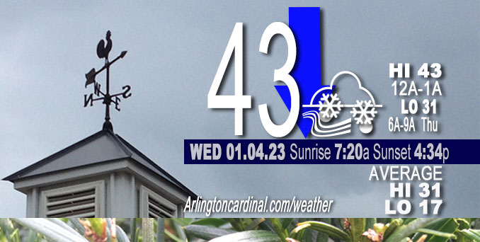
Wednesday Hi 43 falling since midnight, cloudy, rain change to snow about 7p, winds SW, 10 to 11 to 10 MPH, G15 to 18 to 15 MPH ending 8p
NWS CHGO | NWS HRLY | /NWSchicago | 🌡
ARLINGTON HEIGHTS WEATHER
▴ forecast7 (Arl. Hts.) | RADAR | WIDE RADAR
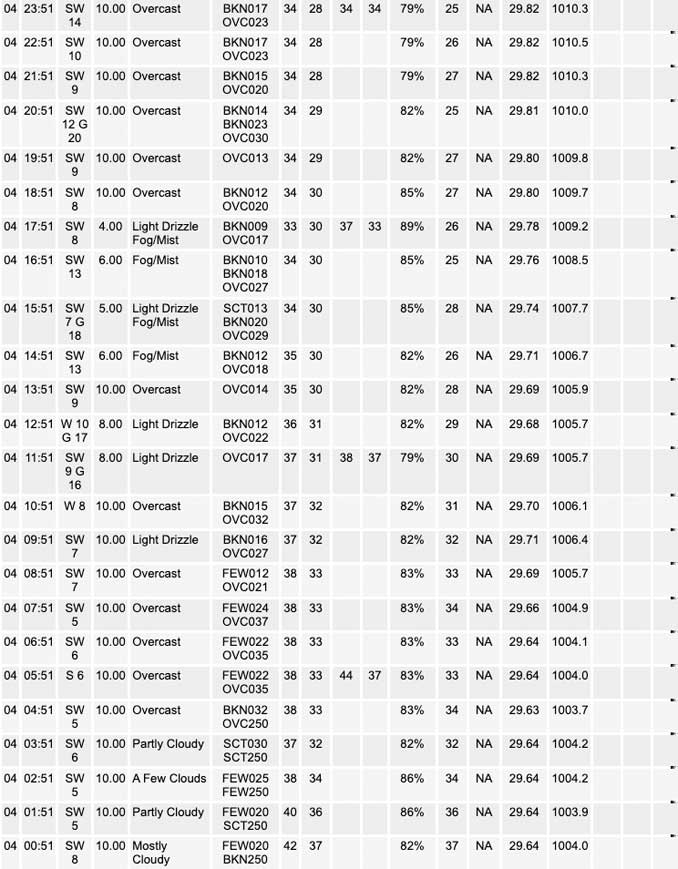
⏪ Hrly Data Table | Hrly Future Graph ⏩
IMPORTANT NOTE ON NWS DATA
⏪ Hrly Data Table | Hrly Future Graph ⏩
======================
Wednesday and Wednesday Night …
No Weather Hazards expected…
Light snow likely Wednesday night through Thursday midday, especially along and north of I-80. No significant snow accumulation Wednesday, but about 0.2 inch show accumulation possible Thursday with full cloud coverage continuing through Thursday evening.
Rainfall total was 1.12 inches Tuesday, January 3, 2023.
DISCUSSION…
Early this morning, an occluded front has passed north of I-80 (where it did not warm up yesterday) while a true cold front exists south of I-80 (where 60s were realized).
Hello mobile users! If you encounter a mobile “unfriendly” weather page, turn your phone sideways for a better view.
======================
O’HARE FORECAST …
Forecast Beginning Wednesday, Jan. 04, 2023
Wednesday: A slight chance of rain showers before 3pm, then a chance of drizzle between 3pm and 5pm, then a chance of rain and snow showers after 5pm. Cloudy, with a high near 38. Southwest wind around 10 mph, with gusts as high as 20 mph. Chance of precipitation is 30%.
Wednesday Night: A chance of rain and snow showers before 8pm, then scattered snow showers. Cloudy, with a low around 31. Southwest wind around 10 mph, with gusts as high as 15 mph. Chance of precipitation is 30%.
Thursday: A 50 percent chance of snow. Cloudy, with a high near 34. Southwest wind 10 to 15 mph, with gusts as high as 20 mph.
Thursday Night: A chance of flurries before midnight. Mostly cloudy, with a low around 29. West wind around 10 mph.
Friday: Partly sunny, with a high near 35. West wind 5 to 10 mph.
Friday Night: Mostly cloudy, with a low around 27.
Saturday: A slight chance of snow before noon, then a slight chance of rain and snow. Partly sunny, with a high near 38. Chance of precipitation is 20%.
Saturday Night: A chance of snow after midnight. Mostly cloudy, with a low around 29.
Sunday: Partly sunny, with a high near 38.
Sunday Night: Partly cloudy, with a low around 28.
Monday: Mostly sunny, with a high near 39.
Monday Night: Partly cloudy, with a low around 28.
Tuesday: Partly sunny, with a high near 38.


CHICAGOWEATHERSTATION.COM

ChicagoWeatherStation.com I O’Hare Normal Temps/Precip I O’Hare Record Temps, Precip, Snow
LIVE RADAR | STORM TRACKS | UNISYS US IR SAT | UNISYS Midwest IR SAT | UNISYS More IR SAT
WunderMap® with Temperature/Wind Data || Google: Arlington Heights Area Temps | US TEMPS
Full Screen Motion Weather Radar (Wunderground.com)
Midwest Cloud Cover with Arlington Heights Weather Forecast
ChicagoWeatherStation.com I O’Hare Normal Temps/Precip I O’Hare Record Temps, Precip, Snow
SUNLIGHT DATA FOR SECURITY, TRAFFIC SAFETY, AND SPORTS
SunCalc.net data with solar azimuth and trajectory, times for dawn, sunrise, solar noon, sunset, dusk …
NIGHT SKY THIS MONTH …
Backyard stargazers get a monthly guide to the northern hemisphere’s skywatching events with “Tonight’s Sky.” Check the night sky objects for this month and past months in the playlist from the Space Telescope Science Institute YouTube channel (Musical track The Far River written by Jonn Serrie, from the album And the Stars Go With You courtesy of New World Music Ltd).
Get updates from The Cardinal ALL NEWS FEEDS on Facebook. Just ‘LIKE’ the ‘Arlington Cardinal Page (become a fan of our page). The updates cover all posts and sub-category posts from The Cardinal — Arlingtoncardinal.com. You can also limit feeds to specific categories. See all of The Cardinal Facebook fan pages at Arlingtoncardinal.com/about/facebook …
Help fund The Cardinal Arlingtoncardinal.com/sponsor
Area Forecast Discussion
National Weather Service Chicago/Romeoville, IL
558 AM CST Wed Jan 4 2023
.SHORT TERM… Issued at 305 AM CST Wed Jan 4 2023
Through Thursday…
Key Messages:
* Return to more typical wintertime weather and high temperatures
* Light rain/drizzle turning more to scattered snow showers from west to east across the area this afternoon and early evening
* Light snow becoming probable very late tonight through Thursday midday, especially along and north of I-80
Early this morning, an occluded front has passed north of I-80 (where it did not warm up yesterday) while a true cold front south of I-80 (where 60s were realized). This feature has scooted the stubborn fog out on southwest winds behind the occlusion. The dry slot from the system centered over the Minnesota/Iowa border has ended rain early this morning, but this will be temporary. As the closed upper low starts to meander eastward it will gradually spread back scattered precipitation, with chance/coverage peaking during the overnight into the day Thursday.
For today, lift and column moisture will initially be focused in the lower levels (sub 700 mb), partly due to the upper low nearly stationary today and an unfavorable jet quadrant over the area this morning and early afternoon. The saturation looks to largely be shy of the ice nucleation layer (-8 or colder), so drizzle to light rain showers are expected first with any precipitation before snow shower-ish activity. While temperatures are favored not to climb at all and will likely cool some in places due to wet-bulb cooling, it is not anticipated that there will be any liquid precipitation concurrent with subfreezing temperatures. The chance of that occurring looks around 10 percent for north central Illinois at this time. The transition to snow as the dominant precipitation type with the scattered activity is expected for all locations shortly after sunset. There is uncertainty on coverage of precipitation today and tonight, with expectations of 30-50 percent with the higher values north and west of I-55. Some of those locations will probably realize even higher coverage for periods this afternoon, but difficult to get too specific in this setup.
The upper low will start to shift east-southeast tonight toward the Wisconsin/Illinois border region. With still a strong potential vorticity (PV) anomaly driving this and a 60+ kt upper jet digging around its southern periphery, the upper low is forecast to maintain its intensity. An embedded vorticity maximum within this is forecast to swing through northern Illinois very late tonight into Thursday morning, providing focused ascent and deeply saturated profiles for some snow. The quality of this snow will be better than this afternoon and evening`s, though the DGZ layer is not deep. With surface temperatures expected to be 28-31, ratios looks to be 10-12:1. A light coating of snow is probable in areas during this time, and would not be astonished to see a couple localized one inch plus amounts. Not seeing signs of broader or greater overperforming, with almost all models showing QPF below 0.1 of an inch and NBM probabilities of greater than an inch of snow < 10 percent. MTF/NWS Chicago
