
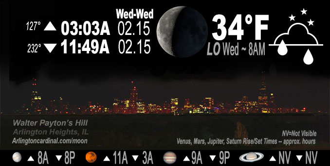
🌘 🌑 🌗 🌕 Waning Crescent Moon, sky cover overnight Tue. to Wed. 99% to 74% to 82%, winds SE to SW to WSW, 18 to 22 to 15 to 24 MPH, Low 34, 8p Wed.
NWS CHGO | NWS HRLY | /NWSchicago | 🌡
ARLINGTON HEIGHTS WEATHER
▴ forecast7 (Arl. Hts.) | RADAR | WIDE RADAR
IMPORTANT NOTE ON NWS DATA
======================
NIGHT FORECASTS …
NOTE: Keep in mind lunar rise and set times don’t always correspond with night weather and early morning lows because on some days during the month the moon is visible in the sky predominantly during the daytime hours.
Overnight Tuesday/Wednesday …
Elevated Non Thunderstorm Wind Risk.
Wind Advisory activated south of I-80 first and then northern counties at 9:52 p.m.
Limited late night Snow and Sleet Risk northwest.
DISCUSSION…
Light rain overnight Tuesday to Wednesday with wind gusts increasing from about 28 MPH to 46 MPH and even 55 MPH. Temperatures drop Wednesday during the day. Another storm system is expected to bring a wintry mix of snow and sleet to parts of northern Illinois late Wednesday night into Thursday morning, before changing over to mainly snow before ending Thursday evening. Some snow accumulation appears likely across far northern Illinois. Farther to the southeast, there is a chance of thunderstorms mainly Thursday morning roughly southeast of the I-57 corridor across east central Illinois and northwest Indiana.
Hello mobile users! If you encounter mobile “unfriendly” weather page, turn your phone sideways for a better view.
======================
O’HARE FORECAST …
Forecast Beginning Tuesday Night, Feb. 14, 2023 …
Tuesday Night: Showers, mainly before 1am. Low around 44. Breezy, with a south southeast wind 15 to 20 mph becoming southwest after midnight. Winds could gust as high as 40 mph. Chance of precipitation is 100%. New precipitation amounts between a tenth and quarter of an inch possible.
Wednesday: Partly sunny, with a temperature falling to around 44 by 8am. Breezy, with a west southwest wind 20 to 25 mph decreasing to 15 to 20 mph in the afternoon. Winds could gust as high as 45 mph.
Wednesday Night: A 20 percent chance of rain after midnight. Mostly cloudy, with a low around 32. Northwest wind 5 to 10 mph becoming northeast 10 to 15 mph after midnight. Winds could gust as high as 25 mph.
Thursday: Snow likely, possibly mixed with rain and sleet, becoming all snow after 3pm. Cloudy, with a high near 37. Breezy, with a north northeast wind 20 to 25 mph, with gusts as high as 40 mph. Chance of precipitation is 70%.
Thursday Night: A 30 percent chance of snow before midnight. Mostly cloudy, with a low around 15. Blustery.
Friday: Sunny, with a high near 27.
Friday Night: Clear, with a low around 20.
Saturday: Mostly sunny, with a high near 45. Breezy.
Saturday Night: Mostly cloudy, with a low around 34.
Sunday: Partly sunny, with a high near 47.
Sunday Night: Mostly cloudy, with a low around 34.
Monday: Washington’s Birthday: Partly sunny, with a high near 47.
O’Hare forecast archive and hourly weather observations archive are available HERE on the CARDINAL NEWS Magazine.
Arlingtoncardinal.com/moonphases
Arlingtoncardinal.com/nightsky
NIGHT SKY THIS MONTH …
Check the night sky objects for this month and past months in the playlist from the Space Telescope Science Institute YouTube channel Backyard stargazers get a monthly guide to the northern hemisphere’s skywatching events with “Tonight’s Sky” (Musical track The Far River written by Jonn Serrie, from the album And the Stars Go With You courtesy of New World Music Ltd. Musical track The Far River written by Jonn Serrie, from the album And the Stars Go With You courtesy of New World Music Ltd).
Telephoto lens, ISO 100, f/11, Shutter Speed 1/100 to 1/125 for the Moon.
Get updates from The Cardinal ALL NEWS FEEDS on Facebook. Just ‘LIKE’ the ‘Arlington Cardinal Page (become a fan of our page). The updates cover all posts and sub-category posts from The Cardinal — Arlingtoncardinal.com. You can also limit feeds to specific categories. See all of The Cardinal Facebook fan pages at Arlingtoncardinal.com/about/facebook …
Help fund The Cardinal Arlingtoncardinal.com/sponsor
Telephoto lens, ISO 1600, f/11, Shutter Speed 2.5″ for the skyline. The skyline exposure was toned down, and brightness and contrast was adjusted in Photoshop.
Area Forecast Discussion
National Weather Service Chicago/Romeoville, IL
1118 PM CST Tue Feb 14 2023
.UPDATE… Issued at 931 PM CST Tue Feb 14 2023
Conditions remain mixed in the low levels this evening, more so than normally would be expected after dark. The low level jet has maximized over northeast Illinois, and thus occasional wind gusts to 45 mph, and a few sporadic gusts in the lower 50 mph range, including at Chicago O`Hare recently with a 1-minute ob at 48 kt (55 mph). These gusts have also been maximized in the urban areas that are a bit warmer.
We have correspondingly bumped up the start of the Wind Advisory for areas south of I-80 but including Cook/DuPage this evening, even though widespread wind gusts of 45-50 mph have been somewhat limited away from the metro area. This seemed prudent given the band of showers over west central IL will encounter this higher low level jet maximum and may be able to overperform what they`ve been doing upstream.
There will likely be a lull in winds after this band of showers moves through overnight. A lightning strike cannot be ruled out, but given the main instability axis skirts the area to the northwest, this would be the exception. Latest AMDAR soundings do have a bit of a warm nose at 3000 ft, but there is still 50+ kt of winds below that, so we will have to watch the 11pm – 2am window for some sporadic higher gusts from these showers.
KMD/NWS Chicago
&&
.SHORT TERM… Issued at 1258 PM CST Tue Feb 14 2023
Through Wednesday night…
CONUS satellite imagery augmented by a recent hand surface and RA Panalyses depict a maturing surface cyclone over the Southern Plains within the left exit region of an intensifying 150 kt 250mb jet streak across the Lower Mississippi River Valley. Arcs of showers continue to expand near and ahead of the developing surface low with a broad (and intensifying) WAA regime. The first showers are now crossing northern Illinois, though the dry low-level airmass (characterized by surface T/Td spreads of 15-20 degrees) has thus far chewed up most raindrops. Continued top-down moistening via evaporation should eventually allow for raindrops to start dotting the ground this afternoon. The next band of rain is much broader and encompasses much of Iowa and Missouri, and is on track to reach our area around or just after sunset. Accordingly, we are anticipating a 2-4 hour period of showers this evening before tapering takes place from west to east by 10 PM. As the surface low matures and lifts northeastward over western Iowa this evening, the low-level pressure gradient will also tighten allowing for south to southeasterly winds to gradually intensify with gusts of 30-35 mph becoming common by sunset.
Tonight, the surface low is expected to reach peak intensity (~984 mb or so) while entering southern Minnesota as a dry slot noses into the Lower Great Lakes and an impressive 60-70kt 850-700mb LLJ slides overhead. Cooling mid-level temperatures around the periphery of the low and mid-level drying within the northeastward-spreading dry slot will steepen mid-level lapse rates and maintain the integrity of a pool of 150-250 J/kg of MUCAPE spreading northeastward from Missouri into northern Illinois. At the same time, a narrow plume of surface dew points ranging from 45-50 degrees currently in southwestern Missouri will spread northeastward, causing low-level lapse rates to improve modestly. Taken together, a band of low-topped convection originating near the MO/KS/IA borders this evening may survive and sweep across the area overnight, particularly between 04Z/10PM and 7Z/1 AM. With strong low-level wind field in place (re: LLJ) and steepening low-level lapse rates (re: low-level moisture advection), any taller convective shower may efficiently transport wind gusts of 45-50 mph toward the ground. Such a threat appears highest northwest of Interstate 55 in closer proximity to the cold core of the low and hence better MUCAPE. After touching base with SPC, we felt the probability of severe-caliber gusts was too low to warrant a formal mention in a severe weather outlook, though be aware a “pop” of winds may accompany any shower overnight.
Toward daybreak, surface winds and gusts are expected to increase markedly as mixing heights build into the base of the departing low- level wind field and surface pressures rise some 8-12mb/6 hours. BUFKIT overviews depict peak momentum transfer of 45-50kt at the to Pof the forecast mixing channel, which should support surface wind gusts of 45-50 mph across much or northern Illinois and northwestern Indiana. For this reason, we opted to expand the inherited Wind Advisory to the Wisconsin border with the expectation for the strongest winds to occur primarily between 6-10 AM CST (we padded the timing of the official product by 2-3 hours on each side). While winds will gradually decrease through the afternoon hours, it will feel much colder than the past few days as temperatures slowly fall through the 40s and eventually 30s by evening.
Borchardt/NWS Chicago
