
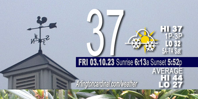
Friday Hi 37, mostly cloudy to partly sunny, light snow until 4p, winds N, 7 to 17 to 6 MPH
NWS CHGO | NWS HRLY | /NWSchicago | 🌡
ARLINGTON HEIGHTS WEATHER
▴ forecast7 (Arl. Hts.) | RADAR | WIDE RADAR
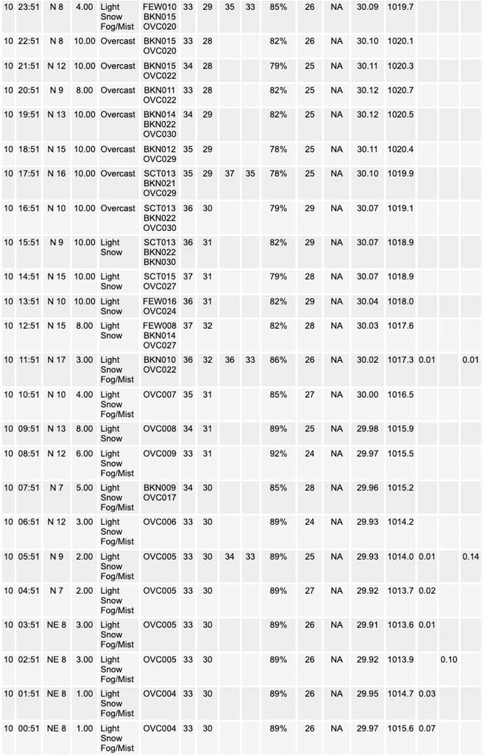
⏪ Hrly Data Table | Hrly Future Graph ⏩
IMPORTANT NOTE ON NWS DATA
⏪ Hrly Data Table | Hrly Future Graph ⏩
Hello mobile users! If you encounter a mobile “unfriendly” weather page, turn your phone sideways for a better view.
======================
Friday and Friday Evening …
Weather Hazards expected …
Elevated Snow Risk ends this morning.
DISCUSSION…
At around 2:30 a.m. snow continues to fall across northern Illinois (generally along and north of I-88) with even a few flares of radar reflectivity >25 dBZ indicative of snow rates >0.5″/hr. Over the next 6 hours or so (until 8:30 a.m.), snow should taper from west to east.
Another bout of accumulating snow possible Saturday night into Sunday with additional scattered snow showers possible Monday.
Cooler temperatures through early next week then rebounding midweek.
======================
O’HARE FORECAST …
Forecast Beginning Friday, Mar. 10, 2023
Friday: Scattered snow showers. Cloudy, with a steady temperature around 34. North wind around 10 mph, with gusts as high as 15 mph. Chance of precipitation is 30%.
Friday Night: Isolated snow showers before 10pm. Mostly cloudy, with a low around 30. North wind 5 to 15 mph. Chance of precipitation is 20%.
Saturday: Mostly cloudy, with a high near 39. East wind 5 to 10 mph.
Saturday Night: Snow, mainly after 9pm. Low around 32. East southeast wind 10 to 15 mph. Chance of precipitation is 90%. New snow accumulation of 1 to 3 inches possible.
Sunday: A chance of snow before noon, then a chance of rain and snow showers. Cloudy, with a high near 38. East southeast wind 5 to 10 mph becoming west in the afternoon. Chance of precipitation is 40%.
Sunday Night: A 30 percent chance of snow showers, mainly before midnight. Mostly cloudy, with a low around 28.
Monday: A chance of flurries. Mostly cloudy, with a high near 34. Breezy.
Monday Night: Mostly cloudy, with a low around 21.
Tuesday: Sunny, with a high near 34.
Tuesday Night: Mostly clear, with a low around 21.
Wednesday: Partly sunny, with a high near 45.
Wednesday Night: Mostly cloudy, with a low around 38.
Thursday: A chance of rain. Mostly cloudy, with a high near 50.
Thursday Night: A chance of rain. Mostly cloudy, with a low around 34.
Friday: A chance of rain. Partly sunny, with a high near 41.


CHICAGOWEATHERSTATION.COM

ChicagoWeatherStation.com I O’Hare Normal Temps/Precip I O’Hare Record Temps, Precip, Snow
LIVE RADAR | STORM TRACKS | UNISYS US IR SAT | UNISYS Midwest IR SAT | UNISYS More IR SAT
WunderMap® with Temperature/Wind Data || Google: Arlington Heights Area Temps | US TEMPS
Full Screen Motion Weather Radar (Wunderground.com)
Midwest Cloud Cover with Arlington Heights Weather Forecast
ChicagoWeatherStation.com I O’Hare Normal Temps/Precip I O’Hare Record Temps, Precip, Snow
SUNLIGHT DATA FOR SECURITY, TRAFFIC SAFETY, AND SPORTS
SunCalc.net data with solar azimuth and trajectory, times for dawn, sunrise, solar noon, sunset, dusk …
NIGHT SKY THIS MONTH …
Backyard stargazers get a monthly guide to the northern hemisphere’s skywatching events with “Tonight’s Sky.” Check the night sky objects for this month and past months in the playlist from the Space Telescope Science Institute YouTube channel (Musical track The Far River written by Jonn Serrie, from the album And the Stars Go With You courtesy of New World Music Ltd).
Get updates from The Cardinal ALL NEWS FEEDS on Facebook. Just ‘LIKE’ the ‘Arlington Cardinal Page (become a fan of our page). The updates cover all posts and sub-category posts from The Cardinal — Arlingtoncardinal.com. You can also limit feeds to specific categories. See all of The Cardinal Facebook fan pages at Arlingtoncardinal.com/about/facebook …
Help fund The Cardinal Arlingtoncardinal.com/sponsor
Area Forecast Discussion
National Weather Service Chicago/Romeoville, IL
541 AM CST Fri Mar 10 2023
.SHORT TERM… Issued at 230 AM CST Fri Mar 10 2023
Through Saturday…
Regional satellite imagery depicts an elongated low pressure system across the Great Lakes region with a classic baroclinic- leaf signature draped from Wisconsin through Michigan and an expansive dry air intrusion from Iowa eastward into Ohio. While the surface reflection of the system is currently passing into western Ohio, the 700mb low pressure center lags behind and is overhead at press time. Accordingly, snow continues to fall across northern Illinois (generally along and north of I-88) with even a few flares of radar reflectivity >25 dBZ indicative of snow rates >0.5″/hr. Over the next 6 hours or so, snow should taper from west to east as the back edge of the 700mb low passes overhead, leaving behind perhaps another inch or two of snow primarily north of Interstate 88. Area webcams show most roads are simply wet or at worst slushy where snow continues to fall, which remains consistent with the ongoing Winter Weather Advisory. Based on the expected end time of the steadiest snow rates toward daybreak, the expiration of the Winter Weather Advisory 7 AM remains appropriate.
As the low-level wind profile uniformly turns north-northeasterly after daybreak along the backside of the departing system, low- level CAA will commence and steepen low-level lapse rates within the residual moist boundary layer. As a result, widely scattered showers appear poised to develop first near the Lake Michigan shoreline toward noon and then expand southward across much of the area this afternoon. Precipitation type may oscillate between rain and snow, though surface temperatures above the freezing mark suggest snow accumulations today are unlikely. Today will not be a washout (or snow globe) by any means, though one may find themselves occasionally needing to use their windshield wipers or rain jacket if out and about this afternoon. Shower coverage should wane after sunset and low-level clouds will attempt to clear as a narrow “pinched” surface high pushes through the Great Lakes, giving way to overnight lows in the mid 20s to around 30 (coldest over the snowpack in far northern Illinois).
Saturday looks relatively quiet with gradually increasing easterly winds and once-again-increasing cloud cover. Highs should range from the mid 30s across the snowpack to lower 40s elsewhere. Chances for precipitation will rise after sunset as the next system approaches from the west (more on that below).
Borchardt/NWS Chicago
