
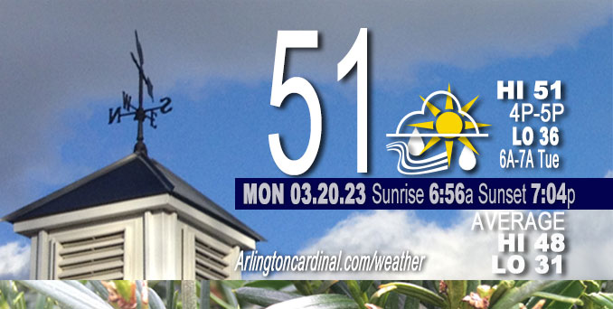
Monday Hi 51, partly sunny, isolated sprinkles after 3p, winds SW, 18 to 22 to 13 MPH, G31 to 36 to 23 MPH continuing Tuesday
NWS CHGO | NWS HRLY | /NWSchicago | 🌡
ARLINGTON HEIGHTS WEATHER
▴ forecast7 (Arl. Hts.) | RADAR | WIDE RADAR
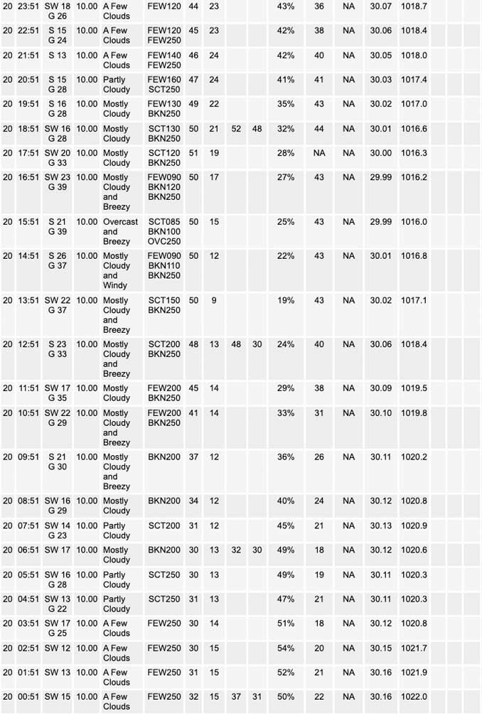
⏪ Hrly Data Table | Hrly Future Graph ⏩
IMPORTANT NOTE ON NWS DATA
⏪ Hrly Data Table | Hrly Future Graph ⏩
Hello mobile users! If you encounter a mobile “unfriendly” weather page, turn your phone sideways for a better view.
======================
Monday and Monday Evening …
Weather Hazards expected …
Limited Non Thunderstorm Wind Risk.
Elevated Fire Weather Risk.
DISCUSSION…
Southwest winds will gust around 35 mph today. Dry and windy weather this afternoon will result in a heightened threat for fire spread, especially for areas southeast of I-55.
Vernal Equinox Monday, March 20, 2023 4:24 PM.
======================
O’HARE FORECAST …
Forecast Beginning Monday, Mar. 20, 2023
Monday: Isolated sprinkles after 3pm. Partly sunny, with a high near 51. Breezy, with a south southwest wind 15 to 20 mph, with gusts as high as 35 mph.
Monday Night: Isolated sprinkles before 10pm. Mostly cloudy, with a low around 36. South southwest wind 10 to 15 mph, with gusts as high as 30 mph.
Tuesday: Mostly cloudy, with a high near 53. South southwest wind 10 to 15 mph, with gusts as high as 20 mph.
Tuesday Night: Showers likely, mainly between 8pm and 2am. Cloudy, with a low around 40. South wind around 15 mph, with gusts as high as 25 mph. Chance of precipitation is 70%.
Wednesday: A 30 percent chance of showers. Cloudy, with a high near 55. South southwest wind around 15 mph, with gusts as high as 20 mph.
Wednesday Night: Showers likely, then showers and possibly a thunderstorm after 11pm. Low around 45. Chance of precipitation is 80%.
Thursday: Showers and possibly a thunderstorm before 8am, then a chance of showers. High near 49. Chance of precipitation is 80%.
Thursday Night: A chance of showers before 8pm, then a chance of rain between 8pm and 2am. Mostly cloudy, with a low around 35.
Friday: A chance of rain after 2pm. Mostly cloudy, with a high near 42.
Friday Night: A chance of rain before 2am, then a chance of rain and snow. Mostly cloudy, with a low around 32.
Saturday: A chance of rain and snow. Partly sunny, with a high near 49.
Saturday Night: Partly cloudy, with a low around 34.
Sunday: A chance of rain. Mostly sunny, with a high near 53.


CHICAGOWEATHERSTATION.COM

ChicagoWeatherStation.com I O’Hare Normal Temps/Precip I O’Hare Record Temps, Precip, Snow
LIVE RADAR | STORM TRACKS | UNISYS US IR SAT | UNISYS Midwest IR SAT | UNISYS More IR SAT
WunderMap® with Temperature/Wind Data || Google: Arlington Heights Area Temps | US TEMPS
Full Screen Motion Weather Radar (Wunderground.com)
Midwest Cloud Cover with Arlington Heights Weather Forecast
ChicagoWeatherStation.com I O’Hare Normal Temps/Precip I O’Hare Record Temps, Precip, Snow
SUNLIGHT DATA FOR SECURITY, TRAFFIC SAFETY, AND SPORTS
SunCalc.net data with solar azimuth and trajectory, times for dawn, sunrise, solar noon, sunset, dusk …
NIGHT SKY THIS MONTH …
Backyard stargazers get a monthly guide to the northern hemisphere’s skywatching events with “Tonight’s Sky.” Check the night sky objects for this month and past months in the playlist from the Space Telescope Science Institute YouTube channel (Musical track The Far River written by Jonn Serrie, from the album And the Stars Go With You courtesy of New World Music Ltd).
Get updates from The Cardinal ALL NEWS FEEDS on Facebook. Just ‘LIKE’ the ‘Arlington Cardinal Page (become a fan of our page). The updates cover all posts and sub-category posts from The Cardinal — Arlingtoncardinal.com. You can also limit feeds to specific categories. See all of The Cardinal Facebook fan pages at Arlingtoncardinal.com/about/facebook …
Help fund The Cardinal Arlingtoncardinal.com/sponsor
/////////////>
Area Forecast Discussion
National Weather Service Chicago/Romeoville, IL
640 AM CDT Mon Mar 20 2023
.SHORT TERM… Issued at 258 AM CDT Mon Mar 20 2023
Through Tuesday…
Main weather messages in the short term…
* Windy, dry and milder weather with a heightened risk of fire spread especially east of I-55 today.
* Low chances for a few sprinkles/light showers this afternoon and early this evening north of I-88.
* Showers developing Tuesday afternoon.
Main weather feature of note this morning is a mid-level short wave trough evident in vapor imagery over the mid-Missouri Valley. Early morning surface analysis depicts a weak surface wave associated with this disturbance over northeastern Nebraska, along a cold front which trails from the northern Great Lakes to the central Rockies. The short wave is progged to track eastward across WI/far northern IL this afternoon and early evening, with the weak surface low moving into WI. This will help to maintain a fairly strong surface pressure gradient across the forecast area, to the northwest of expansive surface high pressure stretching from the lower Mississippi Valley to the mid-Atlantic region. This surface high will effectively block any substantial low-level moisture return despite strong southwest winds today, which may gust around 35 mph at times. The strongest winds are expected generally along and east of the I-55 corridor this afternoon, which along with mild temperatures around 50 degrees and RH values in the 25-30 percent range will present a heightened threat for fire spread.
Low-chance pops for spotty sprinkles remain in the forecast for far northern IL , as ascent with the approaching short wave produces mid- level saturation within/below a region of very stee Pmid-level lapse rates. Dry sub-cloud air will likely evaporate/sublimate a good amount of this precip, though a few isolated sprinkles can`t be ruled out this afternoon/early evening north from the I-88 corridor northward.
Tonight, as the weak surface wave continues to track east from WI, some guidance depicts the weak cold front sagging to near the IL/WI border and perhaps into far northeast IL by morning. Modest southeast onshore flow may keep temperatures cooler (40s) for some North Shore suburbs Tuesday, especially in Lake county IL. Elsewhere, winds should become breezy from the south again (though not as strong as today – 25 mph or so), in response to another short wave emerging from the Central Plains. Renewed warm advection ahead of this wave will support high temperatures in the lower 50s again in most areas, despite increasing and thickening cloud cover. Shower chances will also increase from the west during the afternoon as forcing and moisture transport associated with the approaching wave increase.
Ratzer/NWS Chicago
